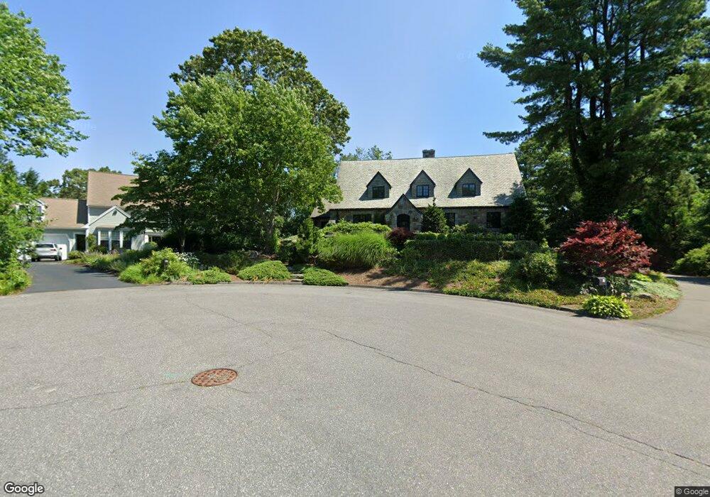
15 High Meadow Cir Wellesley, MA 02482
Wellesley Square NeighborhoodEstimated Value: $3,088,000 - $4,309,000
5
Beds
6
Baths
6,560
Sq Ft
$525/Sq Ft
Est. Value
About This Home
This home is located at 15 High Meadow Cir, Wellesley, MA 02482 and is currently estimated at $3,441,112, approximately $524 per square foot. 15 High Meadow Cir is a home located in Norfolk County with nearby schools including Sprague Elementary School, Wellesley Middle School, and Wellesley Sr High School.
Ownership History
Date
Name
Owned For
Owner Type
Purchase Details
Closed on
Jul 20, 1999
Sold by
Khashggi Betsy L
Bought by
Murphy David L and Murphy Lauren C
Current Estimated Value
Home Financials for this Owner
Home Financials are based on the most recent Mortgage that was taken out on this home.
Original Mortgage
$616,000
Outstanding Balance
$170,231
Interest Rate
7.39%
Mortgage Type
Purchase Money Mortgage
Estimated Equity
$3,270,881
Purchase Details
Closed on
Jul 18, 1989
Sold by
Kirk Michael J
Bought by
Khashoggi Khalid A
Purchase Details
Closed on
Feb 8, 1989
Sold by
Sorrell Timothy A
Bought by
Kirk Michael J
Home Financials for this Owner
Home Financials are based on the most recent Mortgage that was taken out on this home.
Original Mortgage
$427,000
Interest Rate
10.73%
Mortgage Type
Purchase Money Mortgage
Create a Home Valuation Report for This Property
The Home Valuation Report is an in-depth analysis detailing your home's value as well as a comparison with similar homes in the area
Home Values in the Area
Average Home Value in this Area
Purchase History
| Date | Buyer | Sale Price | Title Company |
|---|---|---|---|
| Murphy David L | $800,000 | -- | |
| Khashoggi Khalid A | $570,000 | -- | |
| Kirk Michael J | $610,000 | -- |
Source: Public Records
Mortgage History
| Date | Status | Borrower | Loan Amount |
|---|---|---|---|
| Open | Kirk Michael J | $616,000 | |
| Previous Owner | Kirk Michael J | $427,000 |
Source: Public Records
Tax History
| Year | Tax Paid | Tax Assessment Tax Assessment Total Assessment is a certain percentage of the fair market value that is determined by local assessors to be the total taxable value of land and additions on the property. | Land | Improvement |
|---|---|---|---|---|
| 2025 | $28,383 | $2,761,000 | $1,691,000 | $1,070,000 |
| 2024 | $26,837 | $2,578,000 | $1,537,000 | $1,041,000 |
| 2023 | $26,243 | $2,292,000 | $1,362,000 | $930,000 |
| 2022 | $24,248 | $2,076,000 | $1,170,000 | $906,000 |
| 2021 | $23,794 | $2,025,000 | $1,119,000 | $906,000 |
| 2020 | $23,409 | $2,025,000 | $1,119,000 | $906,000 |
| 2019 | $22,573 | $1,951,000 | $1,068,000 | $883,000 |
| 2018 | $19,251 | $1,611,000 | $697,000 | $914,000 |
| 2017 | $18,994 | $1,611,000 | $697,000 | $914,000 |
| 2016 | $19,638 | $1,660,000 | $686,000 | $974,000 |
| 2015 | $18,785 | $1,625,000 | $652,000 | $973,000 |
Source: Public Records
Map
Nearby Homes
- 26B Pleasant St Unit B
- 34 Pleasant St Unit 5
- 100 Linden St Unit 111
- 63 Oak St Unit B
- 63 Linden St Unit 1
- 63 Linden St Unit 6
- 148 Weston Rd Unit 208
- 5 Abbott St
- 16 Stearns Rd Unit 101
- 16 Stearns Rd Unit 106
- 16 Stearns Rd Unit 103
- 16 Stearns Rd Unit 304
- 16 Stearns Rd Unit 104
- 40 Pinewood Rd
- 29 Pinewood Rd
- 78 Denton Rd
- 85 Grove St Unit 311
- 85 Grove St Unit 306
- 85 Grove St Unit 203
- 81 Audubon Rd
- 12 High Meadow Cir
- 26 Oakencroft Rd
- 7 High Meadow Cir
- 24 Pleasant St Unit 1
- 24 Pleasant St Unit 2
- 24 Pleasant St
- 24 Pleasant St Unit 3
- 8 High Meadow Cir
- 21 Westerly St Unit 9
- 21 Westerly St Unit 8
- 21 Westerly St Unit 7
- 21 Westerly St Unit 6
- 21 Westerly St Unit 5
- 21 Westerly St Unit 4
- 21 Westerly St Unit 3
- 21 Westerly St Unit 2
- 21 Westerly St Unit 17
- 21 Westerly St Unit 16
- 21 Westerly St Unit 15
- 21 Westerly St Unit 14
Your Personal Tour Guide
Ask me questions while you tour the home.