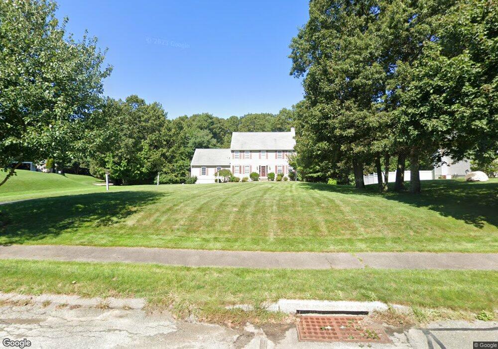
15 High Point Way Wrentham, MA 02093
Estimated Value: $786,000 - $891,000
4
Beds
3
Baths
2,128
Sq Ft
$387/Sq Ft
Est. Value
About This Home
This home is located at 15 High Point Way, Wrentham, MA 02093 and is currently estimated at $822,767, approximately $386 per square foot. 15 High Point Way is a home located in Norfolk County with nearby schools including Delaney Elementary School, Charles E Roderick, and The Sage School.
Ownership History
Date
Name
Owned For
Owner Type
Purchase Details
Closed on
Jul 14, 2000
Sold by
Wrentham Woods Llc
Bought by
Pham Quoc H and Pham Thu T
Current Estimated Value
Create a Home Valuation Report for This Property
The Home Valuation Report is an in-depth analysis detailing your home's value as well as a comparison with similar homes in the area
Home Values in the Area
Average Home Value in this Area
Purchase History
| Date | Buyer | Sale Price | Title Company |
|---|---|---|---|
| Pham Quoc H | $297,755 | -- |
Source: Public Records
Mortgage History
| Date | Status | Borrower | Loan Amount |
|---|---|---|---|
| Open | Pham Quoc H | $102,000 | |
| Closed | Pham Quoc H | $109,300 | |
| Closed | Pham Quoc H | $113,000 | |
| Closed | Pham Quoc H | $100,000 |
Source: Public Records
Tax History Compared to Growth
Tax History
| Year | Tax Paid | Tax Assessment Tax Assessment Total Assessment is a certain percentage of the fair market value that is determined by local assessors to be the total taxable value of land and additions on the property. | Land | Improvement |
|---|---|---|---|---|
| 2025 | $8,635 | $745,000 | $325,700 | $419,300 |
| 2024 | $8,288 | $690,700 | $325,700 | $365,000 |
| 2023 | $7,958 | $630,600 | $296,000 | $334,600 |
| 2022 | $7,164 | $524,100 | $227,800 | $296,300 |
| 2021 | $7,195 | $511,400 | $238,600 | $272,800 |
| 2020 | $7,256 | $509,200 | $215,200 | $294,000 |
| 2019 | $7,232 | $512,200 | $231,700 | $280,500 |
| 2018 | $6,844 | $480,600 | $232,000 | $248,600 |
| 2017 | $6,690 | $469,500 | $227,500 | $242,000 |
| 2016 | $6,583 | $461,000 | $220,900 | $240,100 |
| 2015 | $6,011 | $401,300 | $182,100 | $219,200 |
| 2014 | $5,948 | $388,500 | $175,100 | $213,400 |
Source: Public Records
Map
Nearby Homes
- 483 Thurston St
- 120 Hawes St
- 65 Pond St
- 362 East St
- 80 Mill St
- 11 Goodwin Dr
- 319 Taunton St
- 1 Lorraine Metcalf Dr
- 25 Foxboro Rd
- 270 Dedham St
- 406 South St
- 9 Oak Dr
- 16 Treasure Island Rd
- 10 Nature View Dr
- 15 Nature View Dr
- 11 Orchard Place Unit 11
- 160 Washington St Unit 36
- 11 Earle Stewart Ln
- 14 Baker St
- Lot 1 - Blueberry 2 Car Plan at King Philip Estates
- 25 High Point Way
- 20 Oak Ridge Dr
- 35 High Point Way
- 20 High Point Way
- 10 Oak Ridge Dr
- 10 Oak Ridge Dr Unit 1
- 10 High Point Way
- 30 High Point Way
- 55 Oak Ridge Dr
- 45 High Point Way
- 45 Oak Ridge Dr
- 35 Oak Ridge Dr
- 15 Old Quarry Rd
- 25 Old Quarry Rd
- 25 Oak Ridge Dr
- 15 Oak Ridge Dr
- 16 Old Quarry Rd
- 14 Old Quarry Rd
- 24 Old Quarry Rd
- 30 Old Quarry Rd