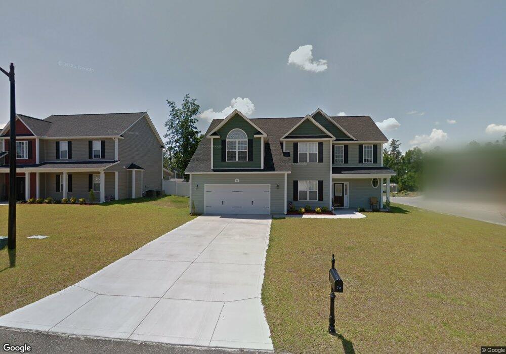
15 Historian Point Cameron, NC 28326
Estimated Value: $382,000 - $404,952
5
Beds
4
Baths
3,306
Sq Ft
$118/Sq Ft
Est. Value
About This Home
This home is located at 15 Historian Point, Cameron, NC 28326 and is currently estimated at $390,738, approximately $118 per square foot. 15 Historian Point is a home located in Harnett County with nearby schools including Benhaven Elementary School, Overhills Middle School, and Overhills High School.
Ownership History
Date
Name
Owned For
Owner Type
Purchase Details
Closed on
May 17, 2023
Sold by
Arellano Arturo and Arellano Elvira H
Bought by
Aldonis Lucile
Current Estimated Value
Home Financials for this Owner
Home Financials are based on the most recent Mortgage that was taken out on this home.
Original Mortgage
$347,985
Outstanding Balance
$338,113
Interest Rate
6.28%
Mortgage Type
FHA
Estimated Equity
$52,625
Purchase Details
Closed on
Jan 27, 2012
Sold by
Regency Homes Inc
Bought by
Rellano Arturo A and Rellano Elvira H
Home Financials for this Owner
Home Financials are based on the most recent Mortgage that was taken out on this home.
Original Mortgage
$224,600
Interest Rate
2.75%
Mortgage Type
VA
Create a Home Valuation Report for This Property
The Home Valuation Report is an in-depth analysis detailing your home's value as well as a comparison with similar homes in the area
Home Values in the Area
Average Home Value in this Area
Purchase History
| Date | Buyer | Sale Price | Title Company |
|---|---|---|---|
| Aldonis Lucile | $360,000 | None Listed On Document | |
| Aldonis Lucile | $360,000 | None Listed On Document | |
| Rellano Arturo A | $220,000 | None Available |
Source: Public Records
Mortgage History
| Date | Status | Borrower | Loan Amount |
|---|---|---|---|
| Open | Aldonis Lucile | $347,985 | |
| Closed | Aldonis Lucile | $347,985 | |
| Previous Owner | Rellano Arturo A | $224,600 |
Source: Public Records
Tax History Compared to Growth
Tax History
| Year | Tax Paid | Tax Assessment Tax Assessment Total Assessment is a certain percentage of the fair market value that is determined by local assessors to be the total taxable value of land and additions on the property. | Land | Improvement |
|---|---|---|---|---|
| 2025 | $2,503 | $340,109 | $0 | $0 |
| 2024 | $2,503 | $340,109 | $0 | $0 |
| 2023 | $2,503 | $340,109 | $0 | $0 |
| 2022 | $2,684 | $340,109 | $0 | $0 |
| 2021 | $2,684 | $298,710 | $0 | $0 |
| 2020 | $2,684 | $298,710 | $0 | $0 |
| 2019 | $2,669 | $298,710 | $0 | $0 |
| 2018 | $2,609 | $298,710 | $0 | $0 |
| 2017 | $2,609 | $298,710 | $0 | $0 |
| 2016 | $2,666 | $305,460 | $0 | $0 |
| 2015 | -- | $305,460 | $0 | $0 |
| 2014 | -- | $305,460 | $0 | $0 |
Source: Public Records
Map
Nearby Homes
- 12 Historian Point
- 30 Historian Point
- 38 Historian Point
- 70 Culpepper Rd
- 35 Historian Point
- 18 Culpepper Rd
- 84 Culpepper Rd
- 489 Regimental Dr
- 71 Culpepper Rd
- 489 Regimental (L3) Dr
- 42 Historian Point
- 39 Historian Point
- 34 Ambrose Point
- 503 Regimental Dr
- 17 Culpepper Rd
- 27 Germantown Rd
- 85 Culpepper (L54) Rd
- 100 Culpepper Rd
- 44 Ambrose Point