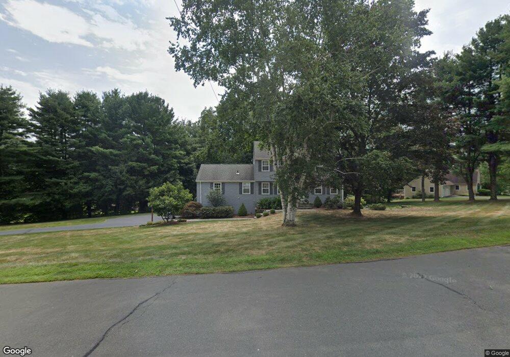
15 Homestead Rd West Simsbury, CT 06092
Estimated Value: $599,000 - $630,000
4
Beds
3
Baths
2,184
Sq Ft
$281/Sq Ft
Est. Value
About This Home
This home is located at 15 Homestead Rd, West Simsbury, CT 06092 and is currently estimated at $613,640, approximately $280 per square foot. 15 Homestead Rd is a home located in Hartford County with nearby schools including Central School, Henry James Memorial School, and Simsbury High School.
Ownership History
Date
Name
Owned For
Owner Type
Purchase Details
Closed on
Nov 10, 2022
Sold by
Lockwood Pamela A
Bought by
Pamela Lockwood Ret
Current Estimated Value
Purchase Details
Closed on
Jul 2, 1996
Sold by
Lepage Homes Inc
Bought by
Etter John and Etter Mary
Purchase Details
Closed on
May 1, 1996
Sold by
Armando Donald
Bought by
Armando Robert and Armando Adeline
Purchase Details
Closed on
Jun 24, 1991
Sold by
Rocco John and Rocco Nancy
Bought by
Lockwood John and Lockwood Pamela
Purchase Details
Closed on
Apr 15, 1991
Sold by
Crown Ridge Inc
Bought by
Reid Kenneth and Reid Barbara
Create a Home Valuation Report for This Property
The Home Valuation Report is an in-depth analysis detailing your home's value as well as a comparison with similar homes in the area
Home Values in the Area
Average Home Value in this Area
Purchase History
| Date | Buyer | Sale Price | Title Company |
|---|---|---|---|
| Pamela Lockwood Ret | -- | None Available | |
| Etter John | $169,631 | -- | |
| Armando Robert | $121,000 | -- | |
| Lockwood John | $250,000 | -- | |
| Reid Kenneth | $155,859 | -- |
Source: Public Records
Mortgage History
| Date | Status | Borrower | Loan Amount |
|---|---|---|---|
| Previous Owner | Reid Kenneth | $146,700 | |
| Previous Owner | Reid Kenneth | $20,000 | |
| Previous Owner | Reid Kenneth | $212,000 |
Source: Public Records
Tax History Compared to Growth
Tax History
| Year | Tax Paid | Tax Assessment Tax Assessment Total Assessment is a certain percentage of the fair market value that is determined by local assessors to be the total taxable value of land and additions on the property. | Land | Improvement |
|---|---|---|---|---|
| 2025 | $9,615 | $281,470 | $98,280 | $183,190 |
| 2024 | $9,376 | $281,470 | $98,280 | $183,190 |
| 2023 | $8,956 | $281,470 | $98,280 | $183,190 |
| 2022 | $9,144 | $236,700 | $99,660 | $137,040 |
| 2021 | $9,144 | $236,700 | $99,660 | $137,040 |
| 2020 | $8,779 | $236,700 | $99,660 | $137,040 |
| 2019 | $8,834 | $236,700 | $99,660 | $137,040 |
| 2018 | $8,898 | $236,700 | $99,660 | $137,040 |
| 2017 | $8,408 | $216,920 | $97,280 | $119,640 |
| 2016 | $8,052 | $216,920 | $97,280 | $119,640 |
| 2015 | $8,052 | $216,920 | $97,280 | $119,640 |
| 2014 | $8,056 | $216,920 | $97,280 | $119,640 |
Source: Public Records
Map
Nearby Homes
- 18 Meadowlark Rd
- 5 Fox Den Rd
- 10 Sachems Trail
- 16 Stratton Forest Way
- 8 Quorn Hunt Rd
- 40 Firetown Rd Unit 39
- 141 Firetown Rd
- 302 Bushy Hill Rd
- 143 N Mountain Rd
- 3 Stebbins Brook Ln
- 301 Bushy Hill Rd
- 1 West St Unit 206
- 48 Library Ln Unit 48
- 21 Christmas Tree Hill
- 25 Barry Ln
- 247 Old Farms Rd
- 23 Red Fox Run
- 15 Sand Hill Rd
- 15 Red Fox Run
- 269 W Mountain Rd
- 17 Homestead Rd
- 16 Homestead Rd
- 14 Homestead Rd
- 12 Homestead Rd
- 4 Watson Dr
- 196 Farms Village Rd
- 19 Homestead Rd
- 9 Homestead Rd
- 18 Homestead Rd
- 10 Homestead Rd
- 192 Farms Village Rd
- 192 Farms Village Rd
- 202 Farms Village Rd
- 199 Farms Village Rd
- 6 Watson Dr
- 10 Grant Estate Dr
- 10 Grant Estate Dr Unit DR
- 18 Case Cir
- 19 Case Cir
- 7 Homestead Rd