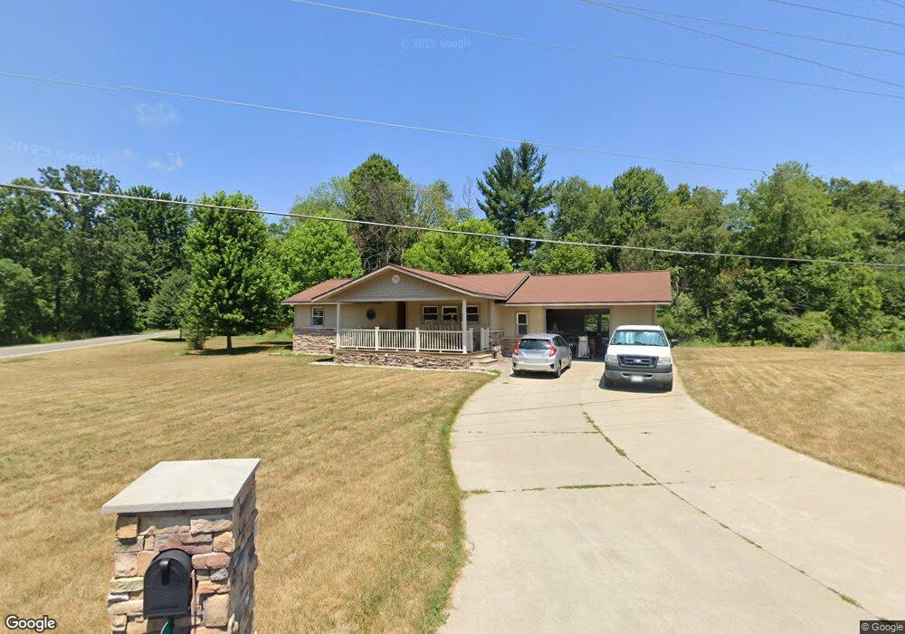
15 Hull St Sparta, MI 49345
Estimated Value: $264,000 - $335,000
3
Beds
2
Baths
1,154
Sq Ft
$256/Sq Ft
Est. Value
About This Home
This home is located at 15 Hull St, Sparta, MI 49345 and is currently estimated at $295,921, approximately $256 per square foot. 15 Hull St is a home located in Kent County with nearby schools including Ridgeview Elementary School, Appleview Elementary School, and Sparta Middle School.
Ownership History
Date
Name
Owned For
Owner Type
Purchase Details
Closed on
Feb 4, 2004
Sold by
Wells Fargo Bank Minnesota Na
Bought by
Thompson Theodore
Current Estimated Value
Home Financials for this Owner
Home Financials are based on the most recent Mortgage that was taken out on this home.
Original Mortgage
$90,000
Outstanding Balance
$41,946
Interest Rate
5.74%
Mortgage Type
Purchase Money Mortgage
Estimated Equity
$253,975
Purchase Details
Closed on
Mar 19, 2003
Sold by
Lott Barry
Bought by
Wells Fargo Bank Minnesota Na
Purchase Details
Closed on
Dec 15, 2000
Sold by
Tenelshof Alice and Feutz Mary B
Bought by
Alcacio Tina and Laviolette Jeffrey
Purchase Details
Closed on
May 9, 1994
Sold by
Tenelshef Alice
Bought by
Tenelshuf Alice and Feutz Mary B
Create a Home Valuation Report for This Property
The Home Valuation Report is an in-depth analysis detailing your home's value as well as a comparison with similar homes in the area
Home Values in the Area
Average Home Value in this Area
Purchase History
| Date | Buyer | Sale Price | Title Company |
|---|---|---|---|
| Thompson Theodore | $90,000 | -- | |
| Wells Fargo Bank Minnesota Na | $92,000 | -- | |
| Alcacio Tina | -- | -- | |
| Laviolette Jeffrey | -- | -- | |
| Tenelshuf Alice | -- | -- |
Source: Public Records
Mortgage History
| Date | Status | Borrower | Loan Amount |
|---|---|---|---|
| Open | Thompson Theodore | $90,000 |
Source: Public Records
Tax History Compared to Growth
Tax History
| Year | Tax Paid | Tax Assessment Tax Assessment Total Assessment is a certain percentage of the fair market value that is determined by local assessors to be the total taxable value of land and additions on the property. | Land | Improvement |
|---|---|---|---|---|
| 2025 | $1,919 | $136,800 | $0 | $0 |
| 2024 | $1,919 | $124,300 | $0 | $0 |
| 2023 | $2,566 | $115,500 | $0 | $0 |
| 2022 | $2,478 | $96,100 | $0 | $0 |
| 2021 | $2,414 | $90,400 | $0 | $0 |
| 2020 | $1,689 | $85,000 | $0 | $0 |
| 2019 | $1,918 | $80,100 | $0 | $0 |
| 2018 | $2,209 | $73,200 | $0 | $0 |
| 2017 | $1,989 | $69,100 | $0 | $0 |
| 2016 | $1,918 | $64,100 | $0 | $0 |
| 2015 | -- | $64,100 | $0 | $0 |
| 2013 | -- | $63,200 | $0 | $0 |
Source: Public Records
Map
Nearby Homes
- 15 15 Mile Rd NW
- 255 15 Mile Rd NW
- 13 15 Mile Rd NW
- 168 Toby Rd NW
- 195 Toby Rd NW
- 143 Toby Rd NW
- 17 Warbler Dr
- 144 Toby Rd NW
- 190 Toby Rd NW
- 11717 Maywood Dr NE
- 124 Toby Rd NW
- 221 Circle Dr Unit 221
- 68 Viking Dr NW
- 26 Traveler Dr NW
- 91 Traveler Dr NW Unit 91
- 83 Viking Dr NW
- 3 Happy End Dr Unit 3
- 451 Cumings Ct NW
- 480 Cumings Ct NW
- 12219 N Division Ave
- 50 Hull St
- 12280 N Division Ave
- 12116 N Division Ave
- 12189 Reyburn Dr NE
- 12320 N Division Ave
- 12189 Reyburn Dr
- 12177 Reyburn Dr
- 12090 N Division Ave
- 12167 Reyburn Dr
- 12110 N Division Ave
- 12155 Reyburn Dr NE
- 12155 Reyburn Dr
- 12143 Reyburn Dr NE
- 12066 N Division Ave
- 12143 Reyburn Dr
- 12366 N Division Ave
- 12180 Reyburn Dr NE
- 12301 N Division Ave
- 12180 Reyburn Dr