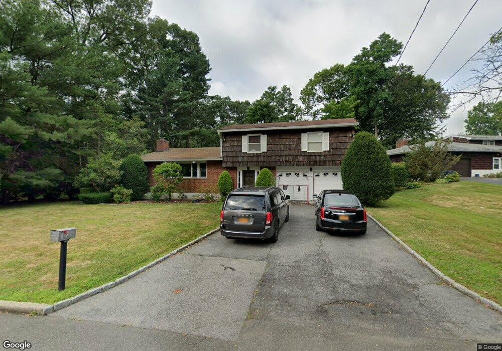
15 Hunt Path New Rochelle, NY 10804
Estimated Value: $897,000 - $1,358,000
4
Beds
4
Baths
1,849
Sq Ft
$655/Sq Ft
Est. Value
About This Home
This home is located at 15 Hunt Path, New Rochelle, NY 10804 and is currently estimated at $1,211,247, approximately $655 per square foot. 15 Hunt Path is a home located in Westchester County with nearby schools including William B. Ward Elementary School, Albert Leonard Middle School, and New Rochelle High School.
Ownership History
Date
Name
Owned For
Owner Type
Purchase Details
Closed on
Dec 11, 2002
Sold by
Kroleski Steven and Kroleski Barbara
Bought by
Kroleski Steven and Pasquantonio Kroleski Jennifer
Current Estimated Value
Home Financials for this Owner
Home Financials are based on the most recent Mortgage that was taken out on this home.
Original Mortgage
$322,700
Outstanding Balance
$135,520
Interest Rate
5.93%
Mortgage Type
Purchase Money Mortgage
Estimated Equity
$1,075,727
Purchase Details
Closed on
Sep 21, 2000
Sold by
Davis Norman
Bought by
Gumbs Monica
Purchase Details
Closed on
Jun 13, 1997
Sold by
15 Hunt Corp
Bought by
Davis Norman
Create a Home Valuation Report for This Property
The Home Valuation Report is an in-depth analysis detailing your home's value as well as a comparison with similar homes in the area
Home Values in the Area
Average Home Value in this Area
Purchase History
| Date | Buyer | Sale Price | Title Company |
|---|---|---|---|
| Kroleski Steven | -- | -- | |
| Gumbs Monica | $312,000 | Commonwealth Land Title Ins | |
| Davis Norman | $185,000 | -- |
Source: Public Records
Mortgage History
| Date | Status | Borrower | Loan Amount |
|---|---|---|---|
| Open | Kroleski Steven | $322,700 |
Source: Public Records
Tax History Compared to Growth
Tax History
| Year | Tax Paid | Tax Assessment Tax Assessment Total Assessment is a certain percentage of the fair market value that is determined by local assessors to be the total taxable value of land and additions on the property. | Land | Improvement |
|---|---|---|---|---|
| 2024 | $21,532 | $15,650 | $5,100 | $10,550 |
| 2023 | $17,565 | $15,650 | $5,100 | $10,550 |
| 2022 | $18,942 | $15,650 | $5,100 | $10,550 |
| 2021 | $18,861 | $15,650 | $5,100 | $10,550 |
| 2020 | $15,399 | $15,650 | $5,100 | $10,550 |
| 2019 | $17,793 | $15,650 | $5,100 | $10,550 |
| 2018 | $14,697 | $15,650 | $5,100 | $10,550 |
| 2017 | $2,688 | $15,650 | $5,100 | $10,550 |
| 2016 | $16,112 | $15,650 | $5,100 | $10,550 |
| 2015 | $14,065 | $15,650 | $5,100 | $10,550 |
| 2014 | $14,065 | $15,650 | $5,100 | $10,550 |
| 2013 | $14,065 | $15,650 | $5,100 | $10,550 |
Source: Public Records
Map
Nearby Homes
- 1 Meadowood Path
- 103 Woodhollow Ln
- 7 Crestwood Ln
- 130 Woodhollow Ln
- 50 Overhill Rd
- 150 Maywood Rd
- 4 Villa Ln
- 51 Valley Rd
- 27 Villa Rd
- 17 Valley Rd
- 2 Sackett Cir
- 120 Lyncroft Rd
- 440 Beechmont Dr
- 629 Pinebrook Blvd
- 19 Mountain Ave
- 220 Pinebrook Blvd
- 7 Senate Place
- 2 Rochelle Rd
- 50 Forest Cir
- 376 Beechmont Dr