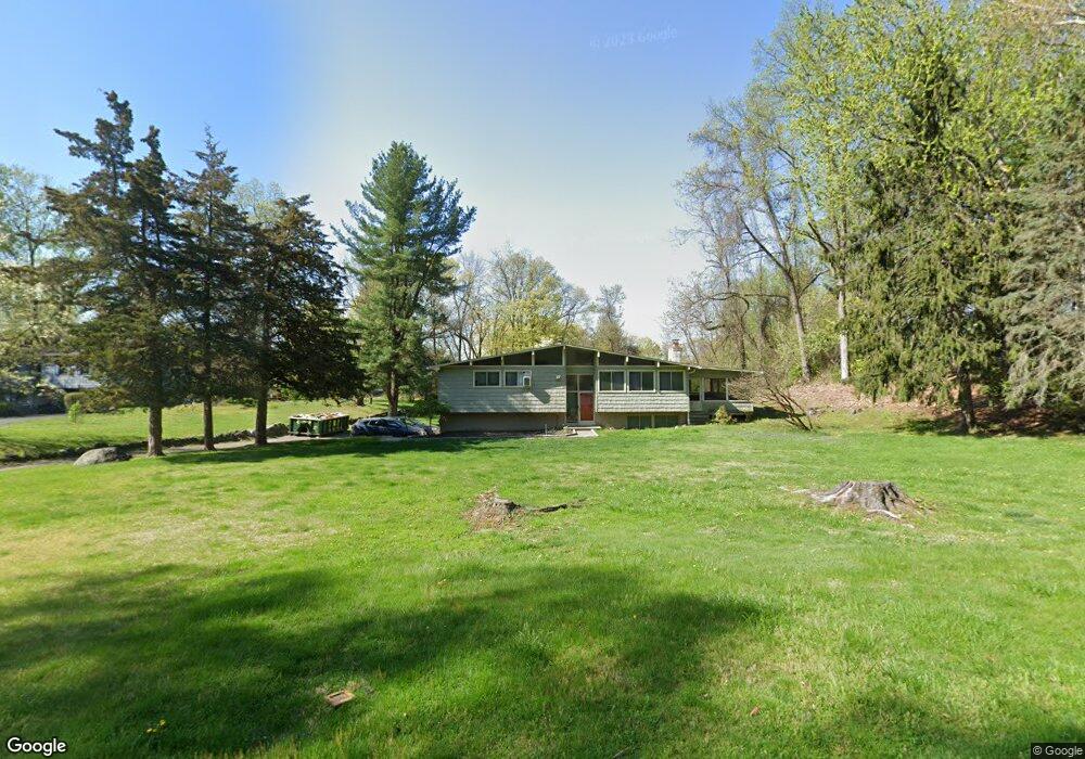
15 John Cava Ln Cortlandt Manor, NY 10567
Estimated Value: $752,023 - $860,000
--
Bed
--
Bath
--
Sq Ft
0.93
Acres
About This Home
This home is located at 15 John Cava Ln, Cortlandt Manor, NY 10567 and is currently estimated at $797,506. 15 John Cava Ln is a home located in Westchester County with nearby schools including Furnace Woods Elementary School, Blue Mountain Middle School, and Hendrick Hudson High School.
Ownership History
Date
Name
Owned For
Owner Type
Purchase Details
Closed on
Jul 30, 2004
Sold by
Diggin Michael
Bought by
Callaghan Steven and Callaghan Ann
Current Estimated Value
Home Financials for this Owner
Home Financials are based on the most recent Mortgage that was taken out on this home.
Original Mortgage
$352,500
Interest Rate
5.74%
Mortgage Type
Purchase Money Mortgage
Purchase Details
Closed on
Feb 24, 2003
Sold by
Diggin Michael and Yang Kyong Hui
Bought by
Diggin Michael
Purchase Details
Closed on
Aug 29, 2000
Sold by
Singer Steven and Singer Sue C
Bought by
Diggin Michael and Yang Kyong Hui
Home Financials for this Owner
Home Financials are based on the most recent Mortgage that was taken out on this home.
Original Mortgage
$299,600
Interest Rate
8.37%
Mortgage Type
Purchase Money Mortgage
Create a Home Valuation Report for This Property
The Home Valuation Report is an in-depth analysis detailing your home's value as well as a comparison with similar homes in the area
Home Values in the Area
Average Home Value in this Area
Purchase History
| Date | Buyer | Sale Price | Title Company |
|---|---|---|---|
| Callaghan Steven | $470,000 | -- | |
| Diggin Michael | -- | Commonwealth Land Title Ins | |
| Diggin Michael | $374,500 | -- |
Source: Public Records
Mortgage History
| Date | Status | Borrower | Loan Amount |
|---|---|---|---|
| Previous Owner | Callaghan Steven | $352,500 | |
| Previous Owner | Diggin Michael | $299,600 |
Source: Public Records
Tax History Compared to Growth
Tax History
| Year | Tax Paid | Tax Assessment Tax Assessment Total Assessment is a certain percentage of the fair market value that is determined by local assessors to be the total taxable value of land and additions on the property. | Land | Improvement |
|---|---|---|---|---|
| 2024 | $16,314 | $8,875 | $925 | $7,950 |
| 2023 | $15,426 | $8,875 | $925 | $7,950 |
| 2022 | $13,824 | $8,875 | $925 | $7,950 |
| 2021 | $13,741 | $8,875 | $925 | $7,950 |
| 2020 | $13,295 | $8,875 | $925 | $7,950 |
| 2019 | $13,841 | $8,875 | $925 | $7,950 |
| 2018 | $12,396 | $8,875 | $925 | $7,950 |
| 2017 | $4,632 | $8,875 | $925 | $7,950 |
| 2016 | $13,497 | $8,875 | $925 | $7,950 |
| 2015 | -- | $8,875 | $925 | $7,950 |
| 2014 | -- | $8,875 | $925 | $7,950 |
| 2013 | -- | $8,875 | $925 | $7,950 |
Source: Public Records
Map
Nearby Homes
- Lot 7 Mountain Side Trail
- 9 Flanders Ln
- 11 Flanders Ln
- 23 Chester Ct
- 196 Furnace Dock Rd
- 65 Furnace Brook Dr
- 14 Amalfi Dr
- 270 Furnace Dock Rd
- 11 Deer Haunt Dr
- 110 Laurel Hill Rd
- 114 Laurel Hill Rd
- 17 Deforest Dr
- 226 Furnace Dock Rd
- 12 Veronica Ct
- 20 Deforest Dr
- 0 Laurel Hill Rd Unit KEY925925
- 10 Wood Dale Ave
- 16 Scenic Dr Unit X
- 16 Scenic Dr Unit S
- 16 Scenic Dr Unit N