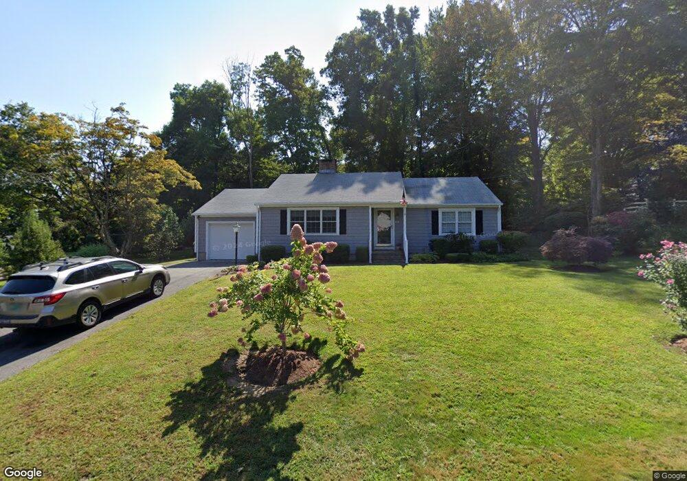
15 Jones Ln Deep River, CT 06417
Estimated Value: $370,000 - $381,000
2
Beds
3
Baths
1,214
Sq Ft
$309/Sq Ft
Est. Value
About This Home
This home is located at 15 Jones Ln, Deep River, CT 06417 and is currently estimated at $374,935, approximately $308 per square foot. 15 Jones Ln is a home located in Middlesex County with nearby schools including Valley Regional High School.
Ownership History
Date
Name
Owned For
Owner Type
Purchase Details
Closed on
Jul 18, 2013
Sold by
Cole Abby A
Bought by
Nucci Joel
Current Estimated Value
Purchase Details
Closed on
Oct 23, 2002
Sold by
Bohling Phoebe H
Bought by
Cole Abby Ann
Home Financials for this Owner
Home Financials are based on the most recent Mortgage that was taken out on this home.
Original Mortgage
$140,600
Interest Rate
6.2%
Create a Home Valuation Report for This Property
The Home Valuation Report is an in-depth analysis detailing your home's value as well as a comparison with similar homes in the area
Home Values in the Area
Average Home Value in this Area
Purchase History
| Date | Buyer | Sale Price | Title Company |
|---|---|---|---|
| Nucci Joel | $225,000 | -- | |
| Cole Abby Ann | $175,750 | -- |
Source: Public Records
Mortgage History
| Date | Status | Borrower | Loan Amount |
|---|---|---|---|
| Previous Owner | Cole Abby Ann | $100,000 | |
| Previous Owner | Cole Abby Ann | $141,075 | |
| Previous Owner | Cole Abby Ann | $140,600 |
Source: Public Records
Tax History
| Year | Tax Paid | Tax Assessment Tax Assessment Total Assessment is a certain percentage of the fair market value that is determined by local assessors to be the total taxable value of land and additions on the property. | Land | Improvement |
|---|---|---|---|---|
| 2025 | $5,028 | $157,220 | $44,590 | $112,630 |
| 2024 | $4,934 | $157,220 | $44,590 | $112,630 |
| 2023 | $4,698 | $157,220 | $44,590 | $112,630 |
| 2022 | $4,556 | $157,220 | $44,590 | $112,630 |
| 2021 | $5,067 | $157,220 | $44,590 | $112,630 |
| 2020 | $4,474 | $149,170 | $45,360 | $103,810 |
| 2019 | $10,087 | $149,170 | $45,360 | $103,810 |
| 2018 | $4,964 | $149,170 | $45,360 | $103,810 |
| 2017 | $4,989 | $149,170 | $45,360 | $103,810 |
| 2016 | $4,107 | $149,170 | $45,360 | $103,810 |
| 2015 | $3,727 | $141,820 | $50,400 | $91,420 |
| 2014 | $3,670 | $141,820 | $50,400 | $91,420 |
Source: Public Records
Map
Nearby Homes
- 19 Jones Ln
- 16 Jones Ln
- 119 Union St
- 8 Jones Ln
- 23 Jones Ln
- 123 Union St
- 115 Union St
- 85 W Bridge St
- 129 Union St
- 111 Union St
- 91 W Bridge St
- 91 A Bridge St
- 113 Union St Unit K
- 113 Union St Unit M
- 113 Union St Unit B
- 113 Union St Unit Q
- 113 Union St Unit A
- 113 Union St Unit C
- 113 Union St Unit D
- 113 Union St Unit E
Your Personal Tour Guide
Ask me questions while you tour the home.