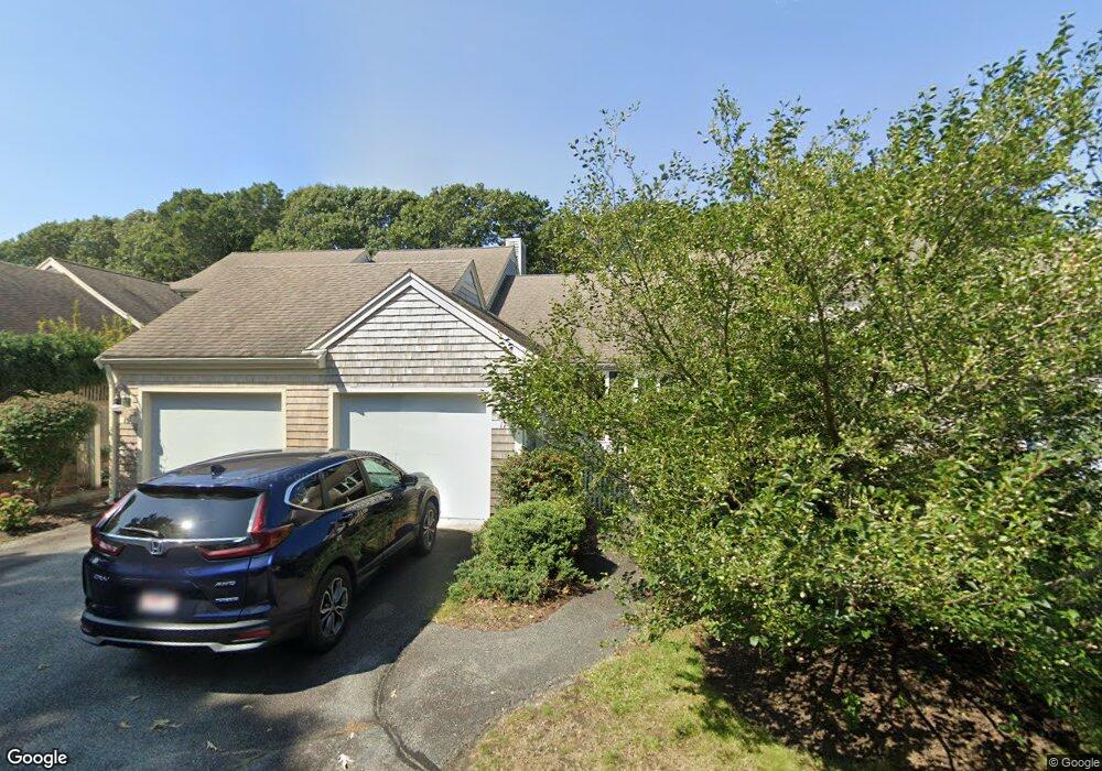
15 Kates Path Unit B Yarmouth Port, MA 02675
Yarmouth Port NeighborhoodEstimated Value: $495,000 - $613,000
2
Beds
3
Baths
1,440
Sq Ft
$400/Sq Ft
Est. Value
About This Home
This home is located at 15 Kates Path Unit B, Yarmouth Port, MA 02675 and is currently estimated at $575,864, approximately $399 per square foot. 15 Kates Path Unit B is a home located in Barnstable County with nearby schools including Dennis-Yarmouth Regional High School.
Ownership History
Date
Name
Owned For
Owner Type
Purchase Details
Closed on
May 27, 2011
Sold by
Heffron Paul T
Bought by
Hopkins Regina M
Current Estimated Value
Home Financials for this Owner
Home Financials are based on the most recent Mortgage that was taken out on this home.
Original Mortgage
$172,000
Outstanding Balance
$120,284
Interest Rate
4.94%
Estimated Equity
$455,580
Purchase Details
Closed on
Mar 1, 1999
Sold by
Wilson Elwood R
Bought by
Heffron Paul T and Heffron Margaret J
Create a Home Valuation Report for This Property
The Home Valuation Report is an in-depth analysis detailing your home's value as well as a comparison with similar homes in the area
Home Values in the Area
Average Home Value in this Area
Purchase History
| Date | Buyer | Sale Price | Title Company |
|---|---|---|---|
| Hopkins Regina M | $215,000 | -- | |
| Heffron Paul T | $187,500 | -- |
Source: Public Records
Mortgage History
| Date | Status | Borrower | Loan Amount |
|---|---|---|---|
| Open | Hopkins Regina M | $172,000 |
Source: Public Records
Tax History Compared to Growth
Tax History
| Year | Tax Paid | Tax Assessment Tax Assessment Total Assessment is a certain percentage of the fair market value that is determined by local assessors to be the total taxable value of land and additions on the property. | Land | Improvement |
|---|---|---|---|---|
| 2025 | $3,471 | $490,300 | $0 | $490,300 |
| 2024 | $3,977 | $538,900 | $0 | $538,900 |
| 2023 | $2,993 | $369,000 | $0 | $369,000 |
| 2022 | $3,758 | $409,400 | $0 | $409,400 |
| 2021 | $3,656 | $382,400 | $0 | $382,400 |
| 2020 | $3,519 | $351,900 | $0 | $351,900 |
| 2019 | $3,300 | $326,700 | $0 | $326,700 |
| 2018 | $3,101 | $301,400 | $0 | $301,400 |
| 2017 | $2,894 | $288,800 | $0 | $288,800 |
| 2016 | $2,756 | $276,200 | $0 | $276,200 |
| 2015 | $2,686 | $267,500 | $0 | $267,500 |
Source: Public Records
Map
Nearby Homes
- 17 Kates Path Unit A
- 228 Kates Path
- 64 Kates Path
- 158 Kates Path
- 43 Canterbury Rd
- 19 John Halls Cartpath Village Unit E
- 19 John Hall Cartway Unit E
- 50 John Hall Cartway
- 50 John Hall Cartway Unit 50
- 42 John Hall Cartway Unit 42
- 28 Oak Glen
- 44 Stratford Ln
- 25 Oak Glen Village Unit 25
- 25 Oak Glen
- 17 Nottingham Dr
- 30 W Woods
- 30 W Woods Cir Unit 30
- 2 Pine Grove
- 800 Route 6a
- 800 Route 6a
- 21 Kates Path
- 19 Kates Path
- 17 Kates Path
- 15 Kates Path
- 13 Kates Path
- 11 Kates Path
- 19 Kate's Path Unit 19
- 13 Kate's Point Unit 13
- 11 Kate's Point Unit 11
- 21 Kates Path Unit 21-D
- 11 Kates Path Unit E
- 13 Kates Path Unit 13
- 79 Kates Path
- 79 Kates Path Unit B
- 17 Kate's Path
- 17 Kate's Path Unit 17
- 29 Kates Path
- 27 Kates Path
- 25 Kates Path
- 23 Kates Path