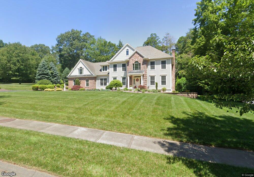
15 Kensington Dr Wilbraham, MA 01095
Estimated Value: $755,000 - $946,000
4
Beds
4
Baths
3,654
Sq Ft
$232/Sq Ft
Est. Value
About This Home
This home is located at 15 Kensington Dr, Wilbraham, MA 01095 and is currently estimated at $848,921, approximately $232 per square foot. 15 Kensington Dr is a home located in Hampden County with nearby schools including Minnechaug Regional High School, St. John the Baptist School, and Wilbraham & Monson Academy.
Ownership History
Date
Name
Owned For
Owner Type
Purchase Details
Closed on
Jul 6, 2004
Sold by
R E Laplante Const
Bought by
Youmell Edward and Youmell Nina
Current Estimated Value
Create a Home Valuation Report for This Property
The Home Valuation Report is an in-depth analysis detailing your home's value as well as a comparison with similar homes in the area
Home Values in the Area
Average Home Value in this Area
Purchase History
| Date | Buyer | Sale Price | Title Company |
|---|---|---|---|
| Youmell Edward | $122,900 | -- |
Source: Public Records
Tax History Compared to Growth
Tax History
| Year | Tax Paid | Tax Assessment Tax Assessment Total Assessment is a certain percentage of the fair market value that is determined by local assessors to be the total taxable value of land and additions on the property. | Land | Improvement |
|---|---|---|---|---|
| 2025 | $14,204 | $794,400 | $126,200 | $668,200 |
| 2024 | $13,860 | $749,200 | $126,200 | $623,000 |
| 2023 | $12,972 | $693,100 | $126,200 | $566,900 |
| 2022 | $12,972 | $633,100 | $126,200 | $506,900 |
| 2021 | $13,500 | $588,000 | $120,600 | $467,400 |
| 2020 | $13,159 | $588,000 | $120,600 | $467,400 |
| 2019 | $12,818 | $588,000 | $120,600 | $467,400 |
| 2018 | $12,694 | $560,700 | $120,600 | $440,100 |
| 2017 | $12,335 | $560,700 | $120,600 | $440,100 |
| 2016 | $12,200 | $564,800 | $134,000 | $430,800 |
| 2015 | $11,284 | $540,400 | $134,000 | $406,400 |
Source: Public Records
Map
Nearby Homes
- 103 Sandalwood Dr Unit site 00
- 111 Sandalwood Dr Unit site 00
- 99 Sandalwood Dr Unit site 00
- 57 Sandalwood Dr Unit site 61
- 26 Sandalwood Dr
- 15 Sandalwood Dr Unit site 00
- 10 Forest Glade Dr
- 11 Wellfleet Dr
- 4 Lance Ln
- 11 Hickory Hill Dr
- 344 Stony Hill Rd
- 6V Melikian Dr
- 8 Glenn Dr
- 19 Linwood Dr
- 32 Lodge Ln Unit 32
- 34 Blacksmith Rd
- 24 Lodge Ln Unit 24
- 116 Cherry Dr Unit 116
- 88 Manchonis Rd
- 2205 Boston Rd Unit I 82
- 17 Woodsley Rd
- 17 Kensington Dr
- 11 Kensington Dr
- 14 Kensington Dr
- 12 Kensington Dr
- 15 Woodsley Rd
- 18 Kensington Dr
- 10 Kensington Dr
- 18 Woodsley Rd
- 16 Woodsley Rd
- 9 Kensington Dr
- 11 Woodsley Rd
- 14 Woodsley Rd
- 8 Kensington Dr
- 43 Cypress Ln Unit 43
- 43 Cypress Ln
- 12 Woodsley Rd
- 45 Cypress Ln Unit 45
- 45 Cypress Ln
- 7 Kensington Dr