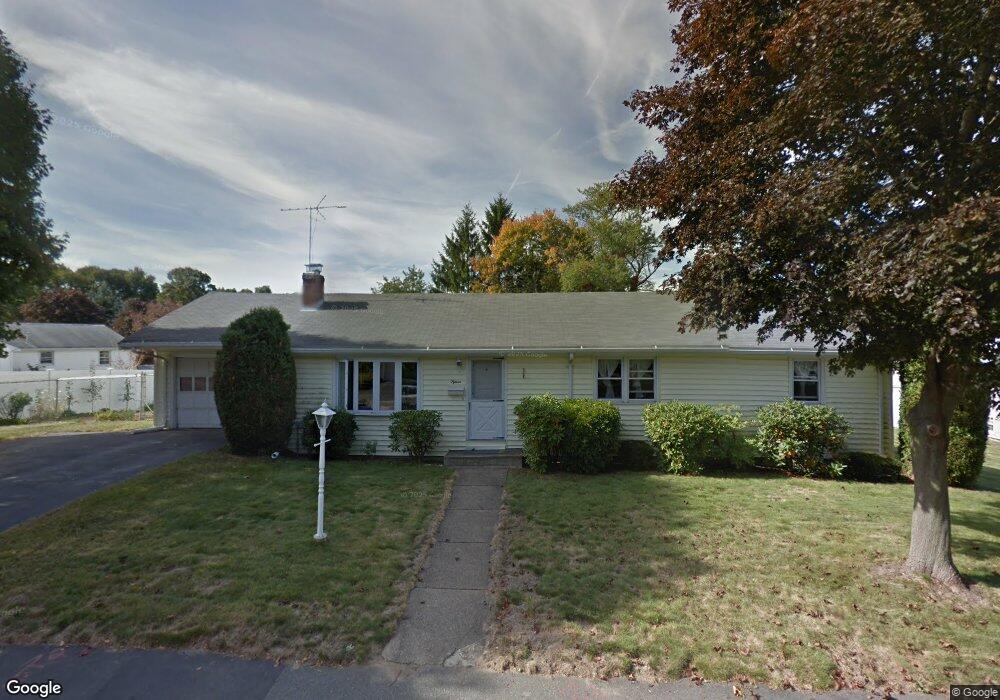
15 Kensington St Braintree, MA 02184
East Braintree NeighborhoodEstimated Value: $719,522 - $788,000
3
Beds
2
Baths
1,487
Sq Ft
$511/Sq Ft
Est. Value
About This Home
This home is located at 15 Kensington St, Braintree, MA 02184 and is currently estimated at $759,881, approximately $511 per square foot. 15 Kensington St is a home located in Norfolk County with nearby schools including Braintree High School, Sacred Heart Elementary School, and Thayer Academy.
Create a Home Valuation Report for This Property
The Home Valuation Report is an in-depth analysis detailing your home's value as well as a comparison with similar homes in the area
Home Values in the Area
Average Home Value in this Area
Tax History Compared to Growth
Tax History
| Year | Tax Paid | Tax Assessment Tax Assessment Total Assessment is a certain percentage of the fair market value that is determined by local assessors to be the total taxable value of land and additions on the property. | Land | Improvement |
|---|---|---|---|---|
| 2025 | $7,002 | $701,600 | $399,000 | $302,600 |
| 2024 | $6,347 | $669,500 | $367,500 | $302,000 |
| 2023 | $6,057 | $620,600 | $336,000 | $284,600 |
| 2022 | $5,757 | $578,600 | $294,000 | $284,600 |
| 2021 | $5,302 | $532,900 | $265,700 | $267,200 |
| 2020 | $5,016 | $508,700 | $241,500 | $267,200 |
| 2019 | $4,908 | $486,400 | $241,500 | $244,900 |
| 2018 | $4,700 | $445,900 | $210,000 | $235,900 |
| 2017 | $4,676 | $435,400 | $199,500 | $235,900 |
| 2016 | $4,606 | $419,500 | $189,000 | $230,500 |
| 2015 | $4,597 | $415,300 | $184,800 | $230,500 |
| 2014 | $4,179 | $365,900 | $160,700 | $205,200 |
Source: Public Records
Map
Nearby Homes
- 298 Lisle St
- 605 Middle St Unit 38
- 124 Louise Rd
- 51 Faxon St
- 491 Washington St Unit 1
- 428 John Mahar Hwy Unit 301
- 414 John Mahar Hwy Unit 402
- 418 John Mahar Hwy Unit 408
- 37 Monatiquot Ave
- 37 Lantern Ln
- 41 Lantern Ln
- 74 Magnolia St
- 141 Commercial St Unit 9
- 15 Summer St
- 6 Oak St
- 125 Allen St Unit A
- 6 Franklin St
- 61 Grove St
- 141 Hobart St
- 159 Hobart St