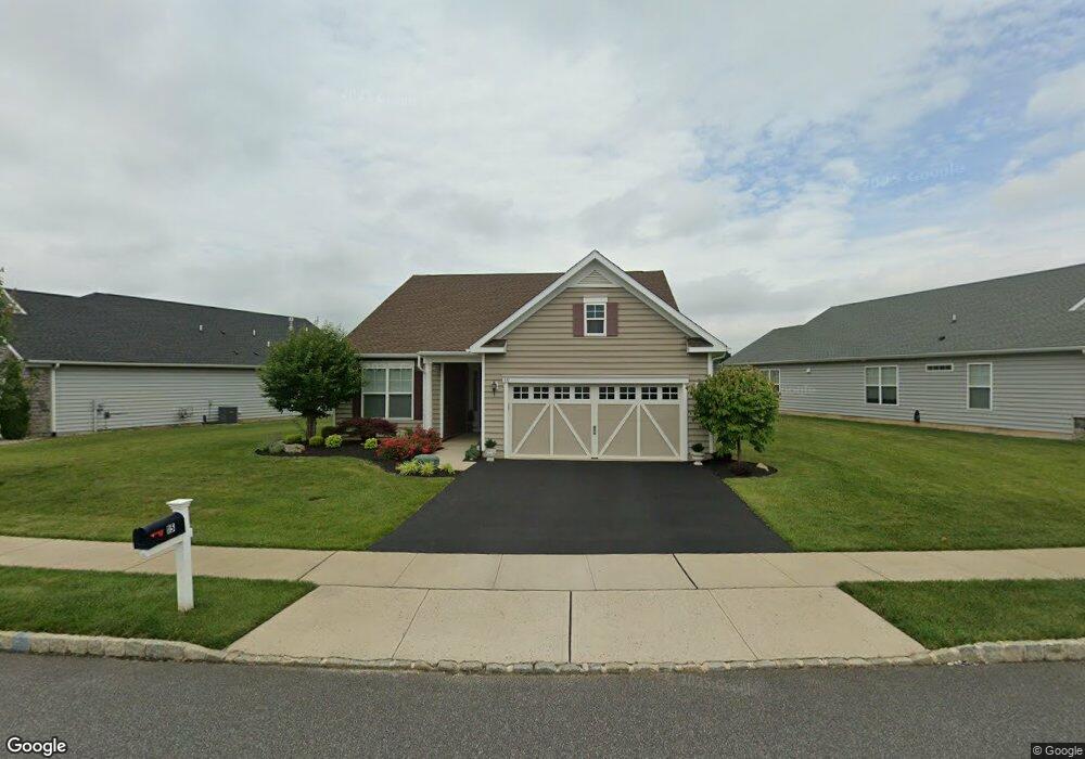
15 Landmark Rd Jamesburg, NJ 08831
Estimated Value: $763,000 - $872,000
--
Bed
--
Bath
2,725
Sq Ft
$305/Sq Ft
Est. Value
About This Home
This home is located at 15 Landmark Rd, Jamesburg, NJ 08831 and is currently estimated at $832,476, approximately $305 per square foot. 15 Landmark Rd is a home with nearby schools including Oak Tree Elementary School, Monroe Township Middle School, and Monroe Township High School.
Ownership History
Date
Name
Owned For
Owner Type
Purchase Details
Closed on
Oct 19, 2017
Sold by
K Honanian At Monroe Nj Ii Llc
Bought by
Czarneski Robert and Czarneski Judith A
Current Estimated Value
Home Financials for this Owner
Home Financials are based on the most recent Mortgage that was taken out on this home.
Original Mortgage
$247,100
Outstanding Balance
$206,453
Interest Rate
3.83%
Mortgage Type
New Conventional
Estimated Equity
$626,023
Create a Home Valuation Report for This Property
The Home Valuation Report is an in-depth analysis detailing your home's value as well as a comparison with similar homes in the area
Home Values in the Area
Average Home Value in this Area
Purchase History
| Date | Buyer | Sale Price | Title Company |
|---|---|---|---|
| Czarneski Robert | $512,125 | Eastern Title Agency Inc |
Source: Public Records
Mortgage History
| Date | Status | Borrower | Loan Amount |
|---|---|---|---|
| Open | Czarneski Robert | $247,100 |
Source: Public Records
Tax History Compared to Growth
Tax History
| Year | Tax Paid | Tax Assessment Tax Assessment Total Assessment is a certain percentage of the fair market value that is determined by local assessors to be the total taxable value of land and additions on the property. | Land | Improvement |
|---|---|---|---|---|
| 2025 | $12,512 | $445,100 | $140,000 | $305,100 |
| 2024 | $12,076 | $445,100 | $140,000 | $305,100 |
| 2023 | $12,076 | $445,100 | $140,000 | $305,100 |
| 2022 | $11,871 | $445,100 | $140,000 | $305,100 |
| 2021 | $8,858 | $445,100 | $140,000 | $305,100 |
| 2020 | $11,831 | $445,100 | $140,000 | $305,100 |
| 2019 | $11,564 | $445,100 | $140,000 | $305,100 |
| 2018 | $2,578 | $100,000 | $100,000 | $0 |
| 2017 | $2,538 | $100,000 | $100,000 | $0 |
| 2016 | $2,500 | $100,000 | $100,000 | $0 |
| 2015 | $3,416 | $140,000 | $140,000 | $0 |
Source: Public Records
Map
Nearby Homes
- 17 Landmark Rd
- 456 Roxbury Ln Unit O
- 452 New Haven Way Unit N
- 467A New Haven Way
- 467B New Haven Way Unit A
- 388 Orrington Ln Unit A
- 394C Orrington Ln
- 394 Orrington Ln Unit C
- 394 Orrington Ln
- 479 Newport Way
- 213 Blackberry Way
- 355C New Haven Way
- 340 Narragansett Ln Unit D
- 374 New Bedford Ln
- 335B Old Nassau Rd
- 297 Heather Way
- 222 Springmeadow Way
- 374N New Bedford Ln
- 377 Old Nassau Rd Unit 377B
- 377 Old Nassau Rd
- 11 Landmark Rd
- 9 Landmark Rd
- 18 Independence Dr
- 1 Commons Ct
- 16 Independence Dr
- 22 Independence Dr
- 7 Landmark Rd
- 12 Landmark Rd
- 14 Independence Dr
- 19 Landmark Rd
- 10 Landmark Rd
- 3 Commons Ct
- 5 Landmark Rd
- 24 Independence Dr
- 21 Landmark Rd
- 8 Landmark Rd
- 12 Independence Dr
- 25 Independence Dr
- 4 Commons Ct
- 19 Independence Dr