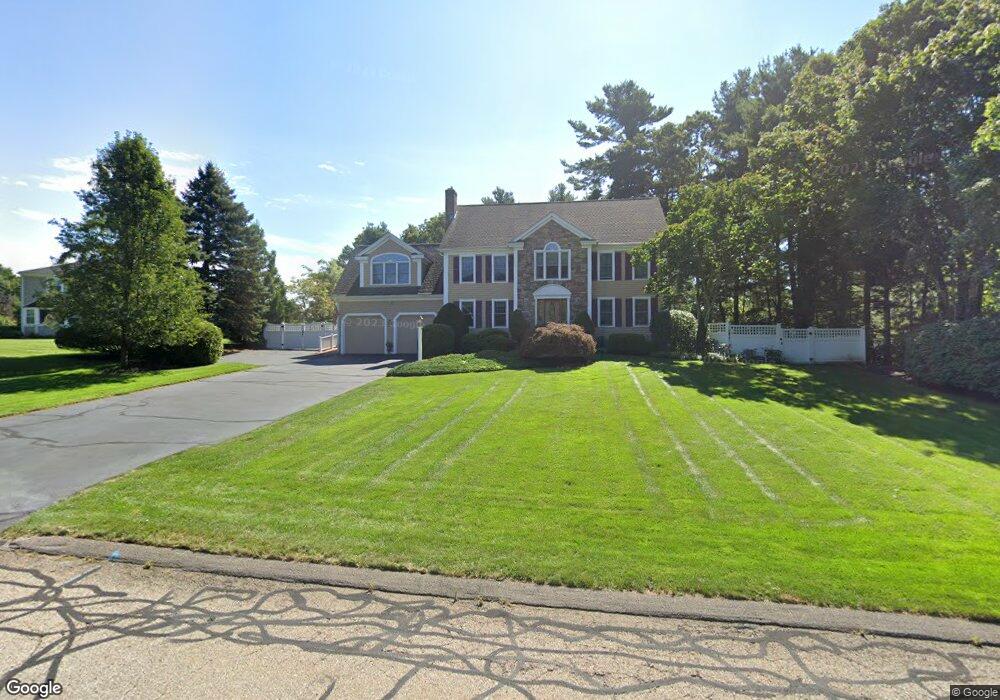
15 Laurie Ln Wrentham, MA 02093
Estimated Value: $1,093,058 - $1,313,000
4
Beds
4
Baths
3,613
Sq Ft
$329/Sq Ft
Est. Value
About This Home
This home is located at 15 Laurie Ln, Wrentham, MA 02093 and is currently estimated at $1,187,015, approximately $328 per square foot. 15 Laurie Ln is a home located in Norfolk County with nearby schools including Delaney Elementary School and Charles E Roderick.
Ownership History
Date
Name
Owned For
Owner Type
Purchase Details
Closed on
Oct 2, 2019
Sold by
Denerley Sheilagh
Bought by
Sheilagh Denerley T
Current Estimated Value
Purchase Details
Closed on
Nov 22, 1991
Sold by
Colwell Calvin W and Colwell Scott W
Bought by
Denerley Robert and Denerley Sheilagh
Home Financials for this Owner
Home Financials are based on the most recent Mortgage that was taken out on this home.
Original Mortgage
$135,000
Interest Rate
8.7%
Mortgage Type
Purchase Money Mortgage
Create a Home Valuation Report for This Property
The Home Valuation Report is an in-depth analysis detailing your home's value as well as a comparison with similar homes in the area
Home Values in the Area
Average Home Value in this Area
Purchase History
| Date | Buyer | Sale Price | Title Company |
|---|---|---|---|
| Sheilagh Denerley T | -- | -- | |
| Denerley Robert | $245,000 | -- |
Source: Public Records
Mortgage History
| Date | Status | Borrower | Loan Amount |
|---|---|---|---|
| Previous Owner | Denerley Robert | $140,000 | |
| Previous Owner | Denerley Robert | $135,000 |
Source: Public Records
Tax History Compared to Growth
Tax History
| Year | Tax Paid | Tax Assessment Tax Assessment Total Assessment is a certain percentage of the fair market value that is determined by local assessors to be the total taxable value of land and additions on the property. | Land | Improvement |
|---|---|---|---|---|
| 2025 | $10,684 | $921,800 | $315,200 | $606,600 |
| 2024 | $10,204 | $850,300 | $315,200 | $535,100 |
| 2023 | $10,133 | $802,900 | $286,600 | $516,300 |
| 2022 | $9,282 | $679,000 | $220,700 | $458,300 |
| 2021 | $9,193 | $653,400 | $231,200 | $422,200 |
| 2020 | $9,562 | $671,000 | $208,600 | $462,400 |
| 2019 | $9,182 | $650,300 | $208,600 | $441,700 |
| 2018 | $8,735 | $613,400 | $208,800 | $404,600 |
| 2017 | $8,496 | $596,200 | $204,800 | $391,400 |
| 2016 | $8,387 | $587,300 | $198,900 | $388,400 |
| 2015 | $8,124 | $542,300 | $176,500 | $365,800 |
| 2014 | $8,101 | $529,100 | $169,700 | $359,400 |
Source: Public Records
Map
Nearby Homes
- 570 Franklin St
- 50 Reed Fulton Ave Unit Lot 61
- 45 Joshua Rd
- 131 Creek St Unit 7
- 246 Forest Grove Ave
- 10 Nature View Dr
- 15 Nature View Dr
- 12 Waites Crossing Way
- 11 Elliot Mills Unit 11
- 11 Earle Stewart Ln
- Lot 3 - 14 Earle Stewart Ln
- 45 King St
- Lot 1 - Blueberry 2 Car Plan at King Philip Estates
- Lot 8 - Blueberry 2 Car Plan at King Philip Estates
- Lot 5 - Hughes 2 car Plan at King Philip Estates
- Lot 6 - Blueberry 3 Car Plan at King Philip Estates
- Lot 2 - Camden 2 Car Plan at King Philip Estates
- Lot 7 - Cedar Plan at King Philip Estates
- Lot 4 - Hemingway 2 Car Plan at King Philip Estates
- Lot 3 - Blueberry 2 Car Plan at King Philip Estates