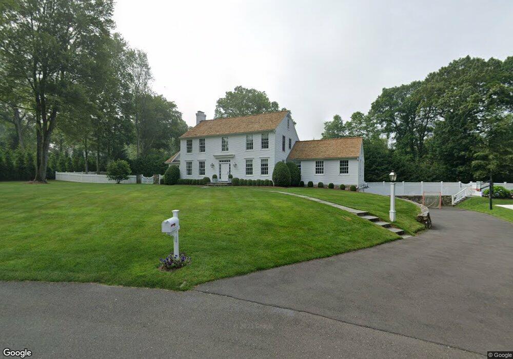
15 Leeuwarden Ln Darien, CT 06820
Estimated Value: $2,668,000 - $3,004,000
4
Beds
3
Baths
2,608
Sq Ft
$1,094/Sq Ft
Est. Value
About This Home
This home is located at 15 Leeuwarden Ln, Darien, CT 06820 and is currently estimated at $2,852,436, approximately $1,093 per square foot. 15 Leeuwarden Ln is a home located in Fairfield County with nearby schools including Ox Ridge Elementary School, Middlesex Middle School, and Darien High School.
Ownership History
Date
Name
Owned For
Owner Type
Purchase Details
Closed on
Apr 4, 2011
Sold by
Levy Carla Anne
Bought by
Giordano Richard P and Giordano Holly M
Current Estimated Value
Home Financials for this Owner
Home Financials are based on the most recent Mortgage that was taken out on this home.
Original Mortgage
$695,000
Interest Rate
5.04%
Create a Home Valuation Report for This Property
The Home Valuation Report is an in-depth analysis detailing your home's value as well as a comparison with similar homes in the area
Home Values in the Area
Average Home Value in this Area
Purchase History
| Date | Buyer | Sale Price | Title Company |
|---|---|---|---|
| Giordano Richard P | $1,395,000 | -- |
Source: Public Records
Mortgage History
| Date | Status | Borrower | Loan Amount |
|---|---|---|---|
| Open | Giordano Richard P | $200,000 | |
| Open | Giordano Richard P | $679,501 | |
| Closed | Giordano Richard P | $695,000 |
Source: Public Records
Tax History Compared to Growth
Tax History
| Year | Tax Paid | Tax Assessment Tax Assessment Total Assessment is a certain percentage of the fair market value that is determined by local assessors to be the total taxable value of land and additions on the property. | Land | Improvement |
|---|---|---|---|---|
| 2025 | $22,738 | $1,468,880 | $779,100 | $689,780 |
| 2024 | $21,578 | $1,468,880 | $779,100 | $689,780 |
| 2023 | $17,739 | $1,007,300 | $519,400 | $487,900 |
| 2022 | $17,356 | $1,007,300 | $519,400 | $487,900 |
| 2021 | $16,963 | $1,007,300 | $519,400 | $487,900 |
| 2020 | $16,479 | $1,007,300 | $519,400 | $487,900 |
| 2019 | $15,926 | $966,980 | $519,400 | $447,580 |
| 2018 | $0 | $1,152,130 | $556,500 | $595,630 |
| 2017 | $18,618 | $1,152,130 | $556,500 | $595,630 |
| 2016 | $18,169 | $1,152,130 | $556,500 | $595,630 |
| 2015 | $13,766 | $896,840 | $534,450 | $362,390 |
| 2014 | $13,462 | $896,840 | $534,450 | $362,390 |
Source: Public Records
Map
Nearby Homes
- 76 Deepwood Rd
- 11 Old Oak Rd
- 30 Lake Dr
- 825 Hope St Unit 4
- 7 Barnstable Ln
- 910 Hope St Unit 5B
- 900 Hope St Unit 8C
- 261 Hollow Tree Ridge Rd
- 970 Hope St Unit 4J
- 41 Wakemore St
- 27 Northill St Unit 3A
- 311 Noroton Ave
- 16 Columbus Place
- 32 Kensett Ln Unit 32
- 72 Kensett Ln
- 78 Elizabeth Ave
- 88 Maple Tree Ave Unit G
- 98 Holmes Ave
- 31 Sussex Place
- 95 Columbus Place Unit 6
- 11 Leeuwarden Ln
- 19 Top O Hill Rd
- 26 Leeuwarden Ln
- 13 Briar Brae Rd
- 15 Briar Brae Rd
- 16 Top O Hill Rd
- 17 Top O Hill Rd
- 30 Leeuwarden Rd
- 7 Leeuwarden Ln
- 11 Briar Brae Rd
- 17 Briar Brae Rd
- 12 Top O Hill Rd
- 20 Leeuwarden Rd
- 15 Top O Hill Rd
- 31 Miller Rd
- 19 Briar Brae Rd
- 27 Miller Rd
- 10 Briar Brae Rd
- 9 Briar Brae Rd
- 34 Leeuwarden Rd