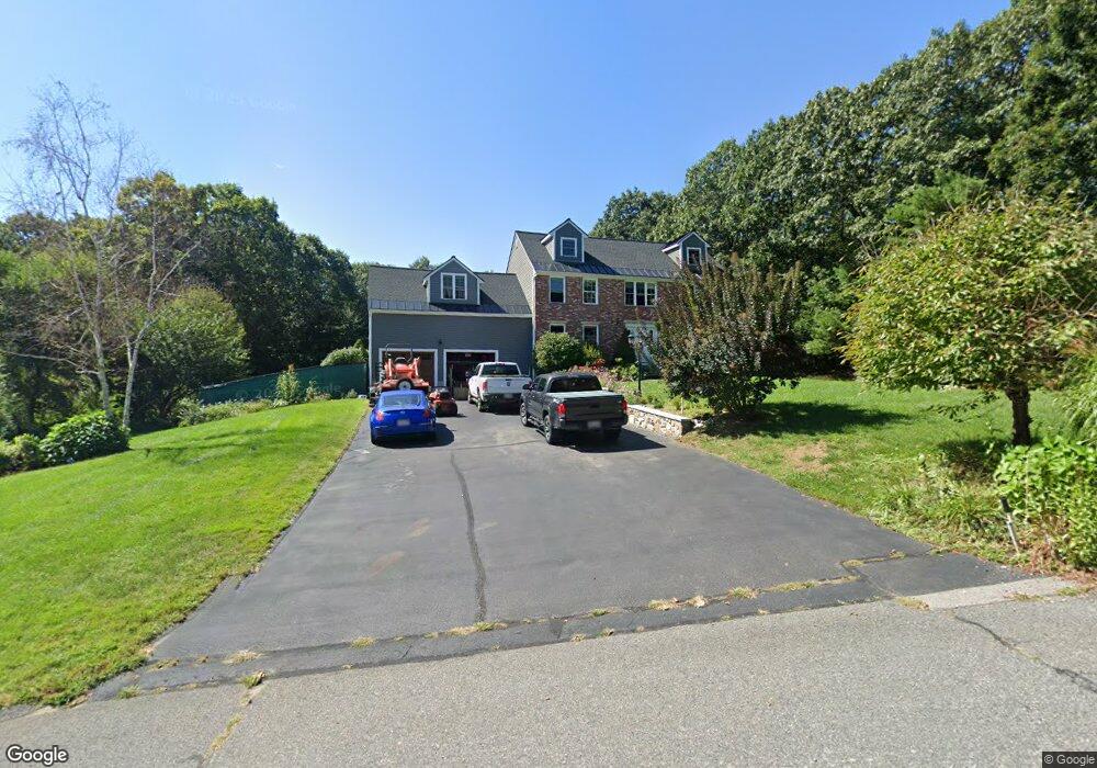
15 Lisa Dr Wrentham, MA 02093
Estimated Value: $920,118 - $1,308,000
5
Beds
3
Baths
3,002
Sq Ft
$363/Sq Ft
Est. Value
About This Home
This home is located at 15 Lisa Dr, Wrentham, MA 02093 and is currently estimated at $1,088,780, approximately $362 per square foot. 15 Lisa Dr is a home located in Norfolk County with nearby schools including Delaney Elementary School, Charles E Roderick, and Foxborough Regional Charter School.
Ownership History
Date
Name
Owned For
Owner Type
Purchase Details
Closed on
Jan 14, 1994
Sold by
Federico Tr Gino
Bought by
Wells Robbin W
Current Estimated Value
Home Financials for this Owner
Home Financials are based on the most recent Mortgage that was taken out on this home.
Original Mortgage
$200,000
Interest Rate
7.22%
Mortgage Type
Purchase Money Mortgage
Create a Home Valuation Report for This Property
The Home Valuation Report is an in-depth analysis detailing your home's value as well as a comparison with similar homes in the area
Purchase History
| Date | Buyer | Sale Price | Title Company |
|---|---|---|---|
| Wells Robbin W | $280,000 | -- |
Source: Public Records
Mortgage History
| Date | Status | Borrower | Loan Amount |
|---|---|---|---|
| Closed | Wells Robbin W | $200,000 |
Source: Public Records
Tax History
| Year | Tax Paid | Tax Assessment Tax Assessment Total Assessment is a certain percentage of the fair market value that is determined by local assessors to be the total taxable value of land and additions on the property. | Land | Improvement |
|---|---|---|---|---|
| 2025 | $9,707 | $837,500 | $302,100 | $535,400 |
| 2024 | $9,232 | $769,300 | $302,100 | $467,200 |
| 2023 | $9,248 | $732,800 | $274,500 | $458,300 |
| 2022 | $8,775 | $641,900 | $256,000 | $385,900 |
| 2021 | $8,137 | $578,300 | $223,400 | $354,900 |
| 2020 | $8,274 | $580,600 | $198,600 | $382,000 |
| 2019 | $7,951 | $563,100 | $198,600 | $364,500 |
| 2018 | $7,815 | $548,800 | $198,800 | $350,000 |
| 2017 | $7,600 | $533,300 | $195,000 | $338,300 |
| 2016 | $7,443 | $521,200 | $189,400 | $331,800 |
| 2015 | $7,466 | $498,400 | $182,000 | $316,400 |
| 2014 | $6,931 | $452,700 | $160,500 | $292,200 |
Source: Public Records
Map
Nearby Homes
- 282 Thurston St
- 483 Thurston St
- 25 Foxboro Rd
- 576 Dedham St
- 131 Washington St Unit 50
- 75 Foxboro Rd
- 8 Conway Ln
- 12 Goodwin Dr
- 1 Weber Farm Rd Unit 1
- 10 Nature View Dr
- 15 Nature View Dr
- 8 Weber Farm Rd Unit 8
- 11 Weber Farm Rd Unit 11
- 30 Weber Farm Rd Unit 30
- 9 Sharon Ave
- 11 Sharon Ave
- 7 Hill St Unit 12
- 7 Hill St Unit 16
- 5 Post Rd
- 0 W Birch Rd
Your Personal Tour Guide
Ask me questions while you tour the home.