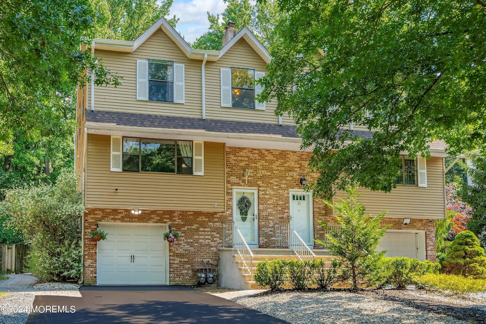

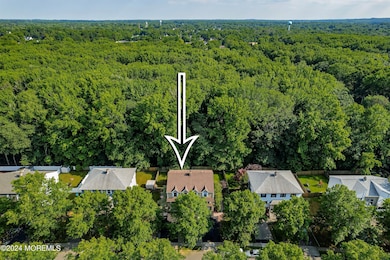
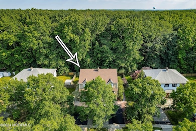
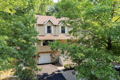
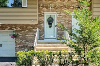
15 Lone Star Ln Manalapan, NJ 07726
Estimated payment $4,040/month
Highlights
- End Unit
- 1 Car Attached Garage
- Walk-In Closet
- Pine Brook Elementary School Rated A-
- Eat-In Kitchen
- Patio
About This Home
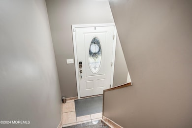
Showings start on 9/19/25. Welcome home to this stunning 4 bed, 2.5 bath, 1-car garage duplex home nestled in a desirable Briarheath complex of Manalapan. Property has a beautiful fully fenced private yard w/ paved patio. Brand new heating and cooling system. Main level featuring a spacious family & dining room, eat-in kitchen and a powder room. 3rd level features 3 bedrooms and 2 full baths. Master bed includes full bath and a walk-in closet. Ground level presents a living area with sliding doors to the yard, a bedroom, laundry and garage. Magnificent location within easy reach of shopping, dining, parks, and transportation. Top rated blue ribbon schools! Front porch, front steps and driveway replaced in 2024. Don't miss the opportunity to make this townhouse your new home!
Listing Agent
Realty One Group Central Brokerage Phone: 732-259-9300 License #1864074 Listed on: 09/19/2025

Townhouse Details
Home Type
- Townhome
Est. Annual Taxes
- $8,033
Year Built
- Built in 1989
Lot Details
- 5,227 Sq Ft Lot
- End Unit
- Fenced
HOA Fees
- $235 Monthly HOA Fees
Parking
- 1 Car Attached Garage
- Driveway
- Off-Street Parking
Home Design
- Slab Foundation
- Shingle Roof
- Vinyl Siding
Interior Spaces
- 2,377 Sq Ft Home
- 3-Story Property
- Ceiling Fan
- Blinds
- Sliding Doors
- Family Room
- Living Room
- Dining Room
Kitchen
- Eat-In Kitchen
- Stove
- Dishwasher
Flooring
- Linoleum
- Ceramic Tile
- Vinyl
Bedrooms and Bathrooms
- 4 Bedrooms
- Primary bedroom located on third floor
- Walk-In Closet
- Primary Bathroom is a Full Bathroom
Laundry
- Laundry Room
- Dryer
- Washer
Finished Basement
- Heated Basement
- Walk-Out Basement
- Basement Fills Entire Space Under The House
Outdoor Features
- Patio
- Exterior Lighting
Schools
- Milford Brk Elementary School
- Manalapan-Englshtwn Middle School
- Manalapan High School
Utilities
- Forced Air Heating and Cooling System
- Heating System Uses Natural Gas
- Natural Gas Water Heater
Listing and Financial Details
- Exclusions: Personal items
- Assessor Parcel Number 28-03100-0000-00005-02
Community Details
Overview
- Association fees include common area, exterior maint
- Briarheath Subdivision
- On-Site Maintenance
Pet Policy
- Dogs and Cats Allowed
Additional Features
- Common Area
- Resident Manager or Management On Site
Map
Home Values in the Area
Average Home Value in this Area
Tax History
| Year | Tax Paid | Tax Assessment Tax Assessment Total Assessment is a certain percentage of the fair market value that is determined by local assessors to be the total taxable value of land and additions on the property. | Land | Improvement |
|---|---|---|---|---|
| 2025 | $8,033 | $516,200 | $245,000 | $271,200 |
| 2024 | $7,741 | $475,900 | $245,000 | $230,900 |
| 2023 | $7,741 | $465,500 | $240,000 | $225,500 |
| 2022 | $7,097 | $389,200 | $156,000 | $233,200 |
| 2021 | $7,097 | $352,900 | $145,500 | $207,400 |
| 2020 | $6,732 | $326,800 | $120,500 | $206,300 |
| 2019 | $6,645 | $322,100 | $120,500 | $201,600 |
| 2018 | $6,446 | $310,500 | $120,500 | $190,000 |
| 2017 | $6,275 | $302,400 | $120,500 | $181,900 |
| 2016 | $6,051 | $294,600 | $115,000 | $179,600 |
| 2015 | $6,317 | $304,300 | $115,000 | $189,300 |
| 2014 | $6,375 | $299,300 | $115,000 | $184,300 |
Property History
| Date | Event | Price | List to Sale | Price per Sq Ft |
|---|---|---|---|---|
| 10/06/2025 10/06/25 | Pending | -- | -- | -- |
| 09/19/2025 09/19/25 | For Sale | $595,000 | -- | $250 / Sq Ft |
Purchase History
| Date | Type | Sale Price | Title Company |
|---|---|---|---|
| Deed | $145,000 | -- |
Mortgage History
| Date | Status | Loan Amount | Loan Type |
|---|---|---|---|
| Open | $127,000 | VA |
Source: MOREMLS (Monmouth Ocean Regional REALTORS®)
MLS Number: 22527845
APN: 28-03100-0000-00005-02
Disclaimer: Certain information contained herein is derived from information provided by parties other than Homes.com. All information provided is deemed reliable, but is not guaranteed to be accurate and should be independently verified.
![]() IDX information is provided exclusively for personal, non-commercial use, and may not be used for any purpose other than to identify prospective properties consumers may be interested in purchasing.
IDX information is provided exclusively for personal, non-commercial use, and may not be used for any purpose other than to identify prospective properties consumers may be interested in purchasing.
Information is deemed reliable but not guaranteed.
- 52 Crimson Dr
- 39 Crimson Dr
- Yorktown Plan at Manalapan Grove
- 22 Primrose Ct
- 32 Primrose Ct
- 24 Primrose Ct
- 30 Primrose Ct
- 36 Primrose Ct
- 77 Crimson Dr
- 85 Crimson Dr
- 87 Crimson Dr
- 89 Crimson Dr
- 63 Atrium Way Unit 6-3
- 91 Crimson Dr
- 51 Dortmunder Dr
- 56 Dortmunder Dr
- 29 Wilson Ave
- 57 Chestnut Way
- 21 Pension Hill Rd Unit 1
- 23 Pension Hill Rd