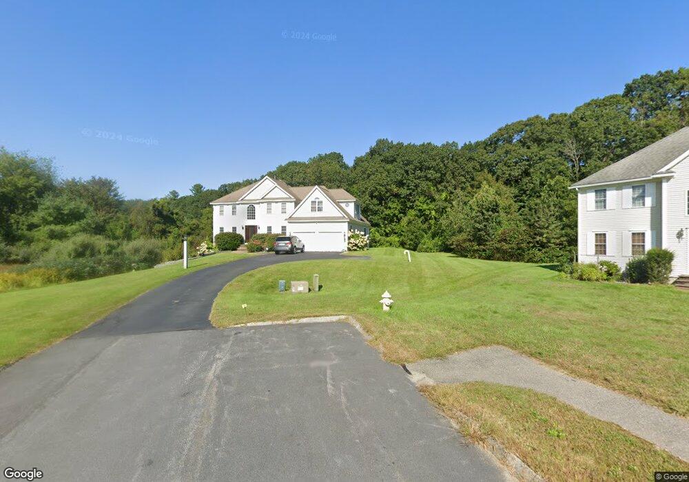
15 Loon Way Westford, MA 01886
Estimated Value: $1,295,025 - $1,492,000
4
Beds
3
Baths
3,465
Sq Ft
$404/Sq Ft
Est. Value
About This Home
This home is located at 15 Loon Way, Westford, MA 01886 and is currently estimated at $1,399,256, approximately $403 per square foot. 15 Loon Way is a home located in Middlesex County with nearby schools including Rita E. Miller Elementary School, Day Elementary School, and Stony Brook School.
Ownership History
Date
Name
Owned For
Owner Type
Purchase Details
Closed on
Dec 23, 2015
Sold by
Shah Paresh K and Shah Meeta P
Bought by
Shah Paresh K and Shah Meeta P
Current Estimated Value
Purchase Details
Closed on
Jun 24, 1999
Sold by
Orion Homes Flaherty
Bought by
Li Siu Wing and Wu Siu Lan
Home Financials for this Owner
Home Financials are based on the most recent Mortgage that was taken out on this home.
Original Mortgage
$150,000
Interest Rate
7.09%
Mortgage Type
Purchase Money Mortgage
Create a Home Valuation Report for This Property
The Home Valuation Report is an in-depth analysis detailing your home's value as well as a comparison with similar homes in the area
Home Values in the Area
Average Home Value in this Area
Purchase History
| Date | Buyer | Sale Price | Title Company |
|---|---|---|---|
| Shah Paresh K | -- | -- | |
| Li Siu Wing | $455,938 | -- | |
| Shah Paresh K | -- | -- | |
| Li Siu Wing | $455,938 | -- |
Source: Public Records
Mortgage History
| Date | Status | Borrower | Loan Amount |
|---|---|---|---|
| Previous Owner | Li Siu Wing | $100,000 | |
| Previous Owner | Li Siu Wing | $85,000 | |
| Previous Owner | Li Siu Wing | $150,000 |
Source: Public Records
Tax History Compared to Growth
Tax History
| Year | Tax Paid | Tax Assessment Tax Assessment Total Assessment is a certain percentage of the fair market value that is determined by local assessors to be the total taxable value of land and additions on the property. | Land | Improvement |
|---|---|---|---|---|
| 2025 | $15,856 | $1,177,100 | $453,700 | $723,400 |
| 2024 | $14,741 | $1,070,500 | $378,400 | $692,100 |
| 2023 | $14,208 | $962,600 | $360,400 | $602,200 |
| 2022 | $14,342 | $889,700 | $297,800 | $591,900 |
| 2021 | $13,274 | $797,700 | $297,800 | $499,900 |
| 2020 | $7,795 | $797,400 | $297,800 | $499,600 |
| 2019 | $12,124 | $732,100 | $297,800 | $434,300 |
| 2018 | $11,845 | $732,100 | $297,800 | $434,300 |
| 2017 | $11,264 | $686,400 | $297,800 | $388,600 |
| 2016 | $10,996 | $674,600 | $283,800 | $390,800 |
| 2015 | $10,837 | $667,300 | $275,200 | $392,100 |
| 2014 | $10,438 | $628,800 | $273,300 | $355,500 |
Source: Public Records
Map
Nearby Homes
- 8 Loon Way
- 9 Loon Way
- 3 Loon Way
- 2 Alder Point Unit 2
- 55 Lawson Rd
- 427 Groton Rd
- 5 Fawn Rd
- 1 Appian Way
- 16 Shipley Cir
- 3 Blue Heron Dr
- 239 Groton Rd
- 8 Hammock Dr Unit 8
- 26 N Hill Rd
- 36 Elm Rd
- 2 Courtview Ln Unit 2
- 6 Lady Constance Way
- 6 Lady Constance Way Unit 21
- 4 Lady Constance Way Unit 20
- Copley Plan at Wendell Place
- Williamstown Plan at Wendell Place