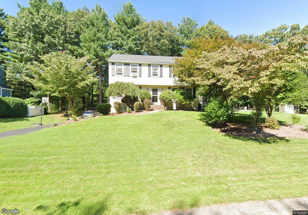
15 Lorraine Metcalf Dr Wrentham, MA 02093
Estimated Value: $717,000 - $851,000
3
Beds
3
Baths
2,200
Sq Ft
$349/Sq Ft
Est. Value
About This Home
This home is located at 15 Lorraine Metcalf Dr, Wrentham, MA 02093 and is currently estimated at $767,727, approximately $348 per square foot. 15 Lorraine Metcalf Dr is a home located in Norfolk County with nearby schools including Delaney Elementary School and Charles E Roderick.
Ownership History
Date
Name
Owned For
Owner Type
Purchase Details
Closed on
Jul 14, 2005
Sold by
Mcneil Paul J and Mcneil Susan M
Bought by
Hitchen David M and Hitchen Lauren J
Current Estimated Value
Home Financials for this Owner
Home Financials are based on the most recent Mortgage that was taken out on this home.
Original Mortgage
$359,000
Outstanding Balance
$186,333
Interest Rate
5.67%
Mortgage Type
Purchase Money Mortgage
Estimated Equity
$581,394
Purchase Details
Closed on
Oct 29, 1993
Sold by
Ferland Robert R and Ferland Maria
Bought by
Glassman Andrew J and Glassman Marcia J
Home Financials for this Owner
Home Financials are based on the most recent Mortgage that was taken out on this home.
Original Mortgage
$146,000
Interest Rate
6.86%
Mortgage Type
Purchase Money Mortgage
Create a Home Valuation Report for This Property
The Home Valuation Report is an in-depth analysis detailing your home's value as well as a comparison with similar homes in the area
Home Values in the Area
Average Home Value in this Area
Purchase History
| Date | Buyer | Sale Price | Title Company |
|---|---|---|---|
| Hitchen David M | $474,000 | -- | |
| Glassman Andrew J | $182,500 | -- |
Source: Public Records
Mortgage History
| Date | Status | Borrower | Loan Amount |
|---|---|---|---|
| Open | Hitchen David M | $359,000 | |
| Closed | Hitchen David M | $60,000 | |
| Previous Owner | Glassman Andrew J | $188,000 | |
| Previous Owner | Glassman Andrew J | $146,000 | |
| Previous Owner | Glassman Andrew J | $124,000 |
Source: Public Records
Tax History Compared to Growth
Tax History
| Year | Tax Paid | Tax Assessment Tax Assessment Total Assessment is a certain percentage of the fair market value that is determined by local assessors to be the total taxable value of land and additions on the property. | Land | Improvement |
|---|---|---|---|---|
| 2025 | $7,128 | $615,000 | $290,300 | $324,700 |
| 2024 | $6,938 | $578,200 | $290,300 | $287,900 |
| 2023 | $6,590 | $522,200 | $264,000 | $258,200 |
| 2022 | $6,477 | $473,800 | $246,300 | $227,500 |
| 2021 | $5,974 | $424,600 | $215,000 | $209,600 |
| 2020 | $5,882 | $412,800 | $191,200 | $221,600 |
| 2019 | $5,689 | $402,900 | $191,200 | $211,700 |
| 2018 | $5,874 | $412,500 | $191,400 | $221,100 |
| 2017 | $5,778 | $405,500 | $187,700 | $217,800 |
| 2016 | $5,655 | $396,000 | $182,300 | $213,700 |
| 2015 | $5,550 | $370,500 | $175,200 | $195,300 |
| 2014 | $5,493 | $358,800 | $168,500 | $190,300 |
Source: Public Records
Map
Nearby Homes
- 270 Dedham St
- 1 Lorraine Metcalf Dr
- 362 East St
- 10 Nature View Dr
- 15 Nature View Dr
- 65 Pond St
- 246 Forest Grove Ave
- 3 Oak Rd
- 319 Taunton St
- 10 W Birch Rd
- 0 W Birch Rd
- 131 Creek St Unit 7
- 25 Foxboro Rd
- 11 Earle Stewart Ln
- 570 Franklin St
- Lot 3 - 14 Earle Stewart Ln
- Lot 1 - Blueberry 2 Car Plan at King Philip Estates
- Lot 8 - Blueberry 2 Car Plan at King Philip Estates
- Lot 5 - Hughes 2 car Plan at King Philip Estates
- Lot 6 - Blueberry 3 Car Plan at King Philip Estates
- 25 Lorraine Metcalf Dr
- 5 Lorraine Metcalf Dr
- 35 Lorraine Metcalf Dr
- 258 Dedham St
- 274 Dedham St
- 30 Lorraine Metcalf Dr
- 40 Lorraine Metcalf Dr
- 45 Lorraine Metcalf Dr
- 282 Dedham St
- 10 Lorraine Metcalf Dr
- 261 Dedham St
- 275 Dedham St
- 50 Lorraine Metcalf Dr
- 279 Dedham St
- 55 Lorraine Metcalf Dr
- 291 Dedham St
- 296 Dedham St
- 220 Dedham St
- 65 Lorraine Metcalf Dr
- 295 Dedham St