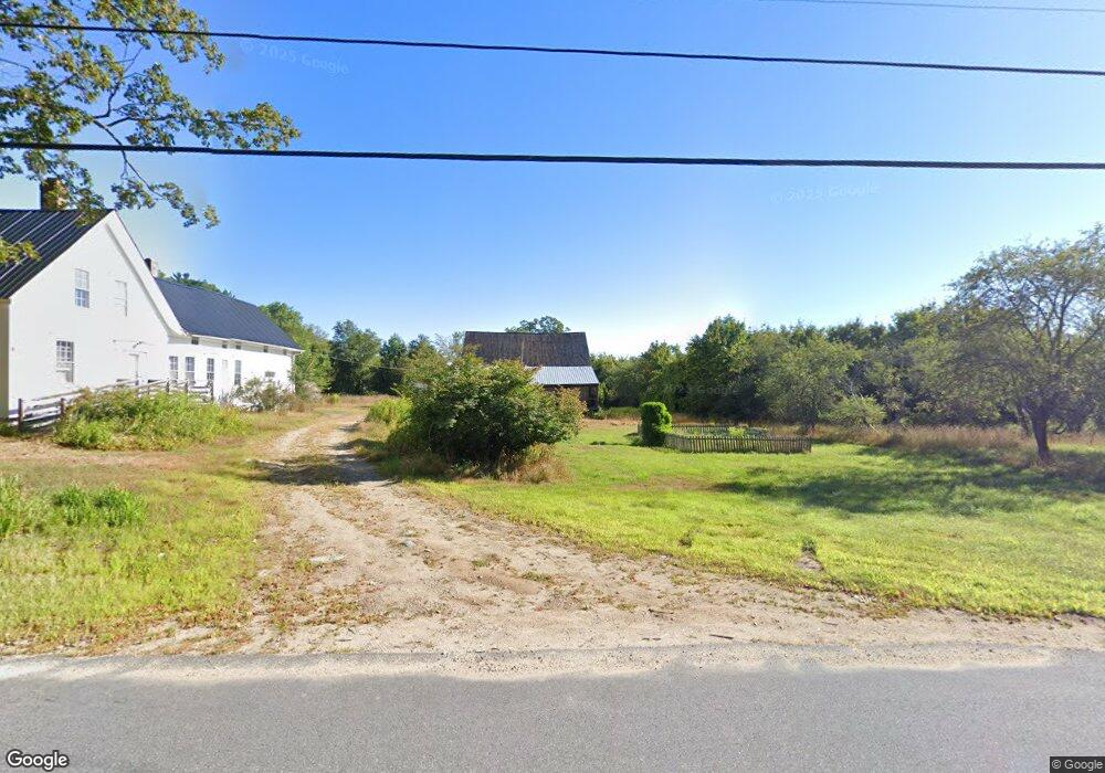
15 Lost Mile Rd West Newfield, ME 04095
Newfield NeighborhoodEstimated Value: $367,000 - $575,000
--
Bed
--
Bath
--
Sq Ft
103.6
Acres
About This Home
This home is located at 15 Lost Mile Rd, West Newfield, ME 04095 and is currently estimated at $431,254. 15 Lost Mile Rd is a home with nearby schools including Massabesic High School.
Ownership History
Date
Name
Owned For
Owner Type
Purchase Details
Closed on
Aug 1, 2017
Sold by
Carlton Katherine T Est
Bought by
Gagnon Linda K and Therrien Jonathan
Current Estimated Value
Home Financials for this Owner
Home Financials are based on the most recent Mortgage that was taken out on this home.
Original Mortgage
$78,750
Outstanding Balance
$65,622
Interest Rate
3.91%
Mortgage Type
Commercial
Estimated Equity
$365,632
Purchase Details
Closed on
Feb 7, 2013
Sold by
Carlton Katherine T
Bought by
Garrity Nichole A and Garrity Anthony J
Create a Home Valuation Report for This Property
The Home Valuation Report is an in-depth analysis detailing your home's value as well as a comparison with similar homes in the area
Home Values in the Area
Average Home Value in this Area
Purchase History
| Date | Buyer | Sale Price | Title Company |
|---|---|---|---|
| Gagnon Linda K | -- | -- | |
| Garrity Nichole A | -- | -- |
Source: Public Records
Mortgage History
| Date | Status | Borrower | Loan Amount |
|---|---|---|---|
| Open | Gagnon Linda K | $78,750 |
Source: Public Records
Tax History Compared to Growth
Tax History
| Year | Tax Paid | Tax Assessment Tax Assessment Total Assessment is a certain percentage of the fair market value that is determined by local assessors to be the total taxable value of land and additions on the property. | Land | Improvement |
|---|---|---|---|---|
| 2024 | $4,163 | $352,800 | $171,800 | $181,000 |
| 2023 | $3,853 | $352,800 | $171,800 | $181,000 |
| 2022 | $3,443 | $352,800 | $171,800 | $181,000 |
| 2021 | $3,211 | $282,200 | $137,400 | $144,800 |
| 2020 | $3,211 | $282,200 | $137,400 | $144,800 |
| 2019 | $3,144 | $282,200 | $137,400 | $144,800 |
| 2018 | $932 | $282,200 | $137,400 | $144,800 |
| 2017 | $2,506 | $232,060 | $87,260 | $144,800 |
| 2016 | $2,428 | $231,018 | $86,218 | $144,800 |
| 2015 | $2,195 | $225,400 | $80,600 | $144,800 |
| 2014 | $1,875 | $201,600 | $98,400 | $103,200 |
| 2013 | $1,921 | $213,400 | $110,200 | $103,200 |
Source: Public Records
Map
Nearby Homes
- 1 Corson Rd
- 209 Lost Mile Rd
- 00 Libby Rd Unit Lot 9
- TBD Wakefield Rd
- 1089 Maplewood Rd
- 174 Wakefield Rd
- 82 Robinhood Rd
- Parcel #1 Sanborn Rd
- 388 Belleau Blvd
- 419 Belleau Blvd
- 0 Province Lake Rd Unit 22854991
- 760 Mountain Rd
- 122 Onamor Dr
- 51 Mill Pond Rd
- 201 Beverly Hills Dr
- 368 Ballards Ridge Rd
- 8 Eliot Dr
- 570 Maplewood Rd
- 314 Beverly Hills Dr
- 420 Ballards Ridge Rd
- 000 Lost Mile Rd
- 36 Lost Mile Rd
- 67 Lost Mile Rd
- 49 Corson Rd
- 285 S Effingham Rd
- 67 Lost Mile Rd
- 70 Lost Mile Rd
- 129 Corson Rd
- 135 Corson Rd
- 276 S Effingham Rd
- 84 Lost Mile Rd
- 275 S Effingham Rd
- 264 S Effingham Rd
- 251 S Effingham Rd
- 96 Lost Mile Rd
- 244 S Effingham Rd
- 87 Corson Rd
- 245 S Effingham Rd
- 121 Lost Mile Rd
- 126 Lost Mile Rd