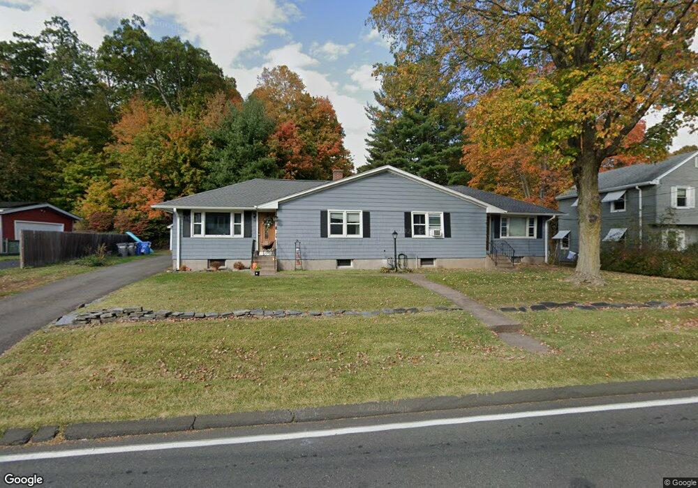
15 Lydall St Manchester, CT 06042
Buckley District NeighborhoodEstimated Value: $334,163 - $422,000
4
Beds
2
Baths
1,976
Sq Ft
$195/Sq Ft
Est. Value
About This Home
This home is located at 15 Lydall St, Manchester, CT 06042 and is currently estimated at $385,791, approximately $195 per square foot. 15 Lydall St is a home located in Hartford County with nearby schools including Bowers School, Illing Middle School, and Elisabeth M. Bennet Academy.
Ownership History
Date
Name
Owned For
Owner Type
Purchase Details
Closed on
Nov 21, 2019
Sold by
Mclain Robin
Bought by
Mgrdichian Lori and Mgrdichian Michael
Current Estimated Value
Purchase Details
Closed on
Jul 16, 2018
Sold by
Mclain Martin G
Bought by
Mclain Robin
Purchase Details
Closed on
Aug 18, 2016
Sold by
Mclain Neale O
Bought by
Mclain Martin G
Purchase Details
Closed on
Nov 29, 2012
Sold by
Est Mclain Gladys A and Mclain Neale O
Bought by
Mclain Neale O
Purchase Details
Closed on
Oct 23, 2012
Sold by
Est Mclain Gladys A and Mclain Neale O
Bought by
Mclain Neale O
Purchase Details
Closed on
Jun 25, 2012
Sold by
Mclain Neale O
Bought by
Mclain Neale O
Create a Home Valuation Report for This Property
The Home Valuation Report is an in-depth analysis detailing your home's value as well as a comparison with similar homes in the area
Home Values in the Area
Average Home Value in this Area
Purchase History
| Date | Buyer | Sale Price | Title Company |
|---|---|---|---|
| Mgrdichian Lori | $225,000 | -- | |
| Mgrdichian Lori | $225,000 | -- | |
| Mclain Robin | $112,500 | -- | |
| Mclain Robin | $112,500 | -- | |
| Mclain Martin G | -- | -- | |
| Mclain Martin G | -- | -- | |
| Mclain Neale O | -- | -- | |
| Mclain Neale O | -- | -- | |
| Mclain Neale O | -- | -- | |
| Mclain Neale O | -- | -- | |
| Mclain Neale O | -- | -- | |
| Mclain Neale O | -- | -- |
Source: Public Records
Tax History
| Year | Tax Paid | Tax Assessment Tax Assessment Total Assessment is a certain percentage of the fair market value that is determined by local assessors to be the total taxable value of land and additions on the property. | Land | Improvement |
|---|---|---|---|---|
| 2025 | $7,144 | $179,400 | $47,200 | $132,200 |
| 2024 | $6,939 | $179,400 | $47,200 | $132,200 |
| 2023 | $6,674 | $179,400 | $47,200 | $132,200 |
| 2022 | $6,543 | $179,400 | $47,200 | $132,200 |
| 2021 | $5,153 | $141,100 | $40,500 | $100,600 |
| 2020 | $5,153 | $141,100 | $40,500 | $100,600 |
| 2019 | $5,153 | $141,100 | $40,500 | $100,600 |
| 2018 | $5,053 | $141,100 | $40,500 | $100,600 |
| 2017 | $4,917 | $141,100 | $40,500 | $100,600 |
| 2016 | $4,855 | $139,300 | $51,700 | $87,600 |
| 2015 | $4,831 | $139,300 | $51,700 | $87,600 |
| 2014 | $4,736 | $139,300 | $51,700 | $87,600 |
Source: Public Records
Map
Nearby Homes
- 85 Lydall St
- 415 Woodbridge St
- 9 Robin Rd
- 86 Doane St
- 241 Henry St
- 4 Buckingham St
- 62 Ambassador Dr Unit D
- 29 Constance Dr
- 52 Lawton Rd
- 16 Lawton Rd Unit 23
- 85 Henry St
- 206 Oakland St
- 40 Grove St Unit B
- 52 Gerard St
- 110 Greenwood Dr
- 17 North St
- 150 Summit St
- 335 Grissom Rd
- 49 Cliffside Dr Unit B
- 28 Elwood Rd
Your Personal Tour Guide
Ask me questions while you tour the home.