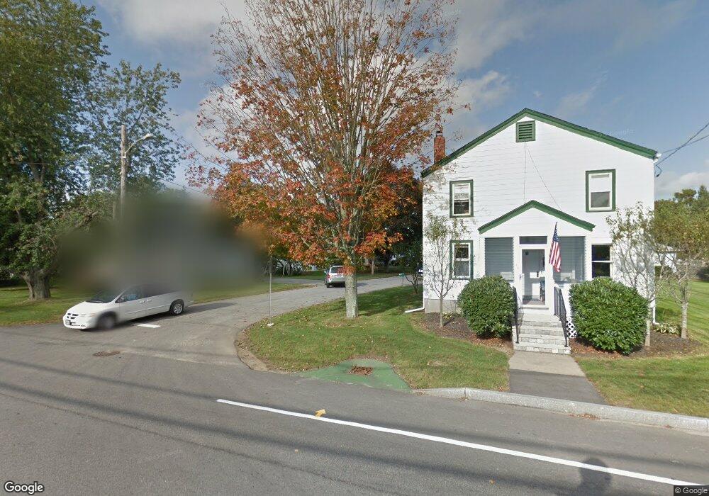
15 Maple Ave Kittery, ME 03904
Estimated Value: $496,000 - $609,535
3
Beds
1
Bath
1,442
Sq Ft
$385/Sq Ft
Est. Value
About This Home
This home is located at 15 Maple Ave, Kittery, ME 03904 and is currently estimated at $555,134, approximately $384 per square foot. 15 Maple Ave is a home with nearby schools including Shapleigh School, Horace Mitchell Primary School, and Robert W Traip Academy.
Ownership History
Date
Name
Owned For
Owner Type
Purchase Details
Closed on
Oct 24, 2018
Sold by
Hale Ryan D and Hale Heather J
Bought by
Fraser Daniel S
Current Estimated Value
Home Financials for this Owner
Home Financials are based on the most recent Mortgage that was taken out on this home.
Original Mortgage
$357,930
Outstanding Balance
$312,800
Interest Rate
4.6%
Mortgage Type
New Conventional
Estimated Equity
$242,334
Create a Home Valuation Report for This Property
The Home Valuation Report is an in-depth analysis detailing your home's value as well as a comparison with similar homes in the area
Home Values in the Area
Average Home Value in this Area
Purchase History
| Date | Buyer | Sale Price | Title Company |
|---|---|---|---|
| Fraser Daniel S | -- | -- |
Source: Public Records
Mortgage History
| Date | Status | Borrower | Loan Amount |
|---|---|---|---|
| Open | Fraser Daniel S | $357,930 |
Source: Public Records
Tax History
| Year | Tax Paid | Tax Assessment Tax Assessment Total Assessment is a certain percentage of the fair market value that is determined by local assessors to be the total taxable value of land and additions on the property. | Land | Improvement |
|---|---|---|---|---|
| 2024 | $4,943 | $348,100 | $157,200 | $190,900 |
| 2023 | $4,738 | $348,100 | $157,200 | $190,900 |
| 2022 | $4,692 | $348,100 | $157,200 | $190,900 |
| 2021 | $4,516 | $347,400 | $157,200 | $190,200 |
| 2020 | $4,481 | $347,400 | $157,200 | $190,200 |
| 2019 | $3,743 | $215,100 | $69,800 | $145,300 |
| 2018 | $25,224 | $215,100 | $69,800 | $145,300 |
| 2017 | $27,160 | $215,100 | $69,800 | $145,300 |
| 2016 | $3,452 | $215,100 | $69,800 | $145,300 |
| 2015 | $3,371 | $215,100 | $69,800 | $145,300 |
| 2014 | $3,338 | $215,100 | $69,800 | $145,300 |
| 2013 | $3,274 | $215,100 | $69,800 | $145,300 |
Source: Public Records
Map
Nearby Homes
- 30-3 Regency Cir Unit 3
- 5 Spinney Way Unit 9
- 29 Main St
- 10 Bayview Ln
- 100 Shepard's Cove Rd Unit F204
- 100 Shepard's Cove Rd Unit G107
- 100 Shepards Cove Rd Unit F204
- 27 Oak Terrace
- 25 Oak Terrace
- 19 Aspen Cir
- 4 Trefethen Ave
- 13 Cross St
- 22 Summer Ln
- 12 Gillis Dr Unit 3
- 35 Badgers Island W Unit 203
- 35 Badgers Island W Unit 301
- 35 Badgers Island W Unit 302
- 35 Badgers Island W Unit 103
- 8 Spruce Point Rd
- 333 Main St
Your Personal Tour Guide
Ask me questions while you tour the home.