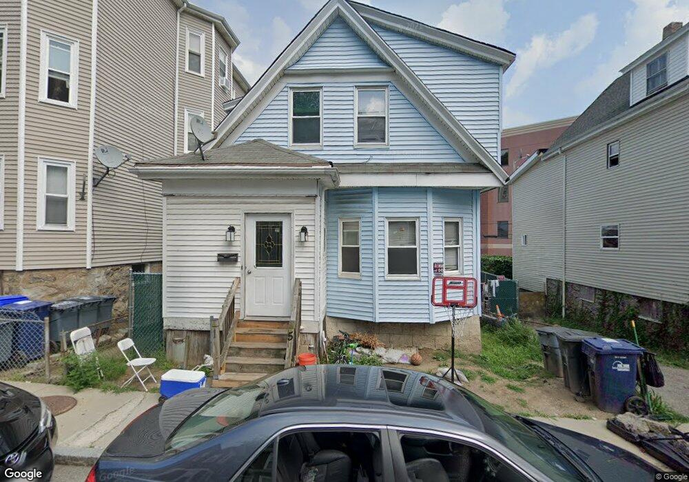
15 Marcy Rd Mattapan, MA 02126
Mattapan Square NeighborhoodEstimated Value: $394,000 - $575,327
4
Beds
2
Baths
1,328
Sq Ft
$396/Sq Ft
Est. Value
About This Home
This home is located at 15 Marcy Rd, Mattapan, MA 02126 and is currently estimated at $526,332, approximately $396 per square foot. 15 Marcy Rd is a home located in Suffolk County with nearby schools including KIPP Academy Boston Charter School, Boston Preparatory Charter Public School, and St. Mary of the Hills School.
Ownership History
Date
Name
Owned For
Owner Type
Purchase Details
Closed on
Aug 28, 2025
Sold by
Mastr Asset Back T 2004-O and Wells Fargo Bank Na Tr
Bought by
Nguyen Muoi
Current Estimated Value
Purchase Details
Closed on
Jan 26, 2024
Sold by
Skinner Rosetta and Wells Fargo Bank Na Tr
Bought by
Mastr Asset Backed T 2004 and Wells Fargo Bank Na Tr
Purchase Details
Closed on
Mar 18, 2019
Sold by
Skinner Rosalita M
Bought by
Skinner Anthony D
Create a Home Valuation Report for This Property
The Home Valuation Report is an in-depth analysis detailing your home's value as well as a comparison with similar homes in the area
Home Values in the Area
Average Home Value in this Area
Purchase History
| Date | Buyer | Sale Price | Title Company |
|---|---|---|---|
| Nguyen Muoi | $375,900 | -- | |
| Nguyen Muoi | $375,900 | -- | |
| Mastr Asset Backed T 2004 | $291,000 | None Available | |
| Mastr Asset Backed T 2004 | $291,000 | None Available | |
| Skinner Anthony D | -- | -- | |
| Skinner Anthony D | -- | -- |
Source: Public Records
Tax History Compared to Growth
Tax History
| Year | Tax Paid | Tax Assessment Tax Assessment Total Assessment is a certain percentage of the fair market value that is determined by local assessors to be the total taxable value of land and additions on the property. | Land | Improvement |
|---|---|---|---|---|
| 2025 | $5,514 | $476,200 | $172,300 | $303,900 |
| 2024 | $4,868 | $446,600 | $191,600 | $255,000 |
| 2023 | $4,568 | $425,300 | $182,500 | $242,800 |
| 2022 | $4,285 | $393,800 | $169,000 | $224,800 |
| 2021 | $4,001 | $375,000 | $160,900 | $214,100 |
| 2020 | $3,661 | $346,700 | $144,600 | $202,100 |
| 2019 | $3,515 | $333,500 | $108,400 | $225,100 |
| 2018 | $3,267 | $311,700 | $108,400 | $203,300 |
| 2017 | $3,028 | $285,900 | $108,400 | $177,500 |
| 2016 | $2,859 | $259,900 | $108,400 | $151,500 |
| 2015 | $2,480 | $204,800 | $85,900 | $118,900 |
| 2014 | $2,363 | $187,800 | $85,900 | $101,900 |
Source: Public Records
Map
Nearby Homes
- 48-50 Rockdale St
- 16 Blue Hill Ave
- 90 Hollingsworth St
- 84 Blue Hills Pkwy
- 645 River St
- 23 Caton St
- 25 Alpine St Unit 7
- 128 Blue Hills Pkwy
- 96 Brook Rd
- 27 Hawthorn Rd
- 770 Cummins Hwy Unit 1
- 770 Cummins Hwy Unit 22
- 20 Massasoit St
- 112 Brush Hill Rd
- 10 Brockton St
- 95 Woodhaven St
- 15 Fairfax Rd
- 839-843 Cummins Hwy
- 214 Brook Rd
- 42 Osceola St