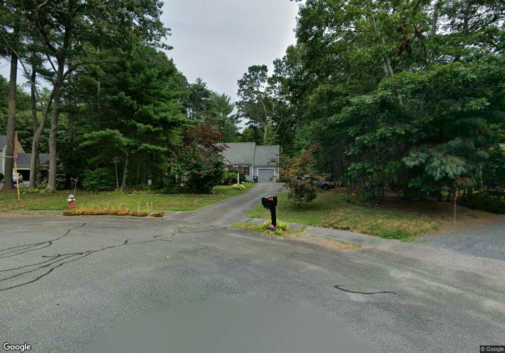
15 Massasoit Ave Norton, MA 02766
Estimated Value: $591,694 - $882,000
3
Beds
2
Baths
1,444
Sq Ft
$490/Sq Ft
Est. Value
About This Home
This home is located at 15 Massasoit Ave, Norton, MA 02766 and is currently estimated at $707,924, approximately $490 per square foot. 15 Massasoit Ave is a home located in Bristol County with nearby schools including L.G. Nourse Elementary School, Henri A. Yelle Elementary School, and Norton Middle School.
Ownership History
Date
Name
Owned For
Owner Type
Purchase Details
Closed on
Apr 17, 2025
Sold by
Carol A Simmons 209 T A and Carol Simmons
Bought by
Simmons Wyatt
Current Estimated Value
Purchase Details
Closed on
Feb 12, 2019
Sold by
Simmons Robert M and Simmons Carol A
Bought by
Carol A Simmons 2009 T A and Carol Simmons
Purchase Details
Closed on
Feb 17, 2012
Sold by
Simmons Robert M and Simmons Carol A
Bought by
Simmons Robert M
Purchase Details
Closed on
Dec 14, 2000
Sold by
Wang James C and Wang Su
Bought by
Simmons Robert M and Simmons Carol A
Create a Home Valuation Report for This Property
The Home Valuation Report is an in-depth analysis detailing your home's value as well as a comparison with similar homes in the area
Home Values in the Area
Average Home Value in this Area
Purchase History
| Date | Buyer | Sale Price | Title Company |
|---|---|---|---|
| Simmons Wyatt | -- | None Available | |
| Simmons Wyatt | -- | None Available | |
| Carol A Simmons 2009 T A | -- | -- | |
| Carol A Simmons 2009 T A | -- | -- | |
| Simmons Robert M | -- | -- | |
| Simmons Robert M | -- | -- | |
| Simmons Robert M | $266,900 | -- | |
| Simmons Robert M | $266,900 | -- |
Source: Public Records
Mortgage History
| Date | Status | Borrower | Loan Amount |
|---|---|---|---|
| Previous Owner | Simmons Robert M | $123,800 |
Source: Public Records
Tax History
| Year | Tax Paid | Tax Assessment Tax Assessment Total Assessment is a certain percentage of the fair market value that is determined by local assessors to be the total taxable value of land and additions on the property. | Land | Improvement |
|---|---|---|---|---|
| 2025 | $6,303 | $486,000 | $185,500 | $300,500 |
| 2024 | $6,044 | $466,700 | $176,700 | $290,000 |
| 2023 | $5,722 | $440,500 | $166,600 | $273,900 |
| 2022 | $5,536 | $388,200 | $151,500 | $236,700 |
| 2021 | $5,276 | $353,400 | $144,300 | $209,100 |
| 2020 | $5,081 | $343,300 | $140,100 | $203,200 |
| 2019 | $4,911 | $329,600 | $134,700 | $194,900 |
| 2018 | $4,716 | $311,100 | $134,700 | $176,400 |
| 2017 | $4,580 | $298,000 | $134,700 | $163,300 |
| 2016 | $4,427 | $283,600 | $134,700 | $148,900 |
| 2015 | $4,300 | $279,400 | $132,100 | $147,300 |
| 2014 | $4,287 | $278,900 | $138,400 | $140,500 |
Source: Public Records
Map
Nearby Homes
- 9 Winnecunnet Dr Unit 9
- O Leonard St
- 103 King Philip Rd
- 35 Owen Rd
- 195 E Main St
- 30 Samoset St
- 17 Lloyd Cir Unit 36
- 24 Lloyd Cir Unit 34
- 0 S Washington St Unit 73437419
- 1 Wilbur Terrace Unit 6
- Lot 3B Hill St
- 32 Olde Farm Rd
- 23 Lullaby Ln
- 0 Kensington Rd
- 13 Lloyd Cir Unit 34
- 11 Lloyd Cir Unit 39
- 152 Pine St Unit 23
- 90 Pine St
- 29 Germain Way Unit 3
- 157 Highland St
- 13 Massasoit Ave
- 8 Massasoit Ave
- 11 Massasoit Ave
- 6 Massasoit Ave
- 4 Massasoit Ave
- 9 Massasoit Ave
- 7 Massasoit Ave
- 2 Heather Hills Way
- 5 Massasoit Ave
- 108 Burt St
- 106 Burt St
- 3 Heather Hills Way
- 104 Burt St
- 1 Heather Hills Way
- 1 Heather Hills Way
- 102 Burt St
- 109 Burt St
- 105 Burt St
- 107 Burt St
- 103 Burt St
Your Personal Tour Guide
Ask me questions while you tour the home.