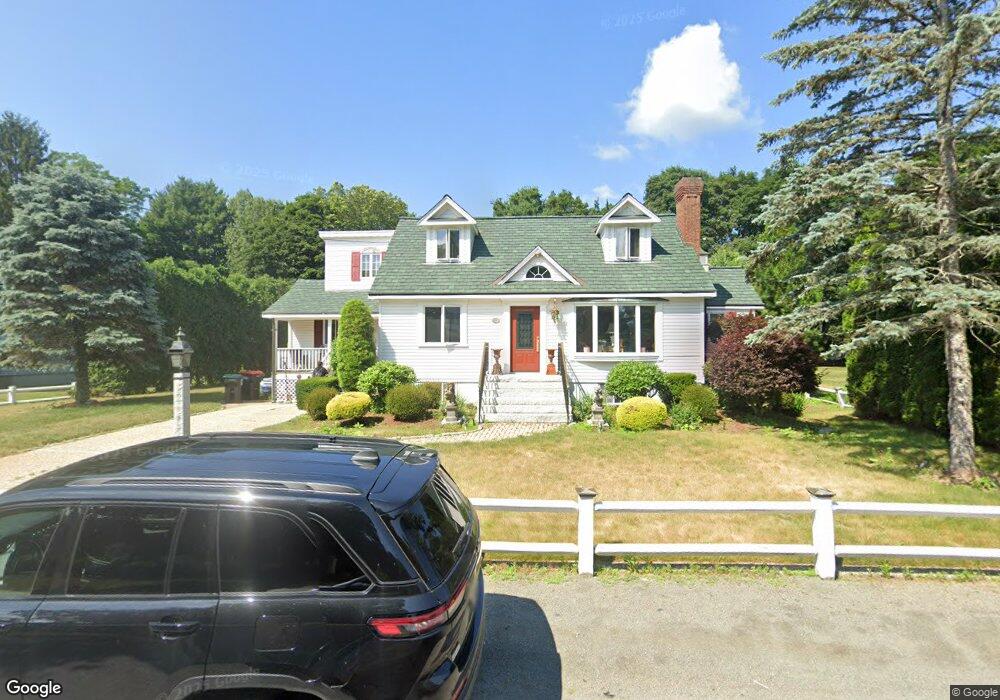
15 Merigan Way Foxboro, MA 02035
Estimated Value: $809,847 - $906,000
3
Beds
2
Baths
2,700
Sq Ft
$320/Sq Ft
Est. Value
About This Home
This home is located at 15 Merigan Way, Foxboro, MA 02035 and is currently estimated at $863,212, approximately $319 per square foot. 15 Merigan Way is a home located in Norfolk County with nearby schools including Foxborough High School, Foxborough Regional Charter School, and Hands-On-Montessori School.
Ownership History
Date
Name
Owned For
Owner Type
Purchase Details
Closed on
Mar 12, 1986
Bought by
Lally Timothy K and Lally Leah J
Current Estimated Value
Create a Home Valuation Report for This Property
The Home Valuation Report is an in-depth analysis detailing your home's value as well as a comparison with similar homes in the area
Home Values in the Area
Average Home Value in this Area
Purchase History
| Date | Buyer | Sale Price | Title Company |
|---|---|---|---|
| Lally Timothy K | $125,000 | -- |
Source: Public Records
Mortgage History
| Date | Status | Borrower | Loan Amount |
|---|---|---|---|
| Open | Lally Timothy K | $94,600 | |
| Closed | Lally Timothy K | $150,000 |
Source: Public Records
Tax History Compared to Growth
Tax History
| Year | Tax Paid | Tax Assessment Tax Assessment Total Assessment is a certain percentage of the fair market value that is determined by local assessors to be the total taxable value of land and additions on the property. | Land | Improvement |
|---|---|---|---|---|
| 2025 | $9,090 | $687,600 | $216,200 | $471,400 |
| 2024 | $8,614 | $637,600 | $216,200 | $421,400 |
| 2023 | $8,229 | $579,100 | $205,800 | $373,300 |
| 2022 | $8,093 | $557,400 | $196,900 | $360,500 |
| 2021 | $7,624 | $517,200 | $179,000 | $338,200 |
| 2020 | $7,438 | $510,500 | $179,000 | $331,500 |
| 2019 | $7,077 | $481,400 | $170,500 | $310,900 |
| 2018 | $6,940 | $476,300 | $170,500 | $305,800 |
| 2017 | $6,532 | $434,300 | $159,300 | $275,000 |
| 2016 | $7,161 | $483,200 | $153,200 | $330,000 |
| 2015 | $6,978 | $459,400 | $129,400 | $330,000 |
| 2014 | $6,849 | $456,900 | $126,900 | $330,000 |
Source: Public Records
Map
Nearby Homes
- 12 Spring St
- 356 Central St
- 619 N Main St
- 11 W Belcher Rd Unit 2
- 42 Angell St
- 44 Angell St Unit 44
- 166 Chauncy St
- 18 Winter St Unit E
- 14 Winter St Unit B
- 22 Pleasant St Unit C
- 84 Cocasset St Unit A6
- 450 West St
- 82 Brook St
- 28 Court St
- 38 Court St
- 24 Mechanic St
- 16 East St Unit 2
- 14 Baker St
- 11 Orchard Place Unit 11
- 9 Independence Dr Unit 9