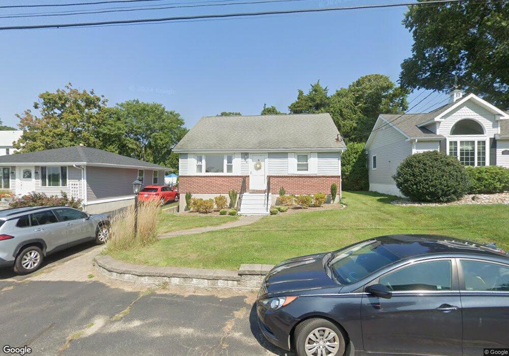
15 Merrill Rd Clinton, CT 06413
Estimated Value: $478,000 - $664,000
3
Beds
2
Baths
1,020
Sq Ft
$572/Sq Ft
Est. Value
About This Home
This home is located at 15 Merrill Rd, Clinton, CT 06413 and is currently estimated at $583,747, approximately $572 per square foot. 15 Merrill Rd is a home located in Middlesex County with nearby schools including Lewin G. Joel Jr. School and The Morgan School.
Ownership History
Date
Name
Owned For
Owner Type
Purchase Details
Closed on
Jul 23, 2019
Sold by
Mcguinness Mark E
Bought by
Mchuinness Judith C
Current Estimated Value
Home Financials for this Owner
Home Financials are based on the most recent Mortgage that was taken out on this home.
Original Mortgage
$233,000
Outstanding Balance
$202,278
Interest Rate
3.8%
Mortgage Type
New Conventional
Estimated Equity
$381,469
Purchase Details
Closed on
Nov 15, 1994
Sold by
Urbanski Wayne L and Urbanski Theresa R
Bought by
Mcguinness Mark E and Mcguinness Judith C
Home Financials for this Owner
Home Financials are based on the most recent Mortgage that was taken out on this home.
Original Mortgage
$106,400
Interest Rate
8.78%
Mortgage Type
Purchase Money Mortgage
Create a Home Valuation Report for This Property
The Home Valuation Report is an in-depth analysis detailing your home's value as well as a comparison with similar homes in the area
Home Values in the Area
Average Home Value in this Area
Purchase History
| Date | Buyer | Sale Price | Title Company |
|---|---|---|---|
| Mchuinness Judith C | -- | -- | |
| Mchuinness Judith C | -- | -- | |
| Mcguinness Mark E | $112,000 | -- | |
| Mcguinness Mark E | $112,000 | -- |
Source: Public Records
Mortgage History
| Date | Status | Borrower | Loan Amount |
|---|---|---|---|
| Open | Mchuinness Judith C | $233,000 | |
| Previous Owner | Mcguinness Mark E | $206,400 | |
| Previous Owner | Mcguinness Mark E | $107,500 | |
| Previous Owner | Mcguinness Mark E | $106,400 |
Source: Public Records
Tax History
| Year | Tax Paid | Tax Assessment Tax Assessment Total Assessment is a certain percentage of the fair market value that is determined by local assessors to be the total taxable value of land and additions on the property. | Land | Improvement |
|---|---|---|---|---|
| 2025 | $6,955 | $223,332 | $133,932 | $89,400 |
| 2024 | $6,758 | $223,332 | $133,932 | $89,400 |
| 2023 | $6,662 | $223,332 | $133,932 | $89,400 |
| 2022 | $6,587 | $220,832 | $133,932 | $86,900 |
| 2021 | $5,310 | $178,000 | $96,400 | $81,600 |
| 2020 | $5,563 | $178,000 | $96,400 | $81,600 |
| 2019 | $5,563 | $178,000 | $96,400 | $81,600 |
| 2018 | $5,436 | $178,000 | $96,400 | $81,600 |
| 2017 | $5,324 | $178,000 | $96,400 | $81,600 |
| 2016 | $4,831 | $178,000 | $96,400 | $81,600 |
| 2015 | $4,093 | $152,900 | $75,400 | $77,500 |
| 2014 | $4,017 | $152,900 | $75,400 | $77,500 |
Source: Public Records
Map
Nearby Homes
- 49 + 51 Uncas Rd
- 75 Shore Rd
- 192 E Main St
- 0 E Main St
- 144 Shore Rd
- 39 Founders Village Unit 39
- 81 Founders Village Unit 81
- 280 E Main St Unit E2
- 144 E Main St Unit 5
- 153 E Main St Unit 10
- 153 E Main St Unit 13
- 153 E Main St Unit 31
- 153 E Main St Unit 8
- 153 E Main St Unit 9
- 153 E Main St Unit 6
- 153 E Main St Unit 7
- 153 E Main St Unit 11
- 153 E Main St Unit 32
- 153 E Main St Unit 5
- 0 151 - 153 East Main St Unit 15
Your Personal Tour Guide
Ask me questions while you tour the home.