Estimated Value: $753,013 - $951,000
4
Beds
3
Baths
1,890
Sq Ft
$439/Sq Ft
Est. Value
About This Home
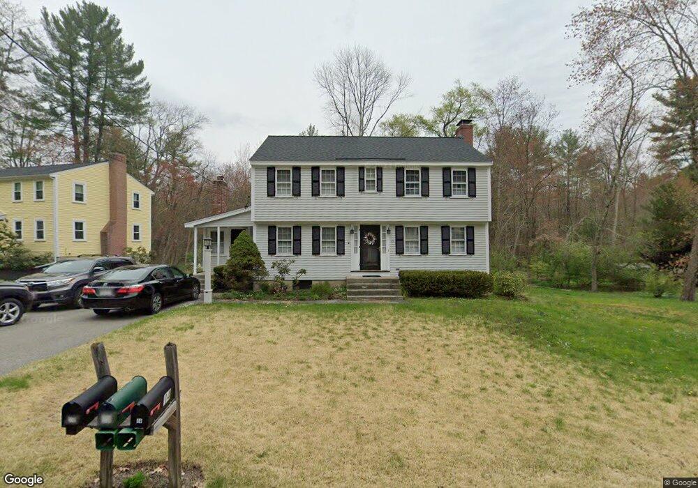
This home is located at 15 Mohawk Dr, Acton, MA 01720 and is currently estimated at $830,003, approximately $439 per square foot. 15 Mohawk Dr is a home located in Middlesex County with nearby schools including Acton-Boxborough Regional High School and Oak Meadow Montessori School.
Ownership History
Date
Name
Owned For
Owner Type
Purchase Details
Closed on
Nov 16, 2023
Sold by
Croswell Richard M and Croswell Diane B
Bought by
Croswell
Current Estimated Value
Purchase Details
Closed on
May 17, 1989
Sold by
Johnson Terrell R
Bought by
Croswell Richrad M
Purchase Details
Closed on
Apr 24, 1987
Sold by
Morin Walter R
Bought by
Kingsley Edward D
Create a Home Valuation Report for This Property
The Home Valuation Report is an in-depth analysis detailing your home's value as well as a comparison with similar homes in the area
Home Values in the Area
Average Home Value in this Area
Purchase History
| Date | Buyer | Sale Price | Title Company |
|---|---|---|---|
| Croswell | -- | None Available | |
| Croswell Richrad M | $220,000 | -- | |
| Croswell Richrad M | $220,000 | -- | |
| Kingsley Edward D | $225,000 | -- |
Source: Public Records
Mortgage History
| Date | Status | Borrower | Loan Amount |
|---|---|---|---|
| Previous Owner | Kingsley Edward D | $192,800 | |
| Previous Owner | Kingsley Edward D | $242,000 | |
| Previous Owner | Kingsley Edward D | $175,000 |
Source: Public Records
Tax History
| Year | Tax Paid | Tax Assessment Tax Assessment Total Assessment is a certain percentage of the fair market value that is determined by local assessors to be the total taxable value of land and additions on the property. | Land | Improvement |
|---|---|---|---|---|
| 2025 | $10,762 | $627,500 | $316,800 | $310,700 |
| 2024 | $10,137 | $608,100 | $316,800 | $291,300 |
| 2023 | $10,021 | $570,700 | $288,100 | $282,600 |
| 2022 | $9,519 | $489,400 | $250,300 | $239,100 |
| 2021 | $9,275 | $458,500 | $231,900 | $226,600 |
| 2020 | $8,762 | $455,400 | $231,900 | $223,500 |
| 2019 | $8,316 | $429,300 | $231,900 | $197,400 |
| 2018 | $8,202 | $423,200 | $231,900 | $191,300 |
| 2017 | $8,127 | $426,400 | $231,900 | $194,500 |
| 2016 | $8,019 | $417,000 | $231,900 | $185,100 |
| 2015 | $7,885 | $413,900 | $231,900 | $182,000 |
| 2014 | $7,714 | $396,600 | $231,900 | $164,700 |
Source: Public Records
Map
Nearby Homes
- 8 Algonquin Rd
- 285 Central St Unit 285
- 60 Nashoba Rd
- 79 Charter Rd
- 92 Willow St Unit 3
- 92 Willow St Unit 2
- 90 Willow St Unit 1
- 246 Main St Unit 2
- 7 Kelley Rd
- 18 Hayward Rd
- 11 Braebrook
- 4 Omega Way
- 25 Nylander Way
- 19 Railroad St Unit D2
- 19 Railroad St Unit C2
- 46 Taylor Rd
- 131 Main St
- 129 Main St Unit 129
- 33 Meadowbrook Rd
- 77 Wheeler Dr Unit 77
Your Personal Tour Guide
Ask me questions while you tour the home.