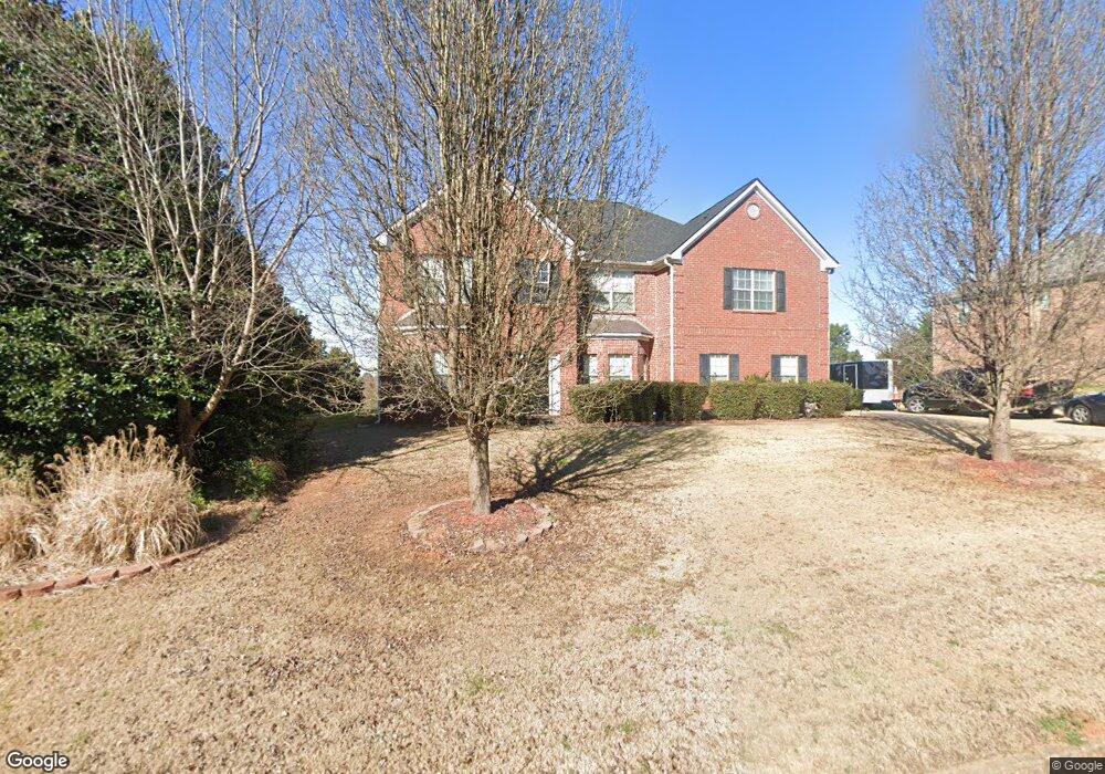
15 Muirfield Dr Covington, GA 30016
Estimated Value: $484,194 - $546,000
5
Beds
4
Baths
4,143
Sq Ft
$127/Sq Ft
Est. Value
About This Home
This home is located at 15 Muirfield Dr, Covington, GA 30016 and is currently estimated at $527,299, approximately $127 per square foot. 15 Muirfield Dr is a home located in Newton County with nearby schools including Livingston Elementary School, Liberty Middle School, and Alcovy High School.
Ownership History
Date
Name
Owned For
Owner Type
Purchase Details
Closed on
Nov 12, 2010
Sold by
Federal Natl Mtg Assn Fnma
Bought by
Singleton Terry R
Current Estimated Value
Home Financials for this Owner
Home Financials are based on the most recent Mortgage that was taken out on this home.
Original Mortgage
$162,608
Outstanding Balance
$106,352
Interest Rate
4.33%
Mortgage Type
FHA
Estimated Equity
$420,947
Purchase Details
Closed on
Sep 7, 2010
Sold by
Bank Of America
Bought by
Federal Natl Mtg Assn Fnma
Purchase Details
Closed on
Apr 19, 2007
Sold by
Franklin Bldrs Inc
Bought by
Lawrence Paul S
Home Financials for this Owner
Home Financials are based on the most recent Mortgage that was taken out on this home.
Original Mortgage
$253,100
Interest Rate
6.11%
Mortgage Type
New Conventional
Create a Home Valuation Report for This Property
The Home Valuation Report is an in-depth analysis detailing your home's value as well as a comparison with similar homes in the area
Home Values in the Area
Average Home Value in this Area
Purchase History
| Date | Buyer | Sale Price | Title Company |
|---|---|---|---|
| Singleton Terry R | -- | -- | |
| Federal Natl Mtg Assn Fnma | -- | -- | |
| Bank Of America | $204,835 | -- | |
| Lawrence Paul S | $273,100 | -- |
Source: Public Records
Mortgage History
| Date | Status | Borrower | Loan Amount |
|---|---|---|---|
| Open | Singleton Terry R | $162,608 | |
| Previous Owner | Lawrence Paul S | $253,100 |
Source: Public Records
Tax History
| Year | Tax Paid | Tax Assessment Tax Assessment Total Assessment is a certain percentage of the fair market value that is determined by local assessors to be the total taxable value of land and additions on the property. | Land | Improvement |
|---|---|---|---|---|
| 2025 | $4,798 | $198,320 | $25,200 | $173,120 |
| 2024 | $4,677 | $186,160 | $25,200 | $160,960 |
| 2023 | $4,614 | $171,720 | $9,600 | $162,120 |
| 2022 | $2,527 | $94,800 | $9,600 | $85,200 |
| 2021 | $3,294 | $110,560 | $9,600 | $100,960 |
| 2020 | $3,325 | $101,120 | $9,600 | $91,520 |
| 2019 | $3,185 | $95,560 | $9,600 | $85,960 |
| 2018 | $3,075 | $91,760 | $11,200 | $80,560 |
| 2017 | $3,209 | $95,640 | $11,200 | $84,440 |
| 2016 | $2,824 | $84,440 | $5,600 | $78,840 |
| 2015 | $2,955 | $88,280 | $5,600 | $82,680 |
| 2014 | $2,666 | $80,080 | $0 | $0 |
Source: Public Records
Map
Nearby Homes
- 66 Ellis Trail
- 60 Muirfield Dr
- 50 Glen Echo Dr
- 15 Glen Echo Dr
- 335 Glen Echo Dr
- 179 Ellis Trail
- 75 Cannonade Ct
- 230 Belmont Trail
- 40 Belmont Cir Unit 2
- 230 Laurel Way
- 395 Willow Shoals Dr
- 25 Castlehill Ct
- 70 Blackberry Ln
- 20 Crooked Creek Way
- 300 Arthurs Ln
- 10 Oaklake Ct
- 220 Lamar Ln
- 345 Arthurs Ln
- 195 Cedar Rd
- 110 Lamar Ln
- 25 Muirfield Dr
- 25 Muirfield Dr Unit 46
- 25 Muirfield Dr Unit 1
- 10 Muirfield Dr
- 35 Muirfield Dr
- 20 Ellis Trail
- 3983 Highway 81 S
- 20 Muirfield Dr
- 15 Tanglewood Dr
- 25 Tanglewood Dr
- 40 Muirfield Dr
- 45 Muirfield Dr
- 3717 Highway 81 S
- 120 Glen Echo Dr
- 110 Glen Echo Dr
- 130 Glen Echo Dr
- 100 Glen Echo Dr
- 50 Muirfield Dr
- 150 Glen Echo Dr
- 35 Tanglewood Dr
Your Personal Tour Guide
Ask me questions while you tour the home.