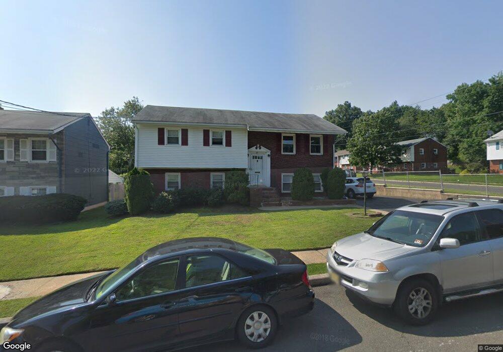
15 N High St Unit 1 Colonia, NJ 07067
Estimated Value: $459,695 - $699,000
3
Beds
1
Bath
1,474
Sq Ft
$429/Sq Ft
Est. Value
About This Home
This home is located at 15 N High St Unit 1, Colonia, NJ 07067 and is currently estimated at $631,924, approximately $428 per square foot. 15 N High St Unit 1 is a home located in Middlesex County with nearby schools including Pennsylvania Ave School, Colonia Middle School, and Colonia High School.
Ownership History
Date
Name
Owned For
Owner Type
Purchase Details
Closed on
Jul 17, 2019
Sold by
Patel Nirali
Bought by
Lawrence Gerald
Current Estimated Value
Purchase Details
Closed on
Feb 22, 2013
Sold by
Dembling Robert H
Bought by
Patel Nirali
Home Financials for this Owner
Home Financials are based on the most recent Mortgage that was taken out on this home.
Original Mortgage
$272,000
Interest Rate
3.57%
Mortgage Type
New Conventional
Create a Home Valuation Report for This Property
The Home Valuation Report is an in-depth analysis detailing your home's value as well as a comparison with similar homes in the area
Home Values in the Area
Average Home Value in this Area
Purchase History
| Date | Buyer | Sale Price | Title Company |
|---|---|---|---|
| Lawrence Gerald | $400,000 | Watson Abstract Setmnt Svcs | |
| Patel Nirali | $340,000 | None Available |
Source: Public Records
Mortgage History
| Date | Status | Borrower | Loan Amount |
|---|---|---|---|
| Previous Owner | Patel Nirali | $272,000 |
Source: Public Records
Tax History Compared to Growth
Tax History
| Year | Tax Paid | Tax Assessment Tax Assessment Total Assessment is a certain percentage of the fair market value that is determined by local assessors to be the total taxable value of land and additions on the property. | Land | Improvement |
|---|---|---|---|---|
| 2025 | $13,963 | $115,400 | $26,800 | $88,600 |
| 2024 | $13,661 | $115,400 | $26,800 | $88,600 |
| 2023 | $13,661 | $115,400 | $26,800 | $88,600 |
| 2022 | $13,322 | $115,400 | $26,800 | $88,600 |
| 2021 | $13,212 | $115,400 | $26,800 | $88,600 |
| 2020 | $12,814 | $115,400 | $26,800 | $88,600 |
| 2019 | $12,511 | $115,400 | $26,800 | $88,600 |
| 2018 | $12,273 | $115,400 | $26,800 | $88,600 |
| 2017 | $12,057 | $115,400 | $26,800 | $88,600 |
| 2016 | $11,964 | $115,400 | $26,800 | $88,600 |
| 2015 | $11,753 | $115,400 | $26,800 | $88,600 |
| 2014 | $11,502 | $115,400 | $26,800 | $88,600 |
Source: Public Records
Map
Nearby Homes
- 21 Windsor Ln
- 92 Mckinley Ave
- 42 Roosevelt Ave
- 54 Montrose Ave
- 49 Cleveland Ave
- 15 Mckinley Ave
- 14 Parson Place
- 25 N Lincoln Ave
- 36 Amherst Ave
- 91 Amherst Ave
- 42 Harrow Dr
- 47 Marlboro Ln
- 16 Stafford Rd
- 150 Carolyn Ave
- 251 Amherst Ave
- 262 Amherst Ave
- 205 Patricia Ave
- 31 Jordan Rd
- 266 Amherst Ave
- 77 Conduit Way
- 15 N High St
- 21 N High St
- 136 Garfield Ave
- 140 Garfield Ave
- 140 Garfield Ave Unit 1
- 135 N Grant Ave
- 25 N High St
- 131 Garfield Ave
- 131 Garfield Ave Unit 1
- 16 N High St
- 125 Garfield Ave
- 139 N Grant Ave
- 144 Garfield Ave
- 144 Garfield Ave Unit 1
- 22 N High St
- 111 Garfield Ave
- 135 Garfield Ave
- 26 N High St
- 108 Garfield Ave
- 108 Garfield Ave Unit 2