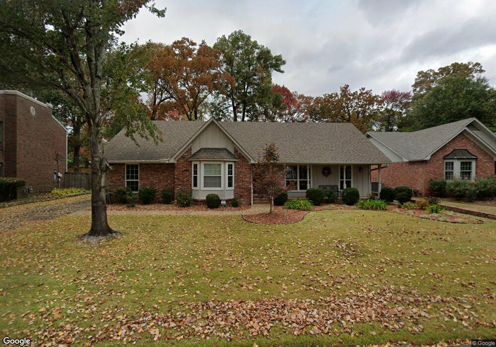
15 Oak Tree Cir North Little Rock, AR 72116
Lakewood NeighborhoodEstimated Value: $256,780 - $331,000
--
Bed
2
Baths
2,481
Sq Ft
$122/Sq Ft
Est. Value
About This Home
This home is located at 15 Oak Tree Cir, North Little Rock, AR 72116 and is currently estimated at $301,445, approximately $121 per square foot. 15 Oak Tree Cir is a home located in Pulaski County with nearby schools including Crestwood Elementary School, North Little Rock Middle School 6th Grade Campus, and North Little Rock High School.
Ownership History
Date
Name
Owned For
Owner Type
Purchase Details
Closed on
May 17, 2015
Sold by
Scroggin Benny and Scroggin Gaylon A
Bought by
Ben & Gaye Scroggin Revocable Trust and Scroggin Gaylon A
Current Estimated Value
Purchase Details
Closed on
Aug 7, 1985
Bought by
Scroggins Benny R and Scroggins Gaylon A
Create a Home Valuation Report for This Property
The Home Valuation Report is an in-depth analysis detailing your home's value as well as a comparison with similar homes in the area
Home Values in the Area
Average Home Value in this Area
Purchase History
| Date | Buyer | Sale Price | Title Company |
|---|---|---|---|
| Ben & Gaye Scroggin Revocable Trust | -- | None Available | |
| Scroggins Benny R | $122,000 | -- |
Source: Public Records
Tax History Compared to Growth
Tax History
| Year | Tax Paid | Tax Assessment Tax Assessment Total Assessment is a certain percentage of the fair market value that is determined by local assessors to be the total taxable value of land and additions on the property. | Land | Improvement |
|---|---|---|---|---|
| 2025 | $1,780 | $48,434 | $9,200 | $39,234 |
| 2024 | $1,780 | $48,434 | $9,200 | $39,234 |
| 2023 | $1,780 | $48,434 | $9,200 | $39,234 |
| 2022 | $1,780 | $48,434 | $9,200 | $39,234 |
| 2021 | $1,780 | $41,110 | $12,200 | $28,910 |
| 2020 | $1,405 | $41,110 | $12,200 | $28,910 |
| 2019 | $1,780 | $41,110 | $12,200 | $28,910 |
| 2018 | $1,430 | $41,110 | $12,200 | $28,910 |
| 2017 | $1,430 | $41,110 | $12,200 | $28,910 |
| 2016 | $1,780 | $39,580 | $6,000 | $33,580 |
| 2015 | $1,780 | $26,641 | $6,000 | $20,641 |
| 2014 | $1,780 | $26,641 | $6,000 | $20,641 |
Source: Public Records
Map
Nearby Homes
- 4524 Dawson Dr
- 4501 Dawson Dr
- 5009 Burrow Dr
- 5101 Burrow Dr
- 4204 Fox Hill Rd
- 5201 Fairway Dr
- 5317 Fairway Ave
- 4105 Dunkeld Dr
- 10 Campden Hill Rd
- 4100 Monticello Dr
- 1003 Silver Creek Dr
- 3405 Bunker Hill Dr
- 250 Smokey Ln Unit 12
- 3404 Bunker Hill Dr
- 5000 Fairway Ave
- 105 Saint Francis Ct
- 6600 Watercrest Loop
- 6633 Watercrest Loop
- 6608 Watercrest Loop
- 6624 Watercrest Loop
- 13 Oak Tree Cir
- 17 Oak Tree Cir
- 4536 Dawson Dr
- 11 Oak Tree Cir
- 4532 Dawson Dr
- 14 Oak Tree Cir
- 19 Oak Tree Cir
- 16 Oak Tree Cir
- 4540 Dawson Dr
- 10 Oak Tree Cir
- 9 Oak Tree Cir
- 18 Oak Tree Cir
- 8 Oak Tree Cir
- 21 Oak Tree Cir
- 4600 Dawson Dr
- 4528 Dawson Dr
- 4529 Dawson Dr
- 7 Oak Tree Cir
- 6 Oak Tree Cir
- 38 Oak Tree Cir