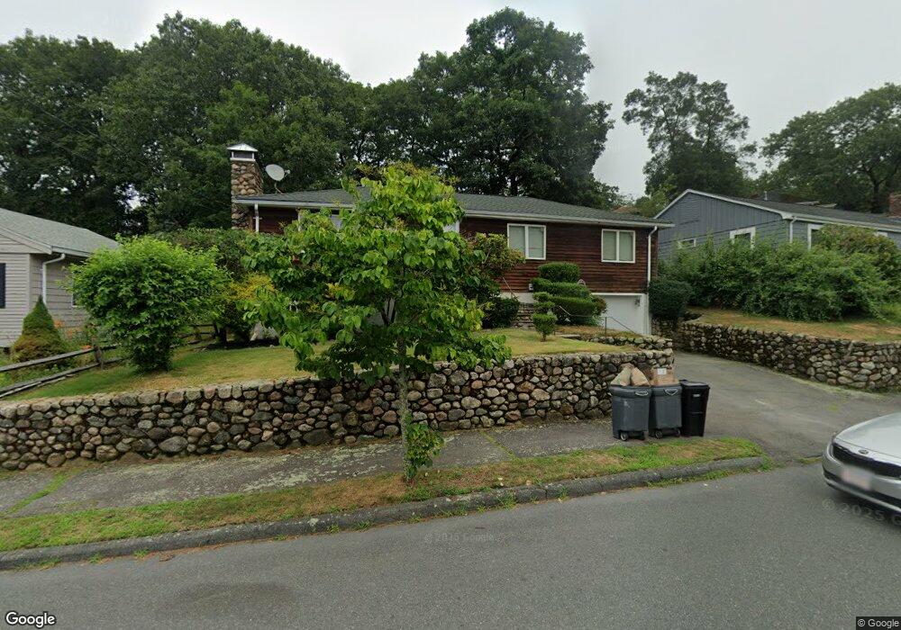
15 Oakledge Rd Swampscott, MA 01907
Estimated Value: $688,000 - $798,000
3
Beds
1
Bath
1,410
Sq Ft
$526/Sq Ft
Est. Value
About This Home
This home is located at 15 Oakledge Rd, Swampscott, MA 01907 and is currently estimated at $741,128, approximately $525 per square foot. 15 Oakledge Rd is a home located in Essex County with nearby schools including Swampscott Middle School and Swampscott High School.
Ownership History
Date
Name
Owned For
Owner Type
Purchase Details
Closed on
Mar 15, 2006
Sold by
George Carolyn A
Bought by
Vulikh Boris
Current Estimated Value
Purchase Details
Closed on
Mar 9, 2004
Sold by
George Nt
Bought by
George James Z
Create a Home Valuation Report for This Property
The Home Valuation Report is an in-depth analysis detailing your home's value as well as a comparison with similar homes in the area
Home Values in the Area
Average Home Value in this Area
Purchase History
| Date | Buyer | Sale Price | Title Company |
|---|---|---|---|
| Vulikh Boris | $325,000 | -- | |
| Vulikh Boris | $325,000 | -- | |
| George James Z | -- | -- | |
| George James Z | -- | -- |
Source: Public Records
Mortgage History
| Date | Status | Borrower | Loan Amount |
|---|---|---|---|
| Open | George James Z | $350,000 | |
| Closed | George James Z | $364,000 | |
| Closed | George James Z | $45,000 |
Source: Public Records
Tax History
| Year | Tax Paid | Tax Assessment Tax Assessment Total Assessment is a certain percentage of the fair market value that is determined by local assessors to be the total taxable value of land and additions on the property. | Land | Improvement |
|---|---|---|---|---|
| 2025 | $7,767 | $677,200 | $356,700 | $320,500 |
| 2024 | $8,119 | $706,600 | $339,300 | $367,300 |
| 2023 | $7,064 | $601,700 | $304,500 | $297,200 |
| 2022 | $6,402 | $499,000 | $261,000 | $238,000 |
| 2021 | $6,365 | $461,200 | $243,600 | $217,600 |
| 2020 | $6,163 | $431,000 | $217,500 | $213,500 |
| 2019 | $6,220 | $409,200 | $195,700 | $213,500 |
| 2018 | $6,269 | $391,800 | $178,300 | $213,500 |
| 2017 | $6,390 | $366,200 | $167,000 | $199,200 |
| 2016 | $6,346 | $366,200 | $167,000 | $199,200 |
| 2015 | $6,280 | $366,200 | $167,000 | $199,200 |
| 2014 | $5,373 | $287,300 | $139,200 | $148,100 |
Source: Public Records
Map
Nearby Homes
- 51 Mountwood Rd
- 50 Mountwood Rd
- 3 Didio Dr
- 178 Norfolk Ave
- 64 Stetson Ave
- 46 Stetson Ave
- 1 Bond St
- 71 Walnut Rd
- 106 Norfolk Ave
- 445 Essex St Unit 304
- 80 Norfolk Ave Unit 1
- 75 Bay View Dr
- 441 Essex St Unit 302
- 49 Blaney St
- 10 Arbutus Rd
- 168 Humphrey St Unit PH
- 146 Burrill St
- 108-110 Burrill St Unit 1
- 11 Boynton St Unit 104
- 11 Boynton St Unit 101
- 11 Oakledge Rd
- 19 Oakledge Rd
- 142 Walker Rd Unit 144
- 138 Walker Rd
- 7 Oakledge Rd
- 148 Walker Rd
- 130 Walker Rd
- 130 Walker Rd Unit 2
- 14 Oakledge Rd
- 14 Oakledge Rd Unit 1 on 1
- 126 Walker Rd Unit 128
- 126 Walker Rd Unit 128
- 128 Walker Rd Unit 128
- 128 Walker Rd Unit 126
- 11 Swampscott Ave
- 10 Oakledge Rd
- 1 Swampscott Ave
- 6 Oakledge Rd
- 152 Walker Rd
- 3 Oakledge Rd
Your Personal Tour Guide
Ask me questions while you tour the home.