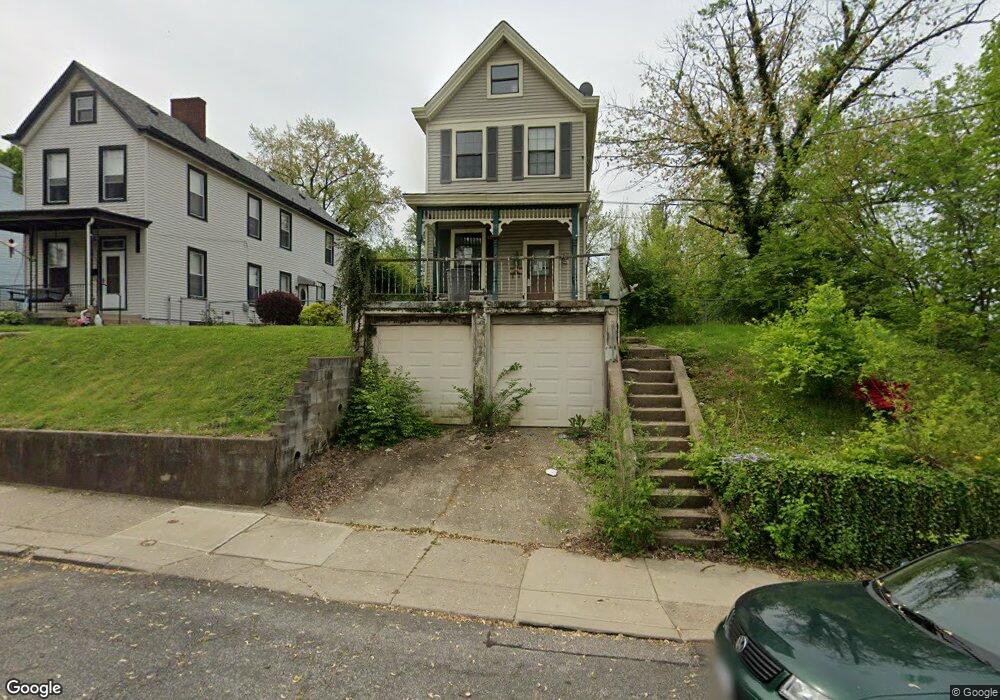
15 Orchard St Unit 15 Cincinnati, OH 45217
Estimated Value: $230,000 - $306,241
2
Beds
2
Baths
1,498
Sq Ft
$186/Sq Ft
Est. Value
About This Home
This home is located at 15 Orchard St Unit 15, Cincinnati, OH 45217 and is currently estimated at $279,310, approximately $186 per square foot. 15 Orchard St Unit 15 is a home located in Hamilton County with nearby schools including St Bernard Elementary School, St Bernard-Elmwood Place High School, and The New School.
Ownership History
Date
Name
Owned For
Owner Type
Purchase Details
Closed on
Feb 5, 2021
Sold by
Southwest Ohio Home Buyers Llc
Bought by
Vallance Kyle and Bruner Izra
Current Estimated Value
Home Financials for this Owner
Home Financials are based on the most recent Mortgage that was taken out on this home.
Original Mortgage
$200,000
Outstanding Balance
$178,723
Interest Rate
2.65%
Mortgage Type
New Conventional
Estimated Equity
$100,587
Purchase Details
Closed on
Oct 1, 2019
Sold by
Secretary Of Veterans Affairs
Bought by
Ohio Home Buyers Llc
Purchase Details
Closed on
May 17, 2019
Sold by
Us Bank National Association
Bought by
Secretary Of Veterans Affairs
Purchase Details
Closed on
Apr 17, 2019
Sold by
Vining Louis R
Bought by
Us Bank National Association
Create a Home Valuation Report for This Property
The Home Valuation Report is an in-depth analysis detailing your home's value as well as a comparison with similar homes in the area
Home Values in the Area
Average Home Value in this Area
Purchase History
| Date | Buyer | Sale Price | Title Company |
|---|---|---|---|
| Vallance Kyle | $234,000 | Chicago Title Company Llc | |
| Ohio Home Buyers Llc | -- | None Available | |
| Secretary Of Veterans Affairs | -- | None Available | |
| Us Bank National Association | $60,000 | None Available |
Source: Public Records
Mortgage History
| Date | Status | Borrower | Loan Amount |
|---|---|---|---|
| Open | Vallance Kyle | $200,000 |
Source: Public Records
Tax History Compared to Growth
Tax History
| Year | Tax Paid | Tax Assessment Tax Assessment Total Assessment is a certain percentage of the fair market value that is determined by local assessors to be the total taxable value of land and additions on the property. | Land | Improvement |
|---|---|---|---|---|
| 2024 | $2,534 | $81,901 | $12,877 | $69,024 |
| 2023 | $2,644 | $81,901 | $12,877 | $69,024 |
| 2022 | $3,279 | $81,900 | $10,045 | $71,855 |
| 2021 | $3,389 | $41,430 | $10,045 | $31,385 |
| 2020 | $3,265 | $41,430 | $10,045 | $31,385 |
| 2019 | $3,049 | $35,410 | $8,586 | $26,824 |
| 2018 | $3,095 | $35,410 | $8,586 | $26,824 |
| 2017 | $2,907 | $35,410 | $8,586 | $26,824 |
| 2016 | $2,964 | $35,750 | $10,112 | $25,638 |
| 2015 | $2,757 | $35,750 | $10,112 | $25,638 |
| 2014 | $2,750 | $35,750 | $10,112 | $25,638 |
| 2013 | $2,816 | $37,629 | $10,644 | $26,985 |
Source: Public Records
Map
Nearby Homes
- 4342 Vine St
- 4241 Vine St
- 52 E Mitchell Ave
- 4237 Vine St
- 130 Baker Ave
- 130 Mary Ln
- 27 Phillips Ave
- 38 Clinton Springs Ave
- 4409 Sullivan Ave
- 3933 Vine St
- 17 Clinton Springs Ln
- 3923 Wess Park Dr
- 208 Mcclelland Ave
- 421 Jefferson Ave
- 508 Advance Ave
- 4432 Greenlee Ave
- 209 Wedgewood Ave
- 515 Advance Ave
- 406 Washington Ave
- 320 Mcclelland Ave