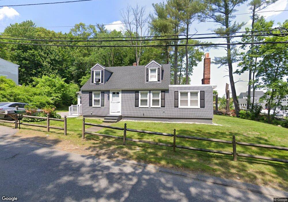
15 Passaconaway Dr Dracut, MA 01826
Estimated Value: $528,000 - $610,000
3
Beds
1
Bath
1,368
Sq Ft
$411/Sq Ft
Est. Value
About This Home
This home is located at 15 Passaconaway Dr, Dracut, MA 01826 and is currently estimated at $562,491, approximately $411 per square foot. 15 Passaconaway Dr is a home located in Middlesex County with nearby schools including Brookside Elementary School, Richardson Middle School, and Dracut Senior High School.
Ownership History
Date
Name
Owned For
Owner Type
Purchase Details
Closed on
Jun 11, 2018
Sold by
Meltzer Ronald P and Desilets Suzanne C
Bought by
Meltzer Ronald P and Meltzer Suzanne C
Current Estimated Value
Purchase Details
Closed on
Jul 20, 2001
Sold by
Perry Kevin J and Perry Patricia A
Bought by
Meltzer Ronald P
Home Financials for this Owner
Home Financials are based on the most recent Mortgage that was taken out on this home.
Original Mortgage
$203,000
Interest Rate
7.2%
Mortgage Type
Purchase Money Mortgage
Purchase Details
Closed on
May 29, 1998
Sold by
Macneill John A and Mac Neill Doris A
Bought by
Perry Kevin J and Perry Patricia A
Home Financials for this Owner
Home Financials are based on the most recent Mortgage that was taken out on this home.
Original Mortgage
$122,450
Interest Rate
7.12%
Mortgage Type
Purchase Money Mortgage
Create a Home Valuation Report for This Property
The Home Valuation Report is an in-depth analysis detailing your home's value as well as a comparison with similar homes in the area
Home Values in the Area
Average Home Value in this Area
Purchase History
| Date | Buyer | Sale Price | Title Company |
|---|---|---|---|
| Meltzer Ronald P | -- | -- | |
| Meltzer Ronald P | $210,000 | -- | |
| Perry Kevin J | $128,900 | -- |
Source: Public Records
Mortgage History
| Date | Status | Borrower | Loan Amount |
|---|---|---|---|
| Previous Owner | Perry Kevin J | $203,000 | |
| Previous Owner | Perry Kevin J | $122,450 | |
| Previous Owner | Perry Kevin J | $75,000 | |
| Previous Owner | Perry Kevin J | $20,000 |
Source: Public Records
Tax History Compared to Growth
Tax History
| Year | Tax Paid | Tax Assessment Tax Assessment Total Assessment is a certain percentage of the fair market value that is determined by local assessors to be the total taxable value of land and additions on the property. | Land | Improvement |
|---|---|---|---|---|
| 2025 | $4,898 | $484,000 | $199,200 | $284,800 |
| 2024 | $4,711 | $450,800 | $189,700 | $261,100 |
| 2023 | $4,543 | $392,300 | $165,000 | $227,300 |
| 2022 | $4,397 | $357,800 | $149,900 | $207,900 |
| 2021 | $4,257 | $327,200 | $136,300 | $190,900 |
| 2020 | $4,125 | $309,000 | $132,300 | $176,700 |
| 2019 | $4,290 | $312,000 | $125,900 | $186,100 |
| 2018 | $4,560 | $277,100 | $125,900 | $151,200 |
| 2017 | $3,692 | $277,100 | $125,900 | $151,200 |
| 2016 | $3,578 | $241,100 | $121,100 | $120,000 |
| 2015 | $3,506 | $234,800 | $121,100 | $113,700 |
| 2014 | $3,330 | $229,800 | $121,100 | $108,700 |
Source: Public Records
Map
Nearby Homes
- 97 Passaconaway Dr
- 10 Edwards St
- 17 Spare St
- 1905 Lakeview Ave
- 14 D St
- 53 4th St
- 79 B St
- 29 Mill St Unit B
- 67 2nd St
- 73 A&B Mammoth Rd
- 73 Mammoth Rd Unit A&B
- 73 Mammoth Rd
- 124 Tennis Plaza Rd Unit 22
- 53 Vinal St
- 35 Camilla Ave
- 671 Nashua Rd
- 9 Cornstalk Ln
- 25 Settlers Way
- 19 Mcgrath Rd
- 74 Tennis Plaza Rd Unit 34
- 1430 Mammoth Rd
- 1422 Mammoth Rd
- 19 Passaconaway Dr
- 1434 Mammoth Rd
- 1408 Mammoth Rd
- 1405 Mammoth Rd
- 1415 Mammoth Rd
- 1419 Mammoth Rd
- 25 Passaconaway Dr
- 1406 Mammoth Rd
- 1400 Mammoth Rd
- 22 Passaconaway Dr
- 1436 Mammoth Rd
- 1427 Mammoth Rd
- 1395 Mammoth Rd
- 12 Jackson Ave
- 1394 Mammoth Rd
- 1440 Mammoth Rd
- 9 O St
- 188 Myron St