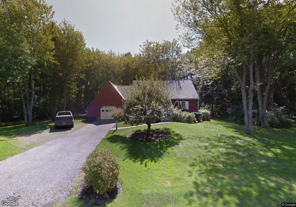
15 Perkins Ct York, ME 03909
York NeighborhoodEstimated Value: $585,000 - $651,275
3
Beds
2
Baths
1,572
Sq Ft
$396/Sq Ft
Est. Value
About This Home
This home is located at 15 Perkins Ct, York, ME 03909 and is currently estimated at $622,319, approximately $395 per square foot. 15 Perkins Ct is a home located in York County with nearby schools including Village Elementary School, Coastal Ridge Elementary School, and York Middle School.
Ownership History
Date
Name
Owned For
Owner Type
Purchase Details
Closed on
Apr 16, 2021
Sold by
Pappalardo Alfred D and Pappalardo Pamela S
Bought by
P S & A D Pappalardo Ret and Pappalardo
Current Estimated Value
Purchase Details
Closed on
Jan 26, 2021
Sold by
Edward S Pappalardo Ret and Pappalardo
Bought by
Pappalaro Alfred D and Pappalaro Pamela S
Create a Home Valuation Report for This Property
The Home Valuation Report is an in-depth analysis detailing your home's value as well as a comparison with similar homes in the area
Home Values in the Area
Average Home Value in this Area
Purchase History
| Date | Buyer | Sale Price | Title Company |
|---|---|---|---|
| P S & A D Pappalardo Ret | -- | None Available | |
| P S & A D Pappalardo Ret | -- | None Available | |
| P S & A D Pappalardo Ret | -- | None Available | |
| Pappalaro Alfred D | -- | None Available | |
| Pappalaro Alfred D | -- | None Available | |
| Pappalaro Alfred D | -- | None Available |
Source: Public Records
Tax History Compared to Growth
Tax History
| Year | Tax Paid | Tax Assessment Tax Assessment Total Assessment is a certain percentage of the fair market value that is determined by local assessors to be the total taxable value of land and additions on the property. | Land | Improvement |
|---|---|---|---|---|
| 2024 | $4,421 | $526,300 | $240,400 | $285,900 |
| 2023 | $3,577 | $423,300 | $137,400 | $285,900 |
| 2022 | $3,393 | $396,800 | $129,600 | $267,200 |
| 2021 | $3,768 | $378,700 | $154,600 | $224,100 |
| 2020 | $3,572 | $321,800 | $137,400 | $184,400 |
| 2019 | $3,033 | $272,000 | $89,300 | $182,700 |
| 2018 | $3,033 | $272,000 | $89,300 | $182,700 |
| 2017 | $2,834 | $258,800 | $89,300 | $169,500 |
| 2016 | $2,935 | $263,200 | $89,300 | $173,900 |
| 2015 | $2,858 | $259,800 | $89,300 | $170,500 |
| 2014 | $2,780 | $259,800 | $89,300 | $170,500 |
| 2013 | $2,710 | $259,800 | $89,300 | $170,500 |
Source: Public Records
Map
Nearby Homes
- 4 Fall Mill Rd
- 16 Orchard Farm Rd
- 11 Orchard Farm Rd
- 8 Ash Ln
- 11 Chestnut Ln
- 801 Us Rt 1 Yorke Woods Unit K-3
- 5 Gowen Ln
- 52 Hooper Shores Rd
- 801 Us Route 1 Unit D2
- 801 U S Route 1 Unit K-3
- 2 Woods Run
- 5 Corn Swamp Rd
- 281 York St
- 294 York St Unit 1
- 294 York St Unit 2
- 294 York St Unit 3
- 2 Lils Alley
- 208 Long Sands Rd
- 3 Long Cove Rd
- 11 Ruch Ln
- 8 Chases Pond Rd
- 2 Chases Pond Rd
- 47 Perkins Dr
- 0 Off Chases Pond Rd Lot#5
- 3 Perkins Dr
- 18 Perkins Ct
- 45 Perkins Dr
- 11 Perkins Ct
- 48 Perkins Dr
- 7 Perkins Dr
- 8 Old Chases Pond Rd
- 10 Perkins Ct
- 44 Perkins Dr
- 22 Chases Pond Rd
- 6 Old Chases Pond Rd
- 41 Perkins Dr
- 6 Perkins Dr
- 9 Perkins Ct
- 9 Perkins Dr
- 40 Perkins Dr