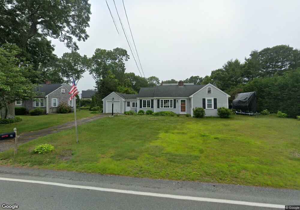
15 Presidents Rd Buzzards Bay, MA 02532
Estimated Value: $519,000 - $686,000
3
Beds
2
Baths
1,201
Sq Ft
$503/Sq Ft
Est. Value
About This Home
This home is located at 15 Presidents Rd, Buzzards Bay, MA 02532 and is currently estimated at $604,206, approximately $503 per square foot. 15 Presidents Rd is a home located in Barnstable County with nearby schools including Bourne High School, St Margaret Regional School, and Cadence Academy Preschool - Bourne.
Ownership History
Date
Name
Owned For
Owner Type
Purchase Details
Closed on
Jul 5, 2013
Sold by
Hahn Steven E and Hahn Ellen M
Bought by
Hahn Ellen M
Current Estimated Value
Purchase Details
Closed on
Jul 29, 2004
Sold by
Morrissey Donald M and Morrissey Leslie A
Bought by
Hahn Ellen M and Hahn Steven E
Create a Home Valuation Report for This Property
The Home Valuation Report is an in-depth analysis detailing your home's value as well as a comparison with similar homes in the area
Home Values in the Area
Average Home Value in this Area
Purchase History
| Date | Buyer | Sale Price | Title Company |
|---|---|---|---|
| Hahn Ellen M | -- | -- | |
| Hahn Ellen M | -- | -- | |
| Hahn Ellen M | $342,000 | -- | |
| Hahn Ellen M | $342,000 | -- |
Source: Public Records
Mortgage History
| Date | Status | Borrower | Loan Amount |
|---|---|---|---|
| Previous Owner | Hahn Ellen M | $186,000 | |
| Previous Owner | Hahn Ellen M | $104,000 | |
| Previous Owner | Hahn Ellen M | $75,000 |
Source: Public Records
Tax History Compared to Growth
Tax History
| Year | Tax Paid | Tax Assessment Tax Assessment Total Assessment is a certain percentage of the fair market value that is determined by local assessors to be the total taxable value of land and additions on the property. | Land | Improvement |
|---|---|---|---|---|
| 2025 | $3,969 | $508,200 | $245,700 | $262,500 |
| 2024 | $3,881 | $483,900 | $234,000 | $249,900 |
| 2023 | $3,772 | $428,200 | $207,100 | $221,100 |
| 2022 | $3,620 | $358,800 | $183,300 | $175,500 |
| 2021 | $3,517 | $326,600 | $166,800 | $159,800 |
| 2020 | $3,408 | $317,300 | $165,200 | $152,100 |
| 2019 | $3,438 | $327,100 | $183,600 | $143,500 |
| 2018 | $2,781 | $304,600 | $174,800 | $129,800 |
| 2017 | $3,108 | $301,700 | $173,200 | $128,500 |
| 2016 | $2,631 | $259,000 | $155,900 | $103,100 |
| 2015 | $2,376 | $235,900 | $132,800 | $103,100 |
Source: Public Records
Map
Nearby Homes
- 151 - 153 Main St
- 16 Washington Ave
- 203 County Rd
- 46 Holt Rd
- 46 Holt Rd Unit A
- 13 Laurel Hill Ct
- 34 Washington Ave
- 18 Carlton Rd
- 44 Cotuit Rd
- 14 Great Rock Rd
- 5 Sea Knoll Ct
- 12 Beachwood Rd
- 26 Carnoustie Rd
- 56 Rip Van Winkle Way
- 12 Turnberry Rd Unit 12
- 60 Sandwich Rd
- 34 Turnberry Rd
- 18 Douglas Ave
- 3 Wolf Rd
- 15 Presidents Rd
- 9 Presidents Rd
- 25 Presidents Rd
- 25 Presidents Rd
- 26 Sea Breeze Dr
- 28 Sea Breeze Dr
- 5 Presidents Rd
- 5 Presidents Rd
- 11 Thorne Rd
- 11 Thorne Rd
- 28 Seabreeze Dr
- 22 Presidents Rd
- 29 Presidents Rd
- 24 Seabreeze Dr
- 24 Sea Breeze Dr
- 1 Presidents Rd
- 30 Presidents Rd
- 30 Presidents Rd
- 4 Thorne Rd
- 10 Thorne Rd