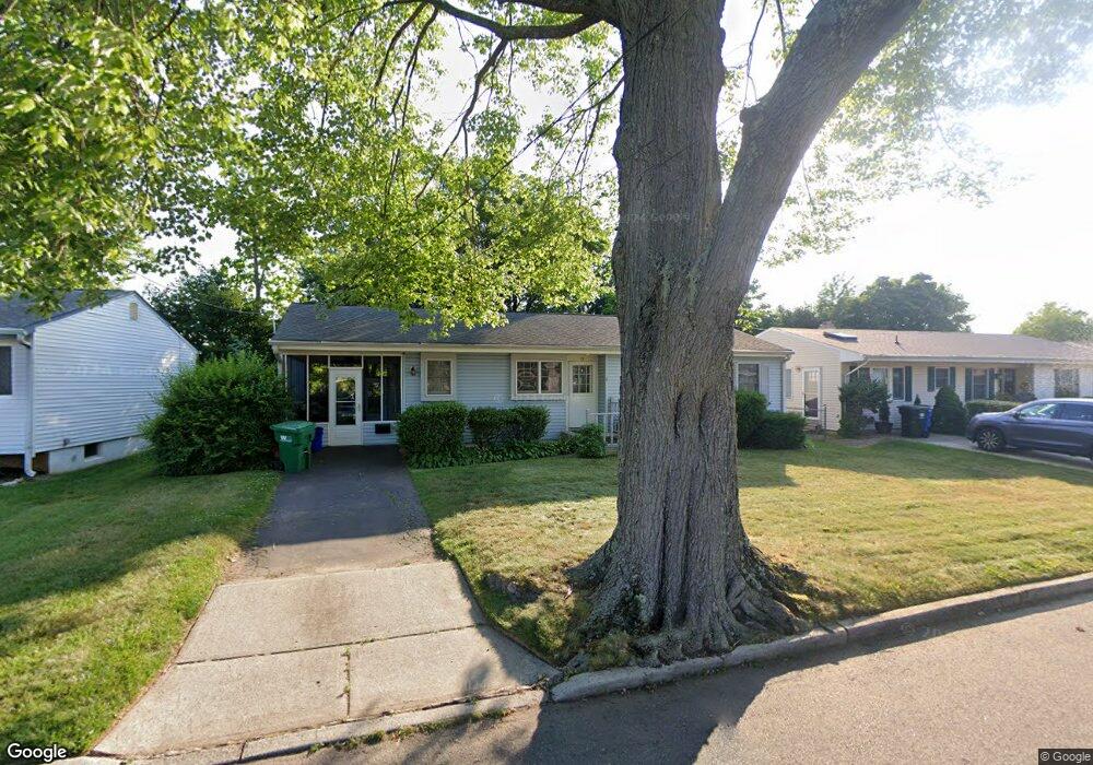
15 Purdue Rd Parlin, NJ 08859
Estimated Value: $449,201 - $494,000
--
Bed
--
Bath
1,108
Sq Ft
$425/Sq Ft
Est. Value
About This Home
This home is located at 15 Purdue Rd, Parlin, NJ 08859 and is currently estimated at $471,050, approximately $425 per square foot. 15 Purdue Rd is a home located in Middlesex County with nearby schools including Old Bridge High School and New Road School of Parlin.
Ownership History
Date
Name
Owned For
Owner Type
Purchase Details
Closed on
May 7, 2020
Sold by
Quinto Eileen and Estate Of Mary M Macfayden
Bought by
Wriolie Steven Thomas
Current Estimated Value
Home Financials for this Owner
Home Financials are based on the most recent Mortgage that was taken out on this home.
Original Mortgage
$204,800
Interest Rate
3.1%
Mortgage Type
New Conventional
Purchase Details
Closed on
Feb 11, 2002
Sold by
Purdue Asso
Bought by
Wright William and Wright Carol
Home Financials for this Owner
Home Financials are based on the most recent Mortgage that was taken out on this home.
Original Mortgage
$128,000
Interest Rate
7.08%
Purchase Details
Closed on
Jun 15, 1956
Bought by
Macfadyen Arthur and Macfadyen Mary M
Create a Home Valuation Report for This Property
The Home Valuation Report is an in-depth analysis detailing your home's value as well as a comparison with similar homes in the area
Home Values in the Area
Average Home Value in this Area
Purchase History
| Date | Buyer | Sale Price | Title Company |
|---|---|---|---|
| Wriolie Steven Thomas | $256,000 | None Available | |
| Wright William | $160,000 | -- | |
| Macfadyen Arthur | -- | -- |
Source: Public Records
Mortgage History
| Date | Status | Borrower | Loan Amount |
|---|---|---|---|
| Previous Owner | Wriolie Steven Thomas | $204,800 | |
| Previous Owner | Wright William | $128,000 |
Source: Public Records
Tax History Compared to Growth
Tax History
| Year | Tax Paid | Tax Assessment Tax Assessment Total Assessment is a certain percentage of the fair market value that is determined by local assessors to be the total taxable value of land and additions on the property. | Land | Improvement |
|---|---|---|---|---|
| 2025 | $7,013 | $119,200 | $50,000 | $69,200 |
| 2024 | $6,744 | $119,200 | $50,000 | $69,200 |
| 2023 | $6,744 | $119,200 | $50,000 | $69,200 |
| 2022 | $6,593 | $119,200 | $50,000 | $69,200 |
| 2021 | $4,832 | $119,200 | $50,000 | $69,200 |
| 2020 | $6,390 | $119,200 | $50,000 | $69,200 |
| 2019 | $6,287 | $119,200 | $50,000 | $69,200 |
| 2018 | $6,220 | $119,200 | $50,000 | $69,200 |
| 2017 | $6,033 | $119,200 | $50,000 | $69,200 |
| 2016 | $5,919 | $119,200 | $50,000 | $69,200 |
| 2015 | $5,812 | $119,200 | $50,000 | $69,200 |
| 2014 | $5,719 | $119,200 | $50,000 | $69,200 |
Source: Public Records
Map
Nearby Homes
- 11 Dartmouth Rd
- 3010 Cheesequake Rd
- 0-0 Confidential Ave
- 41 Pinetree Dr
- 19 Cypress Dr
- 18 Pinetree Dr
- 33 Elm Terrace
- 107 Ernston Rd
- 48 Cedar Terrace
- 3 Campbell Dr
- 41 Kendall Dr
- 96 Brewster Cir
- 21 Becker Dr
- 1072 Bordentown Ave
- 90 Cori St
- 41 Oakwood Dr
- 20 Gillen Dr
- 7 Kenneth Ave
- 75 Woodmere Dr Unit 906
- 75 Woodmere Dr