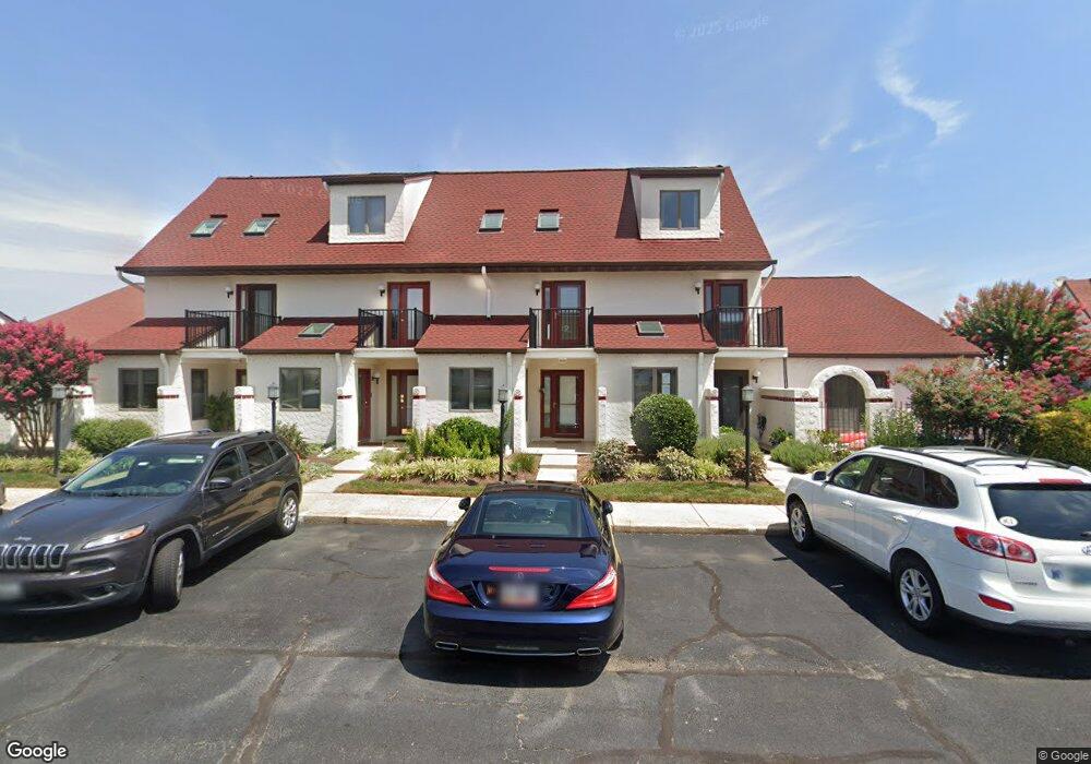
15 Queen Anne Way Unit C Chester, MD 21619
Estimated Value: $279,000 - $287,000
1
Bed
1
Bath
724
Sq Ft
$391/Sq Ft
Est. Value
About This Home
This home is located at 15 Queen Anne Way Unit C, Chester, MD 21619 and is currently estimated at $283,019, approximately $390 per square foot. 15 Queen Anne Way Unit C is a home located in Queen Anne's County with nearby schools including Kent Island Elementary School, Bayside Elementary School, and Stevensville Middle School.
Ownership History
Date
Name
Owned For
Owner Type
Purchase Details
Closed on
Jul 9, 1998
Sold by
First Bank Of Beverly Hills Fsb
Bought by
Lodowski George Nicholas
Current Estimated Value
Purchase Details
Closed on
Jun 21, 1990
Sold by
Sullivan Thomas B and Sullivan Carol D
Bought by
Lanahan Jeffrey H
Home Financials for this Owner
Home Financials are based on the most recent Mortgage that was taken out on this home.
Original Mortgage
$82,650
Interest Rate
10.12%
Create a Home Valuation Report for This Property
The Home Valuation Report is an in-depth analysis detailing your home's value as well as a comparison with similar homes in the area
Home Values in the Area
Average Home Value in this Area
Purchase History
| Date | Buyer | Sale Price | Title Company |
|---|---|---|---|
| Lodowski George Nicholas | $64,500 | -- | |
| First Bank Of Beverly Hills Fsb | $48,930 | -- | |
| Lanahan Jeffrey H | $84,000 | -- |
Source: Public Records
Mortgage History
| Date | Status | Borrower | Loan Amount |
|---|---|---|---|
| Previous Owner | Lanahan Jeffrey H | $82,650 | |
| Closed | Lodowski George Nicholas | -- |
Source: Public Records
Tax History Compared to Growth
Tax History
| Year | Tax Paid | Tax Assessment Tax Assessment Total Assessment is a certain percentage of the fair market value that is determined by local assessors to be the total taxable value of land and additions on the property. | Land | Improvement |
|---|---|---|---|---|
| 2025 | $2,264 | $240,300 | $0 | $0 |
| 2024 | $1,821 | $193,300 | $0 | $0 |
| 2023 | $1,378 | $146,300 | $85,000 | $61,300 |
| 2022 | $1,248 | $140,900 | $0 | $0 |
| 2021 | $1,300 | $135,500 | $0 | $0 |
| 2020 | $1,248 | $130,100 | $75,000 | $55,100 |
| 2019 | $1,248 | $130,100 | $75,000 | $55,100 |
| 2018 | $1,248 | $130,100 | $75,000 | $55,100 |
| 2017 | $1,710 | $178,300 | $0 | $0 |
| 2016 | -- | $178,300 | $0 | $0 |
| 2015 | $2,209 | $178,300 | $0 | $0 |
| 2014 | $2,209 | $180,000 | $0 | $0 |
Source: Public Records
Map
Nearby Homes
- 26L Queen Anne Way
- 9B Queen Victoria Way
- 28E Queen Mary Ct
- 34 Queen Anne Way
- 30 C Queen Mary Ct
- 47 D Queen Anne Way
- 49 Queen Guinivere Way
- 54H Queen Caroline Ct
- 108 Bodys Neck Rd
- 906 Auckland Way
- 306 Skipper Ln
- 3000 Herons Nest Way Unit 11
- 205 Anchor Ln
- 135 Nauset Ln
- 204 Skipper Ln
- 124 Nauset Ln
- 312 Teal Ct Unit F
- 312 Blenny Ln
- 1000 Herons Nest Way Unit 32
- 1000 Herons Nest Way Unit 22
- 12F Queen Anne Way
- 15 Queen Anne Way F
- 15 Queen Anne Way C Unit 15C
- 15 Queen Anne Way Unit 15A
- 15 Queen Anne Way
- 15 Queen Anne Way Unit E
- 15 Queen Anne Way Unit D
- 15 Queen Anne Way Unit 15C
- 15 Queen Anne Way D
- 15 Queen Anne Way H
- 15 Queen Anne Way B
- 12E Queen Anne Way
- 12D Queen Anne Way
- 12H Queen Anne Way
- 12G Queen Anne Way
- 12G Queen Anne Way Unit G
- 12G Queen Anne Way Unit GD1
- 12J Queen Anne Way
- 12A Queen Anne Way
- 12B Queen Anne Way