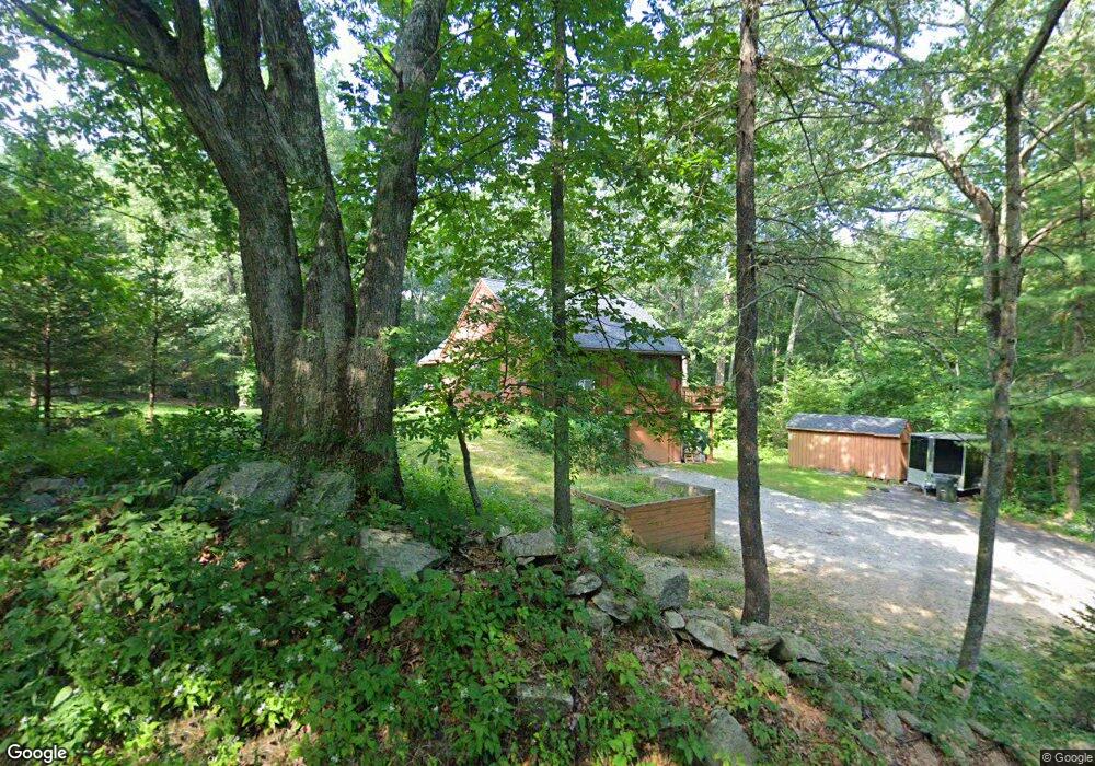
15 Ramshorn Rd Charlton, MA 01507
Estimated Value: $445,000 - $492,000
2
Beds
1
Bath
1,384
Sq Ft
$334/Sq Ft
Est. Value
About This Home
This home is located at 15 Ramshorn Rd, Charlton, MA 01507 and is currently estimated at $462,545, approximately $334 per square foot. 15 Ramshorn Rd is a home located in Worcester County with nearby schools including Shepherd Hill Regional High School and ViewPoint Christian Academy.
Ownership History
Date
Name
Owned For
Owner Type
Purchase Details
Closed on
Apr 3, 2019
Sold by
Bond Lowell H and Bond Marguerite E
Bought by
Bond Ramshorn Road Rt and Bond
Current Estimated Value
Create a Home Valuation Report for This Property
The Home Valuation Report is an in-depth analysis detailing your home's value as well as a comparison with similar homes in the area
Home Values in the Area
Average Home Value in this Area
Purchase History
| Date | Buyer | Sale Price | Title Company |
|---|---|---|---|
| Bond Ramshorn Road Rt | -- | -- | |
| Bond Ramshorn Road Rt | -- | -- |
Source: Public Records
Tax History Compared to Growth
Tax History
| Year | Tax Paid | Tax Assessment Tax Assessment Total Assessment is a certain percentage of the fair market value that is determined by local assessors to be the total taxable value of land and additions on the property. | Land | Improvement |
|---|---|---|---|---|
| 2025 | $4,341 | $390,000 | $90,200 | $299,800 |
| 2024 | $4,173 | $368,000 | $90,200 | $277,800 |
| 2023 | $4,089 | $336,000 | $87,100 | $248,900 |
| 2022 | $3,511 | $264,200 | $79,300 | $184,900 |
| 2021 | $3,716 | $247,600 | $75,100 | $172,500 |
| 2020 | $3,654 | $244,600 | $72,100 | $172,500 |
| 2019 | $3,613 | $244,600 | $72,100 | $172,500 |
| 2018 | $3,302 | $244,600 | $72,100 | $172,500 |
| 2017 | $3,192 | $226,400 | $66,100 | $160,300 |
| 2016 | $3,120 | $226,400 | $66,100 | $160,300 |
| 2015 | $3,038 | $226,400 | $66,100 | $160,300 |
| 2014 | $2,900 | $229,100 | $68,700 | $160,400 |
Source: Public Records
Map
Nearby Homes
- 58 Colburn Rd
- 65 Haggerty Rd
- 76 Number 6 Schoolhouse Rd
- 0 Freeman Rd Unit 73369281
- 2 Lelandville Rd
- 3 Lelandville Rd
- 0 Partridge Hill Rd
- 2 Potter Village Rd
- 16 Sandersdale Rd
- 60 Saundersdale Rd
- 0 Blood Rd
- Lot 1A Sandersdale Rd
- Lot 3A Sandersdale Rd
- Lot 2A Sandersdale Rd
- 91 Burlingame Rd
- 0 Sandersdale Rd
- 6 Blackwell Dr
- 9 Piehl Dr
- 18 Mckinstry Dr
- 20 Drury Ln
- LOT 13 Ramshorn Rd
- 18 Ramshorn Rd
- 10 Ramshorn Rd
- 5 Ramshorn Rd
- 5 Ramshorn Rd
- 5 Ramshorn Rd
- 20 Ramshorn Rd
- 23 Ramshorn Rd
- Lot 6.3 Ramshorn Rd
- 2 Haggerty Rd
- 6 Haggerty Rd
- 6 Haggerty Rd
- 10 Haggerty Rd
- 3 Ramshorn Rd Unit 6
- Lot 1 Ramshorn Rd
- 0 Ramshorn Rd
- 214 Freeman Rd
- 211 Freeman Rd
- 0 Haggerty Rd
- 21 Haggerty Rd