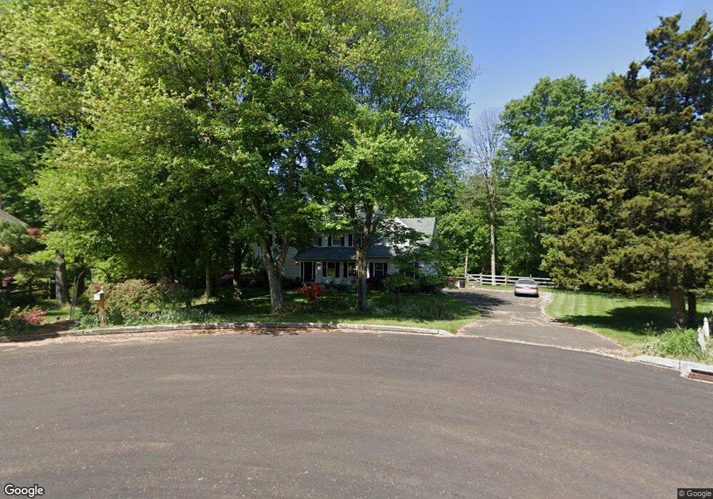
15 Robyn Ln Doylestown, PA 18901
Estimated Value: $718,000 - $1,071,000
4
Beds
3
Baths
2,969
Sq Ft
$301/Sq Ft
Est. Value
About This Home
This home is located at 15 Robyn Ln, Doylestown, PA 18901 and is currently estimated at $894,690, approximately $301 per square foot. 15 Robyn Ln is a home located in Bucks County with nearby schools including Kutz Elementary School, Lenape Middle School, and Central Bucks High School-West.
Ownership History
Date
Name
Owned For
Owner Type
Purchase Details
Closed on
Sep 6, 1991
Sold by
Campi
Bought by
Mcquade John P and Mcquade Leanne E
Current Estimated Value
Purchase Details
Closed on
Aug 2, 1988
Bought by
Campi
Create a Home Valuation Report for This Property
The Home Valuation Report is an in-depth analysis detailing your home's value as well as a comparison with similar homes in the area
Home Values in the Area
Average Home Value in this Area
Purchase History
| Date | Buyer | Sale Price | Title Company |
|---|---|---|---|
| Mcquade John P | $275,000 | -- | |
| Campi | $329,500 | -- |
Source: Public Records
Tax History
| Year | Tax Paid | Tax Assessment Tax Assessment Total Assessment is a certain percentage of the fair market value that is determined by local assessors to be the total taxable value of land and additions on the property. | Land | Improvement |
|---|---|---|---|---|
| 2025 | $10,745 | $60,720 | $12,320 | $48,400 |
| 2024 | $10,745 | $60,720 | $12,320 | $48,400 |
| 2023 | $10,246 | $60,720 | $12,320 | $48,400 |
| 2022 | $10,132 | $60,720 | $12,320 | $48,400 |
| 2021 | $9,923 | $60,720 | $12,320 | $48,400 |
| 2020 | $9,878 | $60,720 | $12,320 | $48,400 |
| 2019 | $9,771 | $60,720 | $12,320 | $48,400 |
| 2018 | $9,741 | $60,720 | $12,320 | $48,400 |
| 2017 | $9,665 | $60,720 | $12,320 | $48,400 |
| 2016 | $9,604 | $60,720 | $12,320 | $48,400 |
| 2015 | -- | $60,720 | $12,320 | $48,400 |
| 2014 | -- | $60,720 | $12,320 | $48,400 |
Source: Public Records
Map
Nearby Homes
- 34 Houk Rd
- 3775 Buckingham Dr
- 3795 Route 202
- 45 Springs Dr
- 2980 Yorkshire Rd
- 000 Cherry Ln
- 150 Watercrest Dr
- 45 Creek Dr
- 223 Cherry Ln
- 152 Watercrest Dr
- 3889 Robin Rd
- 607 S Chubb Dr
- 563 Pebble Hill Rd
- 2361 Turk Rd
- 106 Saddle Dr
- 110 E Ashland St
- 236 Green St
- 146 E Court St
- 69 E Oakland Ave
- 2312 Turk Rd
Your Personal Tour Guide
Ask me questions while you tour the home.