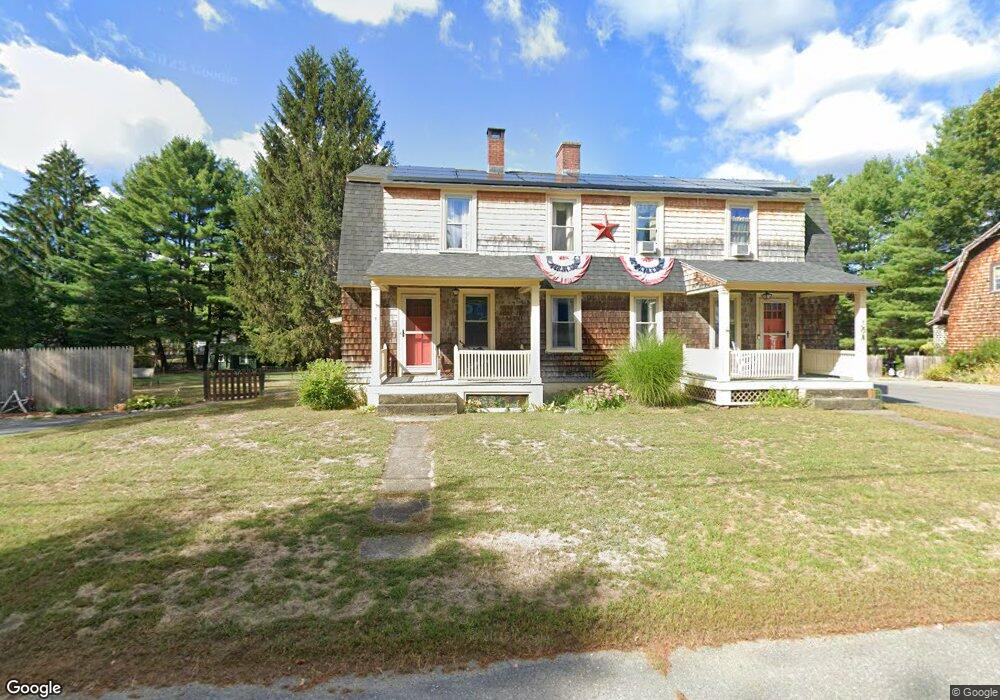
15 Rodman Ave Shirley, MA 01464
Estimated Value: $507,408 - $650,000
5
Beds
3
Baths
2,456
Sq Ft
$229/Sq Ft
Est. Value
About This Home
This home is located at 15 Rodman Ave, Shirley, MA 01464 and is currently estimated at $561,352, approximately $228 per square foot. 15 Rodman Ave is a home located in Middlesex County with nearby schools including Page Hilltop School, Lura A. White Elementary School, and Ayer Shirley Regional Middle School.
Ownership History
Date
Name
Owned For
Owner Type
Purchase Details
Closed on
Jun 30, 2008
Sold by
Pender Allison and Pender Jonathan M
Bought by
Pender Allison
Current Estimated Value
Home Financials for this Owner
Home Financials are based on the most recent Mortgage that was taken out on this home.
Original Mortgage
$207,000
Outstanding Balance
$132,389
Interest Rate
6.07%
Mortgage Type
Purchase Money Mortgage
Estimated Equity
$428,963
Purchase Details
Closed on
Jul 16, 1996
Sold by
Gaston Ralph D
Bought by
Pender Jonathan M and Pender Allison
Home Financials for this Owner
Home Financials are based on the most recent Mortgage that was taken out on this home.
Original Mortgage
$110,000
Interest Rate
7.98%
Mortgage Type
Purchase Money Mortgage
Create a Home Valuation Report for This Property
The Home Valuation Report is an in-depth analysis detailing your home's value as well as a comparison with similar homes in the area
Home Values in the Area
Average Home Value in this Area
Purchase History
| Date | Buyer | Sale Price | Title Company |
|---|---|---|---|
| Pender Allison | -- | -- | |
| Pender Allison | -- | -- | |
| Pender Allison | -- | -- | |
| Pender Allison | -- | -- | |
| Pender Jonathan M | $125,000 | -- | |
| Pender Jonathan M | $125,000 | -- |
Source: Public Records
Mortgage History
| Date | Status | Borrower | Loan Amount |
|---|---|---|---|
| Open | Pender Allison | $207,000 | |
| Closed | Pender Allison | $207,000 | |
| Previous Owner | Pender Jonathan M | $110,000 |
Source: Public Records
Tax History Compared to Growth
Tax History
| Year | Tax Paid | Tax Assessment Tax Assessment Total Assessment is a certain percentage of the fair market value that is determined by local assessors to be the total taxable value of land and additions on the property. | Land | Improvement |
|---|---|---|---|---|
| 2025 | $5,172 | $398,800 | $131,600 | $267,200 |
| 2024 | $4,923 | $362,800 | $112,300 | $250,500 |
| 2023 | $4,682 | $330,200 | $112,300 | $217,900 |
| 2022 | $4,847 | $313,100 | $108,400 | $204,700 |
| 2021 | $4,802 | $290,500 | $96,800 | $193,700 |
| 2020 | $4,575 | $284,000 | $96,800 | $187,200 |
| 2019 | $4,490 | $279,200 | $96,800 | $182,400 |
| 2018 | $4,414 | $268,800 | $92,900 | $175,900 |
| 2017 | $4,313 | $261,100 | $85,200 | $175,900 |
| 2016 | $3,853 | $233,400 | $86,700 | $146,700 |
| 2015 | $3,779 | $218,300 | $81,300 | $137,000 |
Source: Public Records
Map
Nearby Homes
- 25 Front St
- 40 Ayer Rd
- 30 Ayer Rd
- 3 Mill St
- 27 Lancaster Rd
- 45 Clark Rd
- 3 Ambrose Way Unit 3
- 6 Ambrose Way Unit 3
- 19 Ambrose Way Unit 19
- 9 Ambrose Way Unit 9
- 1 Ambrose Way Unit 1
- 7 Ambrose Way Unit 5
- 4 Ambrose Way Unit 4
- 5 Ambrose Way Unit 5
- 13 Ambrose Way Unit 13
- 0 Windsor Rd
- 83 Clark Rd Unit 41
- 95 Old Union Turnpike
- 31 Independence Dr
- 124 Hazen Rd
- 15 Rodman Ave Unit B
- 15 Rodman Ave Unit B (left)
- 15 Rodman Ave Unit A (right)
- 15 A-B Rodman Ave
- 11 Rodman Ave
- 16 Rodman Ave Unit 1
- 16 Rodman Ave
- 16 Rodman Ave Unit A
- 14 Rodman Ave
- 17 Rodman Ave
- 9 Rodman Ave
- 22 Shaker Rd
- 12 Rodman Ave
- 24 Shaker Rd
- 24 Shaker Rd Unit C
- 24 Shaker Rd Unit 2
- 2 Nashua St
- 18 Rodman Ave
- 19 Rodman Ave
- 4 Nashua St