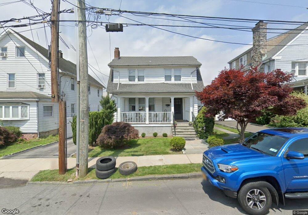
15 Rollhaus Place Port Chester, NY 10573
Estimated Value: $559,000 - $595,000
2
Beds
2
Baths
1,347
Sq Ft
$431/Sq Ft
Est. Value
About This Home
This home is located at 15 Rollhaus Place, Port Chester, NY 10573 and is currently estimated at $580,307, approximately $430 per square foot. 15 Rollhaus Place is a home located in Westchester County with nearby schools including Port Chester Senior High School, Corpus Christi Holy Rosary School, and Westchester Fairfield Hebrew A.
Ownership History
Date
Name
Owned For
Owner Type
Purchase Details
Closed on
May 10, 2007
Sold by
Cugno Lucy Bello Marie and Penebre Nicholas A
Bought by
Vinueza Rina
Current Estimated Value
Home Financials for this Owner
Home Financials are based on the most recent Mortgage that was taken out on this home.
Original Mortgage
$344,925
Outstanding Balance
$210,950
Interest Rate
6.27%
Mortgage Type
Unknown
Estimated Equity
$369,357
Create a Home Valuation Report for This Property
The Home Valuation Report is an in-depth analysis detailing your home's value as well as a comparison with similar homes in the area
Home Values in the Area
Average Home Value in this Area
Purchase History
| Date | Buyer | Sale Price | Title Company |
|---|---|---|---|
| Vinueza Rina | $383,250 | Stewart Title Insurance Co |
Source: Public Records
Mortgage History
| Date | Status | Borrower | Loan Amount |
|---|---|---|---|
| Open | Vinueza Rina | $344,925 |
Source: Public Records
Tax History Compared to Growth
Tax History
| Year | Tax Paid | Tax Assessment Tax Assessment Total Assessment is a certain percentage of the fair market value that is determined by local assessors to be the total taxable value of land and additions on the property. | Land | Improvement |
|---|---|---|---|---|
| 2024 | $7,772 | $489,000 | $120,100 | $368,900 |
| 2023 | $9,495 | $457,000 | $114,400 | $342,600 |
| 2022 | $8,560 | $431,100 | $114,400 | $316,700 |
| 2021 | $8,999 | $384,900 | $114,400 | $270,500 |
| 2020 | $9,078 | $377,400 | $114,400 | $263,000 |
| 2019 | $10,348 | $348,900 | $116,800 | $232,100 |
| 2018 | $6,469 | $345,100 | $118,200 | $226,900 |
| 2017 | $1,411 | $334,500 | $109,400 | $225,100 |
| 2016 | $7,671 | $320,500 | $104,200 | $216,300 |
| 2015 | -- | $332,700 | $114,600 | $218,100 |
| 2014 | -- | $270,100 | $87,800 | $182,300 |
| 2013 | -- | $270,100 | $87,800 | $182,300 |
Source: Public Records
Map
Nearby Homes
- 16 Rollhaus Place
- 1 Landmark Square Unit 235
- 1 Landmark Square Unit 411
- 1 Landmark Square Unit 613
- 1 Landmark Square Unit 530
- 1 Landmark Square Unit 302
- 1 Landmark Square Unit 601
- 1 Landmark Square Unit 233
- 412 Orchard St
- 315 King St Unit 6A
- 315 King St Unit 1L
- 315 King St Unit 1B
- 315 King St Unit 5B
- 315 King St Unit 5C
- 315 King St Unit 2H
- 340 Locust Ave
- 220 Chestnut St Unit 2K
- 325 King St Unit 2G
- 325 King St Unit 6J
- 325 King St Unit 4D
- 16 Rollhaus Place Unit 1
- 12 Rollhaus Place
- 26 Rollhaus Place
- 6 Rollhaus Place
- 14 Rollhaus Place
- 19 Orchard St
- 21 Orchard St
- 17 Orchard St
- 25 Orchard St
- 18 Rollhaus Place
- 27 Orchard St
- 125 Wilkins Ave
- 127 Wilkins Ave
- 129 Wilkins Ave
- 131 Wilkins Ave
- 20 Rollhaus Place
- 29 Orchard St
- 133 Wilkins Ave
- 31 Orchard St
- 24 Rollhaus Place