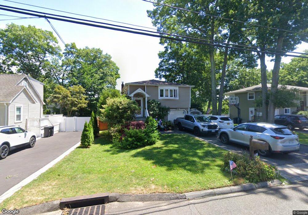
15 Roosevelt Ave Nesconset, NY 11767
Estimated Value: $562,000 - $721,000
3
Beds
1
Bath
1,135
Sq Ft
$554/Sq Ft
Est. Value
About This Home
This home is located at 15 Roosevelt Ave, Nesconset, NY 11767 and is currently estimated at $628,889, approximately $554 per square foot. 15 Roosevelt Ave is a home located in Suffolk County with nearby schools including Tackan Elementary School and St Patrick Elementary School.
Ownership History
Date
Name
Owned For
Owner Type
Purchase Details
Closed on
Feb 28, 2001
Sold by
Corrigan Denise
Bought by
Foley James G and Foley Palma E
Current Estimated Value
Home Financials for this Owner
Home Financials are based on the most recent Mortgage that was taken out on this home.
Original Mortgage
$180,000
Outstanding Balance
$66,180
Interest Rate
7.15%
Estimated Equity
$562,709
Purchase Details
Closed on
May 28, 1999
Sold by
Corrigan Daniel F and Corrigan Denise
Bought by
Corrigan Denise
Home Financials for this Owner
Home Financials are based on the most recent Mortgage that was taken out on this home.
Original Mortgage
$100,000
Interest Rate
7.19%
Create a Home Valuation Report for This Property
The Home Valuation Report is an in-depth analysis detailing your home's value as well as a comparison with similar homes in the area
Home Values in the Area
Average Home Value in this Area
Purchase History
| Date | Buyer | Sale Price | Title Company |
|---|---|---|---|
| Foley James G | $235,000 | -- | |
| Corrigan Denise | -- | Commonwealth Land Title Ins |
Source: Public Records
Mortgage History
| Date | Status | Borrower | Loan Amount |
|---|---|---|---|
| Open | Foley James G | $180,000 | |
| Previous Owner | Corrigan Denise | $100,000 |
Source: Public Records
Tax History Compared to Growth
Tax History
| Year | Tax Paid | Tax Assessment Tax Assessment Total Assessment is a certain percentage of the fair market value that is determined by local assessors to be the total taxable value of land and additions on the property. | Land | Improvement |
|---|---|---|---|---|
| 2024 | $10,174 | $4,220 | $200 | $4,020 |
| 2023 | $10,174 | $4,220 | $200 | $4,020 |
| 2022 | $8,443 | $4,220 | $200 | $4,020 |
| 2021 | $8,443 | $4,220 | $200 | $4,020 |
| 2020 | $9,557 | $4,220 | $200 | $4,020 |
| 2019 | $9,557 | $0 | $0 | $0 |
| 2018 | -- | $4,220 | $200 | $4,020 |
| 2017 | $8,392 | $4,035 | $200 | $3,835 |
| 2016 | $8,302 | $4,035 | $200 | $3,835 |
| 2015 | -- | $4,035 | $200 | $3,835 |
| 2014 | -- | $4,035 | $200 | $3,835 |
Source: Public Records
Map
Nearby Homes
- 19 Marion St
- 74 Joseph Place
- 6 Cleveland St
- 176 Southern Blvd
- 334 Lake Ave S
- 224 Southern Blvd
- 20 Lyda Dr
- 310 Smithtown Blvd
- 3 Guinevere Ln
- 87 Richmond Blvd Unit 2B
- 47 Jeremy Cir
- 477 Gibbs Pond Rd
- 177 San Juan Dr
- 130 N Huron St
- 64 Jeremy Cir
- 185 Southern Blvd
- 25 Jeremy Cir Unit 33
- 187 N Huron St
- 176 (Birmingham Plus Southern Blvd
- 223 N 4th St
- 11 Roosevelt Ave
- 17 Roosevelt Ave
- 14 Marion St
- 16 Marion St
- 19 Roosevelt Ave
- 12 Marion St
- 14 Roosevelt Ave
- 7 Roosevelt Ave
- 16 Roosevelt Ave
- 12 Roosevelt Ave
- 18 Marion St
- 21 Roosevelt Ave
- 10 Marion St
- 20 Roosevelt Ave
- 10 Roosevelt Ave
- 5 Brooks Ave
- 7 Brooks Ave
- 22 Marion St
- 3 Roosevelt Ave
- 25 Roosevelt Ave