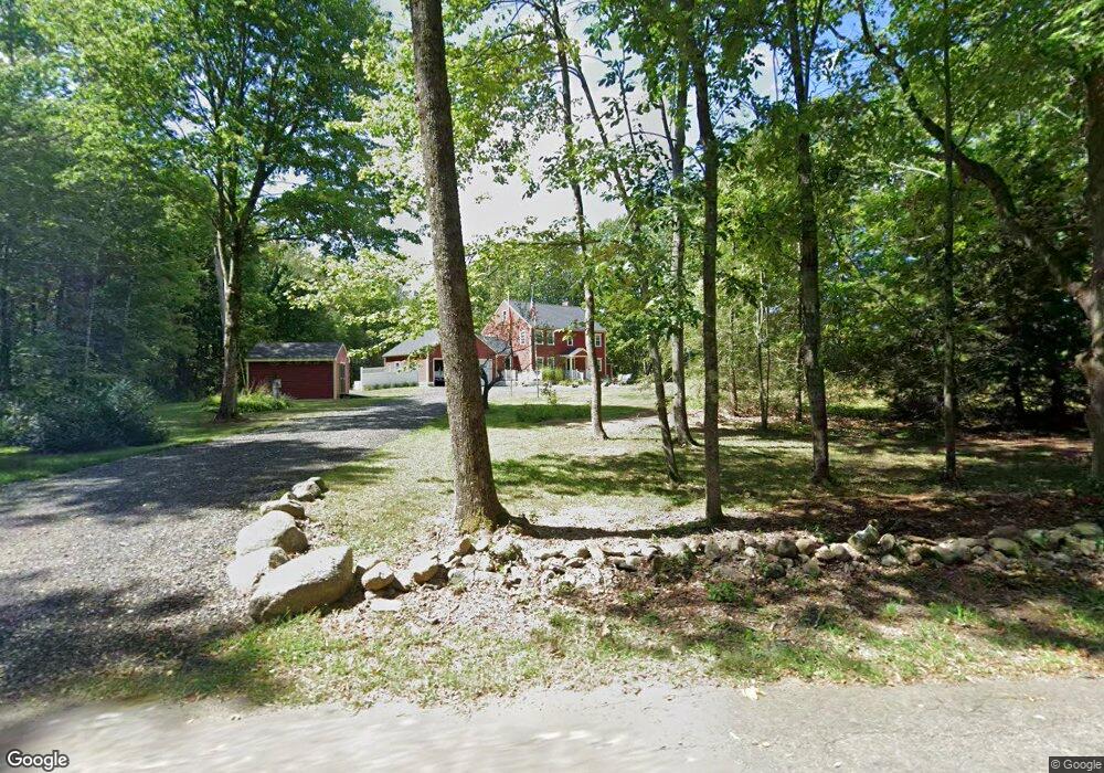
15 Root Rd Hubbardston, MA 01452
Estimated Value: $535,241 - $634,000
3
Beds
4
Baths
2,208
Sq Ft
$265/Sq Ft
Est. Value
About This Home
This home is located at 15 Root Rd, Hubbardston, MA 01452 and is currently estimated at $585,560, approximately $265 per square foot. 15 Root Rd is a home located in Worcester County with nearby schools including Quabbin Regional Middle School and Quabbin Regional High School.
Ownership History
Date
Name
Owned For
Owner Type
Purchase Details
Closed on
Mar 20, 1995
Sold by
Divico Ercole
Bought by
Breagy Susan
Current Estimated Value
Create a Home Valuation Report for This Property
The Home Valuation Report is an in-depth analysis detailing your home's value as well as a comparison with similar homes in the area
Home Values in the Area
Average Home Value in this Area
Purchase History
| Date | Buyer | Sale Price | Title Company |
|---|---|---|---|
| Breagy Susan | $38,000 | -- | |
| Breagy Susan | $38,000 | -- |
Source: Public Records
Mortgage History
| Date | Status | Borrower | Loan Amount |
|---|---|---|---|
| Open | Breagy Susan | $299,900 | |
| Closed | Breagy Susan | $230,000 |
Source: Public Records
Tax History
| Year | Tax Paid | Tax Assessment Tax Assessment Total Assessment is a certain percentage of the fair market value that is determined by local assessors to be the total taxable value of land and additions on the property. | Land | Improvement |
|---|---|---|---|---|
| 2025 | $5,564 | $476,400 | $57,900 | $418,500 |
| 2024 | $6,513 | $552,400 | $51,900 | $500,500 |
| 2023 | $5,439 | $417,400 | $46,300 | $371,100 |
| 2022 | $5,844 | $417,400 | $46,300 | $371,100 |
| 2021 | $5,848 | $394,900 | $46,300 | $348,600 |
| 2020 | $5,753 | $388,200 | $46,300 | $341,900 |
| 2019 | $5,708 | $375,000 | $60,700 | $314,300 |
| 2018 | $5,513 | $364,400 | $60,700 | $303,700 |
| 2017 | $5,550 | $364,400 | $60,700 | $303,700 |
| 2016 | $4,719 | $296,800 | $60,700 | $236,100 |
| 2015 | $4,836 | $324,100 | $60,700 | $263,400 |
| 2014 | $4,747 | $326,900 | $60,700 | $266,200 |
Source: Public Records
Map
Nearby Homes
- 216 Gray Rd
- 16 French Rd
- 7 Williamsville Rd
- 47 Harty Dr
- 1 Barre Road Cut Off
- 225 Queen Lake Rd
- 65 Victoria Ln
- 75 Barre Rd
- 171 South Rd
- 9 Old Princeton Road Cut-Off
- 3 S Cove Rd
- 420 Queen Lake Rd
- 210 Gardner Rd
- 457 Patriots Rd
- 99 Turner Ln
- 12 Otter River Rd
- 198 School St N
- 160 Bentley Rd
- 130-132 School St
- 0 Bentley Rd