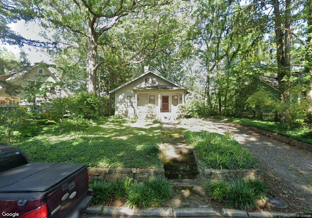
15 Rosewood Ave Asheville, NC 28801
Montford NeighborhoodEstimated Value: $466,557 - $623,000
2
Beds
2
Baths
1,200
Sq Ft
$466/Sq Ft
Est. Value
About This Home
This home is located at 15 Rosewood Ave, Asheville, NC 28801 and is currently estimated at $558,889, approximately $465 per square foot. 15 Rosewood Ave is a home located in Buncombe County with nearby schools including Isaac Dickson Elementary, Hall Fletcher Elementary, and Ira B Jones Elementary.
Ownership History
Date
Name
Owned For
Owner Type
Purchase Details
Closed on
Apr 16, 2008
Sold by
Smith Michael Allen and Common Carolyn E
Bought by
Hardesty R Craig and Costas Jennifer A
Current Estimated Value
Home Financials for this Owner
Home Financials are based on the most recent Mortgage that was taken out on this home.
Original Mortgage
$200,000
Outstanding Balance
$127,088
Interest Rate
6.03%
Mortgage Type
Unknown
Estimated Equity
$431,801
Purchase Details
Closed on
Jun 23, 1997
Sold by
Uzzle Dalma W
Bought by
Owings
Create a Home Valuation Report for This Property
The Home Valuation Report is an in-depth analysis detailing your home's value as well as a comparison with similar homes in the area
Home Values in the Area
Average Home Value in this Area
Purchase History
| Date | Buyer | Sale Price | Title Company |
|---|---|---|---|
| Hardesty R Craig | $310,000 | None Available | |
| Owings | $83,500 | -- |
Source: Public Records
Mortgage History
| Date | Status | Borrower | Loan Amount |
|---|---|---|---|
| Open | Hardesty R Craig | $200,000 |
Source: Public Records
Tax History Compared to Growth
Tax History
| Year | Tax Paid | Tax Assessment Tax Assessment Total Assessment is a certain percentage of the fair market value that is determined by local assessors to be the total taxable value of land and additions on the property. | Land | Improvement |
|---|---|---|---|---|
| 2025 | -- | $295,300 | $167,000 | $128,300 |
| 2024 | -- | $295,300 | $167,000 | $128,300 |
| 2023 | $2,974 | $295,300 | $167,000 | $128,300 |
| 2022 | $2,945 | $295,300 | $0 | $0 |
| 2021 | $2,945 | $295,300 | $0 | $0 |
| 2020 | $3,053 | $283,200 | $0 | $0 |
| 2019 | $3,053 | $283,200 | $0 | $0 |
| 2018 | $3,053 | $283,200 | $0 | $0 |
| 2017 | $3,081 | $137,600 | $0 | $0 |
| 2016 | $1,691 | $137,600 | $0 | $0 |
| 2015 | $1,691 | $137,600 | $0 | $0 |
| 2014 | $1,655 | $136,300 | $0 | $0 |
Source: Public Records
Map
Nearby Homes
- 99999 Gray St
- 57 Rosewood Ave
- 30 Gray St
- 112 Pearson Dr
- 288 Montford Ave
- 44 Watauga St
- 67 Westover Dr
- 51, 51B Westover Dr
- 11 Cullowhee St
- 162 Courtland Place
- 21 Sylvan Ave
- 46 Cumberland Cir
- 149 Courtland Ave Unit 5
- 231 Westover Dr
- 177 Cumberland Ave
- 132 Houston St Unit B
- 99999 Blake St
- 100 West St
- 13 North St
- 26 Hibriten Dr
- 19 Rosewood Ave
- 11 Rosewood Ave
- 4 Hawthorne Ln
- 37 Rosewood Ave
- 8 Hawthorne Ln
- 14 Rosewood Ave
- 10 Rosewood Ave
- 45 Rosewood Ave
- 18 Rosewood Ave
- 22 Rosewood Ave
- 12 Hawthorne Ln
- 99999 Sara St
- 186 Pearson Dr
- 26 Rosewood Ave
- 3 Hawthorne Ln
- 49 Rosewood Ave
- 4 Sara St
- 196 Pearson Dr
- 30 Rosewood Ave
- 204 Pearson Dr