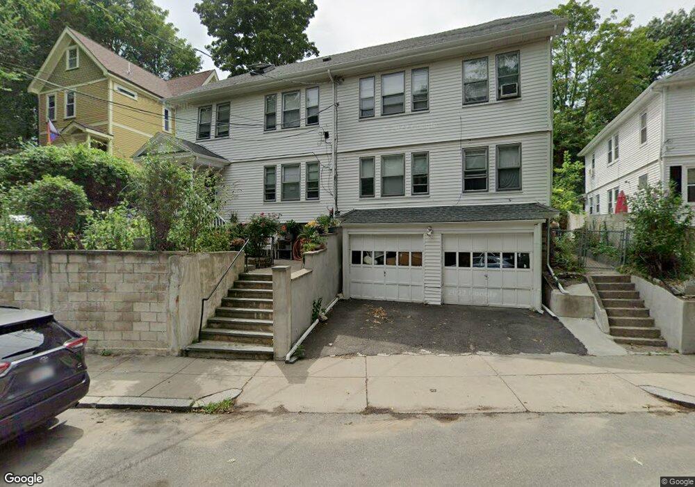
15 Rowe St Unit 17 Roslindale, MA 02131
Roslindale NeighborhoodEstimated Value: $842,000 - $1,169,000
6
Beds
2
Baths
2,932
Sq Ft
$325/Sq Ft
Est. Value
About This Home
This home is located at 15 Rowe St Unit 17, Roslindale, MA 02131 and is currently estimated at $953,091, approximately $325 per square foot. 15 Rowe St Unit 17 is a home located in Suffolk County with nearby schools including Brooke Charter School Roslindale, Sacred Heart STEM School, and St. Clare High School.
Ownership History
Date
Name
Owned For
Owner Type
Purchase Details
Closed on
Mar 4, 1996
Sold by
Callaghan Bridget Est
Bought by
Vides Teresa D
Current Estimated Value
Home Financials for this Owner
Home Financials are based on the most recent Mortgage that was taken out on this home.
Original Mortgage
$96,750
Interest Rate
7.02%
Mortgage Type
Purchase Money Mortgage
Create a Home Valuation Report for This Property
The Home Valuation Report is an in-depth analysis detailing your home's value as well as a comparison with similar homes in the area
Home Values in the Area
Average Home Value in this Area
Purchase History
| Date | Buyer | Sale Price | Title Company |
|---|---|---|---|
| Vides Teresa D | $129,000 | -- |
Source: Public Records
Mortgage History
| Date | Status | Borrower | Loan Amount |
|---|---|---|---|
| Open | Vides Teresa D | $112,000 | |
| Closed | Vides Teresa D | $96,750 | |
| Closed | Vides Teresa D | $25,800 |
Source: Public Records
Tax History Compared to Growth
Tax History
| Year | Tax Paid | Tax Assessment Tax Assessment Total Assessment is a certain percentage of the fair market value that is determined by local assessors to be the total taxable value of land and additions on the property. | Land | Improvement |
|---|---|---|---|---|
| 2025 | $8,247 | $712,200 | $231,700 | $480,500 |
| 2024 | $7,401 | $679,000 | $219,900 | $459,100 |
| 2023 | $7,011 | $652,800 | $211,400 | $441,400 |
| 2022 | $6,457 | $593,500 | $192,200 | $401,300 |
| 2021 | $6,208 | $581,800 | $188,400 | $393,400 |
| 2020 | $5,749 | $544,400 | $170,000 | $374,400 |
| 2019 | $5,413 | $513,600 | $137,300 | $376,300 |
| 2018 | $5,079 | $484,600 | $137,300 | $347,300 |
| 2017 | $5,029 | $474,900 | $137,300 | $337,600 |
| 2016 | $4,837 | $439,700 | $137,300 | $302,400 |
| 2015 | $4,546 | $375,400 | $125,500 | $249,900 |
| 2014 | $4,099 | $325,800 | $125,500 | $200,300 |
Source: Public Records
Map
Nearby Homes
- 27 Rowe St
- 472 Hyde Park Ave Unit 472
- 543 Hyde Park Ave Unit 1
- 28-30 Mount Hope St
- 32 Jewett St
- 117 Sycamore St Unit 1
- 187 Florence St Unit 2L
- 391 Hyde Park Ave Unit 112
- 34 Sammett Ave
- 4 Rowe Ct
- 108 Florence St Unit 3
- 108 Florence St Unit 1
- 60 Starbird Ave Unit 2
- 67 Cummins Hwy Unit 101
- 67 Cummins Hwy Unit 304
- 375 Hyde Park Ave Unit 3
- 16 Hilburn Place
- 250 Poplar St Unit 1
- 41 Hawthorne St Unit 2
- 39 Harrison St Unit B
- 9 Rowe St Unit 11
- 9-11 Rowe St Unit 2
- 9-11 Rowe St Unit 1
- 9 Rowe St Unit 2
- 21-23 Rowe St
- 137 Brown Ave
- 21 Rowe St Unit 1
- 21 Rowe St Unit 23
- 23 Rowe St Unit 23 Rowe
- 23 Rowe St
- 23 Rowe St Unit 2
- 135 Brown Ave
- 131 Brown Ave Unit 2
- 131 Brown Ave Unit 1
- 131 Brown Ave Unit A
- 25 Palfrey St
- 1 Prospect Ave Unit 2
- 1 Prospect Ave
- 1 Prospect Ave Unit 1
- 138 Brown Ave