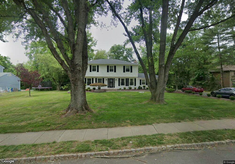
15 Running Brook Dr Millstone Township, NJ 08535
Estimated Value: $730,568 - $851,000
4
Beds
3
Baths
2,046
Sq Ft
$376/Sq Ft
Est. Value
About This Home
This home is located at 15 Running Brook Dr, Millstone Township, NJ 08535 and is currently estimated at $769,642, approximately $376 per square foot. 15 Running Brook Dr is a home located in Monmouth County with nearby schools including Millstone Township Primary School, Millstone Township Elementary School, and Millstone Township Middle School.
Ownership History
Date
Name
Owned For
Owner Type
Purchase Details
Closed on
Jul 2, 2021
Sold by
Kaye Steven and Kaye Jill
Bought by
Kaye Steve and Kaye Jill
Current Estimated Value
Purchase Details
Closed on
Jun 25, 2002
Sold by
Brockman James
Bought by
Kaye Steven and Kaye Jill
Home Financials for this Owner
Home Financials are based on the most recent Mortgage that was taken out on this home.
Original Mortgage
$313,200
Outstanding Balance
$130,272
Interest Rate
6.58%
Estimated Equity
$639,370
Purchase Details
Closed on
Oct 21, 1993
Sold by
Small Timothy
Bought by
Brockman James and Brockman Lauren
Home Financials for this Owner
Home Financials are based on the most recent Mortgage that was taken out on this home.
Original Mortgage
$175,000
Interest Rate
7.03%
Create a Home Valuation Report for This Property
The Home Valuation Report is an in-depth analysis detailing your home's value as well as a comparison with similar homes in the area
Home Values in the Area
Average Home Value in this Area
Purchase History
| Date | Buyer | Sale Price | Title Company |
|---|---|---|---|
| Kaye Steve | -- | None Available | |
| Kaye Steven | $348,000 | -- | |
| Brockman James | $220,000 | -- |
Source: Public Records
Mortgage History
| Date | Status | Borrower | Loan Amount |
|---|---|---|---|
| Open | Kaye Steven | $313,200 | |
| Previous Owner | Brockman James | $175,000 |
Source: Public Records
Tax History Compared to Growth
Tax History
| Year | Tax Paid | Tax Assessment Tax Assessment Total Assessment is a certain percentage of the fair market value that is determined by local assessors to be the total taxable value of land and additions on the property. | Land | Improvement |
|---|---|---|---|---|
| 2025 | $8,957 | $497,200 | $130,500 | $366,700 |
| 2024 | $9,294 | $374,000 | $124,500 | $249,500 |
| 2023 | $9,294 | $374,000 | $124,500 | $249,500 |
| 2022 | $9,028 | $374,000 | $124,500 | $249,500 |
| 2021 | $9,028 | $374,000 | $124,500 | $249,500 |
| 2020 | $8,927 | $374,000 | $124,500 | $249,500 |
| 2019 | $8,759 | $374,000 | $124,500 | $249,500 |
| 2018 | $8,542 | $374,000 | $124,500 | $249,500 |
| 2017 | $8,505 | $374,000 | $124,500 | $249,500 |
| 2016 | $8,396 | $372,000 | $124,500 | $247,500 |
| 2015 | $8,259 | $347,900 | $124,500 | $223,400 |
| 2014 | $7,923 | $304,600 | $103,500 | $201,100 |
Source: Public Records
Map
Nearby Homes
- 13 Running Brook Dr
- 17 Running Brook Dr
- 2 Blue Spruce Ct
- 8 Running Brook Dr
- 11 Running Brook Dr
- 19 Running Brook Dr
- 1 Blue Spruce Ct
- 4 Blue Spruce Ct
- 6 Running Brook Dr
- 7 Giant Maple Ct
- 9 Running Brook Dr
- 21 Running Brook Dr
- 14 Running Brook Dr
- 5 Giant Maple Ct
- 6 Blue Spruce Ct
- 4 Running Brook Dr
- 7 Running Brook Dr
- 4 Old Oak Ct
- 3 Blue Spruce Ct
- 23 Running Brook Dr