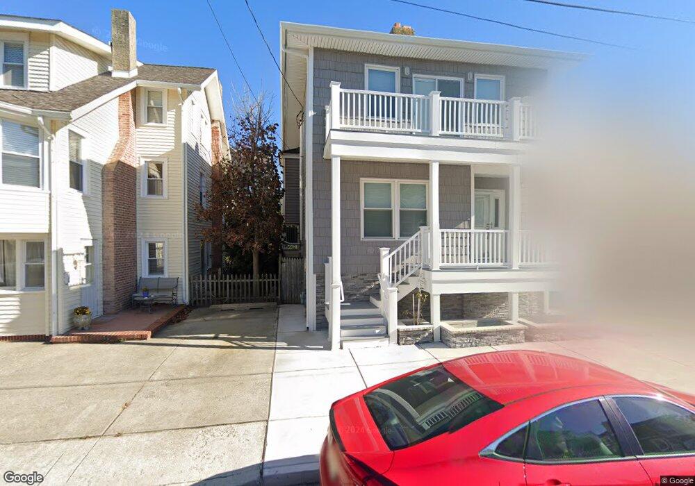
15 S Buffalo Ave Ventnor City, NJ 08406
Estimated Value: $852,000 - $1,090,000
5
Beds
4
Baths
1,878
Sq Ft
$540/Sq Ft
Est. Value
About This Home
This home is located at 15 S Buffalo Ave, Ventnor City, NJ 08406 and is currently estimated at $1,013,758, approximately $539 per square foot. 15 S Buffalo Ave is a home located in Atlantic County with nearby schools including Ventnor Elementary School, Ventnor Middle School, and St. James Elementary School.
Ownership History
Date
Name
Owned For
Owner Type
Purchase Details
Closed on
Nov 9, 2011
Sold by
Nistico Vincent
Bought by
James Louis F and James Cheryl L
Current Estimated Value
Purchase Details
Closed on
May 21, 2008
Sold by
Nistico Vincent
Bought by
Nistico Vincent
Home Financials for this Owner
Home Financials are based on the most recent Mortgage that was taken out on this home.
Original Mortgage
$272,000
Interest Rate
6.11%
Mortgage Type
New Conventional
Create a Home Valuation Report for This Property
The Home Valuation Report is an in-depth analysis detailing your home's value as well as a comparison with similar homes in the area
Home Values in the Area
Average Home Value in this Area
Purchase History
| Date | Buyer | Sale Price | Title Company |
|---|---|---|---|
| James Louis F | $365,000 | American Home Title Agency | |
| Nistico Vincent | -- | Equity Plus Title Agency Llc |
Source: Public Records
Mortgage History
| Date | Status | Borrower | Loan Amount |
|---|---|---|---|
| Previous Owner | Nistico Vincent | $272,000 |
Source: Public Records
Tax History Compared to Growth
Tax History
| Year | Tax Paid | Tax Assessment Tax Assessment Total Assessment is a certain percentage of the fair market value that is determined by local assessors to be the total taxable value of land and additions on the property. | Land | Improvement |
|---|---|---|---|---|
| 2025 | $10,200 | $373,200 | $245,300 | $127,900 |
| 2024 | $10,200 | $373,200 | $245,300 | $127,900 |
| 2023 | $9,599 | $373,200 | $245,300 | $127,900 |
| 2022 | $9,599 | $373,200 | $245,300 | $127,900 |
| 2021 | $9,658 | $373,200 | $245,300 | $127,900 |
| 2020 | $9,670 | $373,200 | $245,300 | $127,900 |
| 2019 | $9,647 | $373,200 | $245,300 | $127,900 |
| 2018 | $9,830 | $373,200 | $245,300 | $127,900 |
| 2017 | $9,882 | $373,200 | $245,300 | $127,900 |
| 2016 | $8,928 | $408,400 | $290,900 | $117,500 |
| 2015 | $8,846 | $408,400 | $290,900 | $117,500 |
| 2014 | $8,409 | $408,400 | $290,900 | $117,500 |
Source: Public Records
Map
Nearby Homes
- 6709 Atlantic Ave
- 1 S Wissahickon Ave
- 101 S Buffalo Ave
- 2 A N Buffalo Ave
- 2 B N Buffalo Ave
- 3 N Wissahickon Ave
- 2 S Newark Ave
- 4 S Newark Ave
- 18 N Buffalo Ave
- 18 N Buffalo #B Ave
- 2 N Newark Ave
- 26 N Richards Ave
- 5 N New Haven Unit Ave Unit C3A
- 102 N Richards Ave
- 113 N Richards Ave
- 5 N Newport Ave
- 118 N Rosborough Ave Unit 2
- 6 N Portland Ave
- 6304 Ventnor Ave
- 6302 Ventnor Ave
- 17 S Buffalo Ave
- 13 S Buffalo Ave
- 11 S Buffalo Ave
- 18 S Richards Ave
- 22 S Richards Ave
- 22 S Richards Ave Unit C
- 22 S Richards Ave Unit A
- 23 S Buffalo Ave
- 20 S Richards Ave Unit 100
- 20 S Richards Ave
- 20 S Richards Ave Unit 3
- 20 S Richards Ave Unit 2
- 20 S Richards Ave Unit 100
- 20 S Richards Ave Unit 1
- 20 S Richards Ave Unit 1
- 12 S Richards Ave
- 24 S Richards Ave
- 9 S Buffalo Ave
- 24 S Buffalo Ave
- 22 S Buffalo Ave