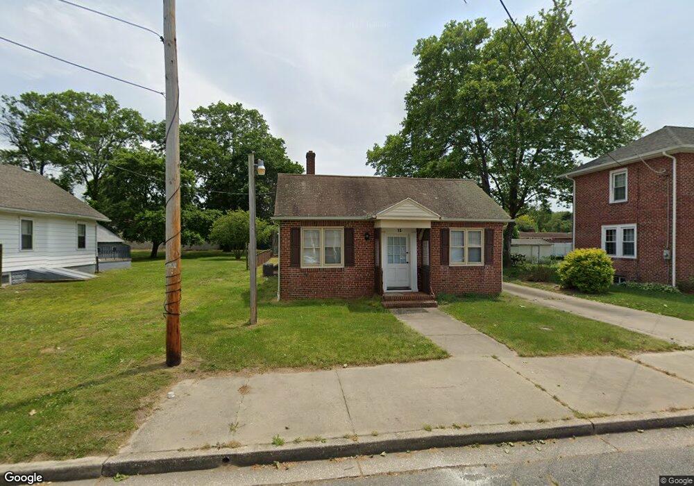
15 S Miller Ave Penns Grove, NJ 08069
Estimated Value: $187,110
--
Bed
--
Bath
2,856
Sq Ft
$66/Sq Ft
Est. Value
About This Home
This home is located at 15 S Miller Ave, Penns Grove, NJ 08069 and is currently priced at $187,110, approximately $65 per square foot. 15 S Miller Ave is a home located in Salem County with nearby schools including Lafayette-Pershing Elementary School, Field Street Elementary School, and Paul W. Carleton Elementary School.
Ownership History
Date
Name
Owned For
Owner Type
Purchase Details
Closed on
May 9, 2025
Sold by
Unity Homes Llc
Bought by
Servius Antoine
Current Estimated Value
Home Financials for this Owner
Home Financials are based on the most recent Mortgage that was taken out on this home.
Original Mortgage
$142,200
Interest Rate
6.3%
Mortgage Type
New Conventional
Purchase Details
Closed on
Jun 16, 2021
Sold by
Sky Unity Holdings Llc
Bought by
Unity Homes Llc
Purchase Details
Closed on
Jun 12, 2020
Sold by
Sky Unity Holdings Llc
Bought by
Unity Homes Llc
Purchase Details
Closed on
Oct 24, 2017
Sold by
Sycamore Investments Llc
Bought by
Sky Unity Holdings Llc
Purchase Details
Closed on
Oct 17, 2017
Sold by
Sycamore Investments Llc
Bought by
Sky Unity Holdings Llc
Purchase Details
Closed on
Mar 2, 2012
Sold by
Martell Silvio
Bought by
Martell Michael
Create a Home Valuation Report for This Property
The Home Valuation Report is an in-depth analysis detailing your home's value as well as a comparison with similar homes in the area
Home Values in the Area
Average Home Value in this Area
Purchase History
| Date | Buyer | Sale Price | Title Company |
|---|---|---|---|
| Servius Antoine | $158,000 | Fidelity National Title | |
| Unity Homes Llc | -- | None Available | |
| Unity Homes Llc | -- | None Available | |
| Sky Unity Holdings Llc | $22,500 | -- | |
| Sky Unity Holdings Llc | $22,500 | -- | |
| Martell Michael | -- | -- |
Source: Public Records
Mortgage History
| Date | Status | Borrower | Loan Amount |
|---|---|---|---|
| Previous Owner | Servius Antoine | $142,200 |
Source: Public Records
Tax History Compared to Growth
Tax History
| Year | Tax Paid | Tax Assessment Tax Assessment Total Assessment is a certain percentage of the fair market value that is determined by local assessors to be the total taxable value of land and additions on the property. | Land | Improvement |
|---|---|---|---|---|
| 2025 | $6,544 | $247,000 | $60,000 | $187,000 |
| 2024 | $6,319 | $177,500 | $35,600 | $141,900 |
| 2023 | $6,319 | $177,500 | $35,600 | $141,900 |
| 2022 | $5,946 | $177,500 | $35,600 | $141,900 |
| 2021 | $5,889 | $177,500 | $35,600 | $141,900 |
| 2020 | $5,941 | $177,500 | $35,600 | $141,900 |
| 2019 | $5,991 | $177,500 | $35,600 | $141,900 |
| 2018 | $5,782 | $183,600 | $39,200 | $144,400 |
| 2017 | $5,391 | $183,600 | $39,200 | $144,400 |
| 2016 | $5,194 | $183,600 | $39,200 | $144,400 |
| 2015 | $4,952 | $183,600 | $39,200 | $144,400 |
| 2014 | $4,687 | $183,600 | $39,200 | $144,400 |
Source: Public Records
Map
Nearby Homes
- 15 1/2 N Miller Ave
- 279 Logwood Ave
- 65 S Miller Ave
- 253 Dixie Dr
- 45 S Virginia Ave
- 5 Dixie Dr
- 83 Willis St
- 243 Wintergreen Ln
- 114 Deming Ave
- 0 Park Ave Unit NJSA2013690
- 113 Primrose Ln
- 39 41 Cumberland Ave
- 32 Walnut St
- 55 57 Walnut St
- 59-61 Walnut St
- 34 38 Cumberland Ave
- 0 Lincoln Avenue & Cumberland
- 32 Westminster Ave
- 0 Cumberland Ave
- 4 Grove St
- 19 S Miller Ave
- 14 S Cedarwood Ave
- 25 S Miller Ave
- 16 S Miller Ave
- 20 S Cedarwood Ave
- 10 S Cedarwood Ave
- 641/2 S Miller Ave
- 10 S Miller Ave
- 246 E Main St
- 246 Harding Hwy
- 250 Harding Hwy
- 93 Maryland Ave
- 18 S Miller Ave
- 245 Harold St
- 256 Harding Hwy
- 238 E Main St
- 251 Harold St
- 30 S Miller Ave
- 240 E Main St
- 244 Harding Hwy