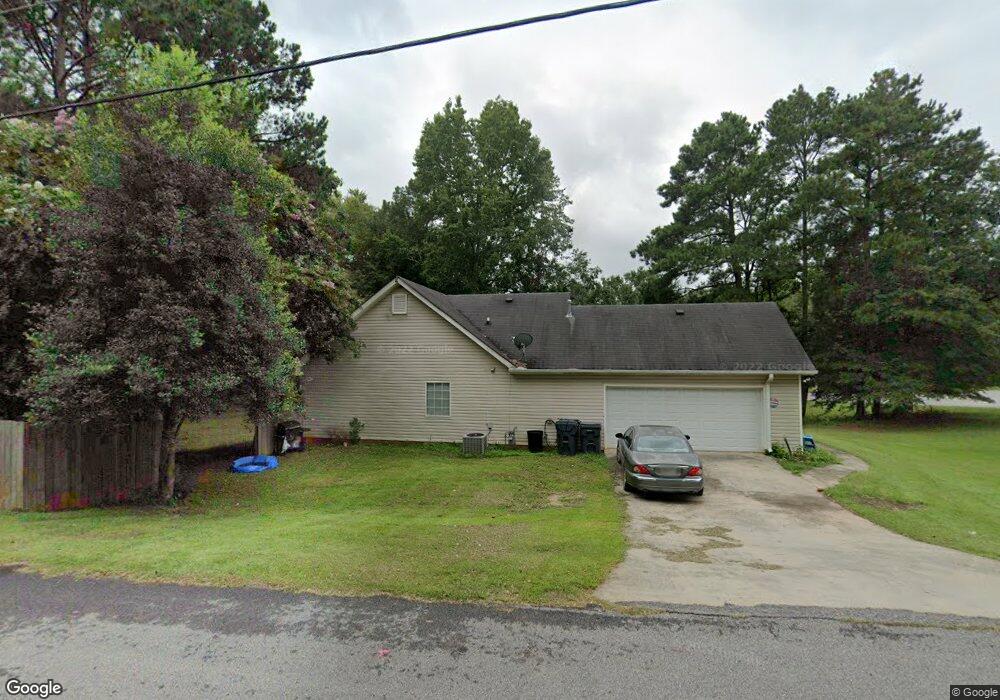
15 Sable Cir Unit 3 Covington, GA 30016
Estimated Value: $239,000 - $251,000
Studio
2
Baths
1,349
Sq Ft
$181/Sq Ft
Est. Value
About This Home
This home is located at 15 Sable Cir Unit 3, Covington, GA 30016 and is currently estimated at $244,752, approximately $181 per square foot. 15 Sable Cir Unit 3 is a home located in Newton County with nearby schools including South Salem Elementary School, Liberty Middle School, and Alcovy High School.
Ownership History
Date
Name
Owned For
Owner Type
Purchase Details
Closed on
Aug 18, 2017
Sold by
Thompson Lindsey R
Bought by
Terrell Tina
Current Estimated Value
Home Financials for this Owner
Home Financials are based on the most recent Mortgage that was taken out on this home.
Original Mortgage
$112,917
Outstanding Balance
$94,591
Interest Rate
4.37%
Mortgage Type
FHA
Estimated Equity
$150,161
Purchase Details
Closed on
Mar 31, 2003
Sold by
Thompson Lindsey R
Bought by
Thompson Lindsey R and Thompson Rosie
Home Financials for this Owner
Home Financials are based on the most recent Mortgage that was taken out on this home.
Original Mortgage
$88,000
Interest Rate
5.74%
Mortgage Type
New Conventional
Purchase Details
Closed on
Mar 12, 1999
Sold by
Thompson Bldrs Inc
Bought by
Pound Ronnie D and Pound Rebecca R
Home Financials for this Owner
Home Financials are based on the most recent Mortgage that was taken out on this home.
Original Mortgage
$89,877
Interest Rate
6.73%
Mortgage Type
FHA
Create a Home Valuation Report for This Property
The Home Valuation Report is an in-depth analysis detailing your home's value as well as a comparison with similar homes in the area
Home Values in the Area
Average Home Value in this Area
Purchase History
| Date | Buyer | Sale Price | Title Company |
|---|---|---|---|
| Terrell Tina | $115,000 | -- | |
| Thompson Lindsey R | -- | -- | |
| Thompson Lindsey R | -- | -- | |
| Pound Ronnie D | $92,900 | -- |
Source: Public Records
Mortgage History
| Date | Status | Borrower | Loan Amount |
|---|---|---|---|
| Open | Terrell Tina | $112,917 | |
| Previous Owner | Thompson Lindsey R | $88,000 | |
| Previous Owner | Thompson Lindsey R | $11,000 | |
| Previous Owner | Pound Ronnie D | $89,877 |
Source: Public Records
Tax History
| Year | Tax Paid | Tax Assessment Tax Assessment Total Assessment is a certain percentage of the fair market value that is determined by local assessors to be the total taxable value of land and additions on the property. | Land | Improvement |
|---|---|---|---|---|
| 2025 | $2,207 | $94,880 | $14,000 | $80,880 |
| 2024 | $2,127 | $87,840 | $14,000 | $73,840 |
| 2023 | $2,255 | $86,960 | $6,000 | $80,960 |
| 2022 | $1,798 | $70,120 | $6,000 | $64,120 |
| 2021 | $1,582 | $56,040 | $6,000 | $50,040 |
| 2020 | $1,447 | $46,960 | $6,000 | $40,960 |
| 2019 | $1,281 | $41,440 | $6,000 | $35,440 |
| 2018 | $1,296 | $41,640 | $6,000 | $35,640 |
| 2017 | $314 | $38,360 | $6,000 | $32,360 |
| 2016 | $142 | $33,360 | $3,800 | $29,560 |
| 2015 | $46 | $30,600 | $3,200 | $27,400 |
| 2014 | $18 | $22,680 | $0 | $0 |
Source: Public Records
Map
Nearby Homes
- 415 Rosser Rd
- 275 Roberts Rd
- 417 Rosser Rd
- 7 Glynnshire Ct
- 10 Logans Run
- 75 Tulip Dr
- 615 St Annes Place
- 30 Freedom Ct
- 800 Mills Dr
- 115 Branchwood Dr
- 50 Freedom Ct
- 100 Creekside Ln
- 35 Charity Chase
- 40 Freebia Walk
- 70 Countryside Ln
- 165 Tulip Dr
- 30 Emerson Trail
- 113 St Annes Place
- 149 St Annes Place
- 161 Geranium Ln
- 15 Sable Cir Unit 1
- 330 Sable Cir Unit 3
- 30 Sable Cir
- 305 Sable Cir Unit 3
- 320 Sable Cir Unit 3
- 185 Falcon Ridge Dr Unit 1
- 195 Falcon Ridge Dr Unit UN 1
- 195 Falcon Ridge Dr
- 155 Falcon Ridge Dr
- 135 Falcon Ridge Dr
- 40 Sable Cir
- 145 Falcon Ridge Dr Unit 1
- 0 Sable Cir Unit 7130901
- 0 Sable Cir Unit 20080645
- 55 Sable Cir Unit 3
- 300 Sable Cir
- 310 Sable Cir
- 125 Falcon Ridge Dr Unit 1
- 205 Falcon Ridge Dr Unit 1
- 285 Sable Cir Unit 3
Your Personal Tour Guide
Ask me questions while you tour the home.