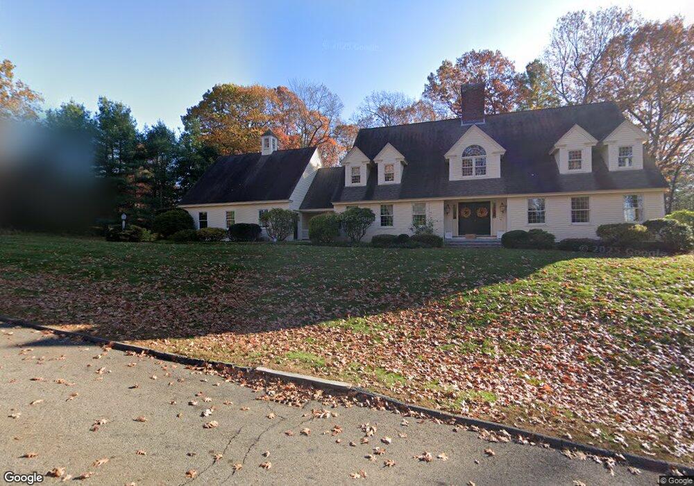
15 Sadie Hutt Ln Southborough, MA 01772
Estimated Value: $1,493,000 - $1,860,000
4
Beds
3
Baths
3,799
Sq Ft
$427/Sq Ft
Est. Value
About This Home
This home is located at 15 Sadie Hutt Ln, Southborough, MA 01772 and is currently estimated at $1,621,333, approximately $426 per square foot. 15 Sadie Hutt Ln is a home located in Worcester County with nearby schools including Albert S. Woodward Memorial School, Margaret A. Neary School, and P. Brent Trottier Middle School.
Ownership History
Date
Name
Owned For
Owner Type
Purchase Details
Closed on
Feb 3, 2011
Sold by
Marshall Bette J
Bought by
Dangelo Anthony and Argiriadi Maria
Current Estimated Value
Create a Home Valuation Report for This Property
The Home Valuation Report is an in-depth analysis detailing your home's value as well as a comparison with similar homes in the area
Home Values in the Area
Average Home Value in this Area
Purchase History
| Date | Buyer | Sale Price | Title Company |
|---|---|---|---|
| Dangelo Anthony | $773,000 | -- |
Source: Public Records
Tax History Compared to Growth
Tax History
| Year | Tax Paid | Tax Assessment Tax Assessment Total Assessment is a certain percentage of the fair market value that is determined by local assessors to be the total taxable value of land and additions on the property. | Land | Improvement |
|---|---|---|---|---|
| 2025 | $19,411 | $1,405,600 | $491,200 | $914,400 |
| 2024 | $18,257 | $1,312,500 | $480,700 | $831,800 |
| 2023 | $16,816 | $1,139,300 | $448,900 | $690,400 |
| 2022 | $16,741 | $1,028,300 | $390,600 | $637,700 |
| 2021 | $4,678 | $1,027,800 | $380,400 | $647,400 |
| 2020 | $15,989 | $959,700 | $355,600 | $604,100 |
| 2019 | $15,726 | $939,400 | $350,700 | $588,700 |
| 2018 | $14,762 | $914,600 | $350,700 | $563,900 |
| 2017 | $4,097 | $876,700 | $315,400 | $561,300 |
| 2016 | $13,621 | $861,000 | $320,800 | $540,200 |
| 2015 | $13,529 | $844,500 | $305,600 | $538,900 |
Source: Public Records
Map
Nearby Homes
- lot 1 Sears Rd
- 14 Wolfpen Ln
- Lot 2 Quinn Rd
- 150 Framingham Rd
- 39 Desimone Dr
- 58 Walker St
- 43 Stearns Rd
- 146 Framingham Rd
- 58 Framingham Rd
- 11 Whispering Brook Rd Unit 55
- 36 E Main St
- 14 Lovers Ln
- 15 Lovers Ln
- 00 Plymouth St
- 3 Madison St
- 53-55 Edinboro St
- 20 Clifford Rd
- 144 Howe St
- 6 Eastbrook Farm Ln
- 2 Adams St
- 13 Sadie Hutt Ln
- 17 Sadie Hutt Ln
- 24 Sadie Hutt Ln
- 5 Sadie Hutt Ln
- 22 Sadie Hutt Ln
- 11 Sadie Hutt Ln
- 20 Sadie Hutt Ln
- 19 Sadie Hutt Ln
- 26 Sadie Hutt Ln
- 16 Sadie Hutt Ln
- 9 Sadie Hutt Ln
- 57 Presidential Dr
- 21 Sadie Hutt Ln
- 49 Presidential Dr
- 51 Presidential Dr
- 14 Sadie Hutt Ln
- 14 Sadie Hutt Ln
- 14 Sadie Hutt Ln Unit B
- 28 Sadie Hutt Ln
- 55 Presidential Dr