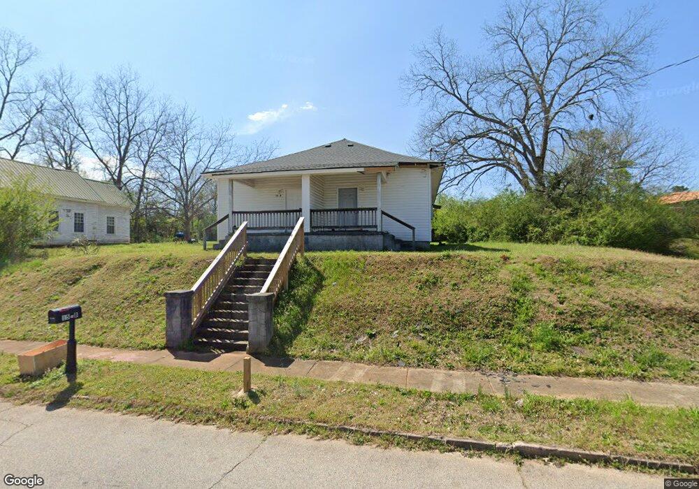
15 Sanford Ave Lagrange, GA 30241
Estimated Value: $29,967 - $226,000
4
Beds
2
Baths
1,712
Sq Ft
$83/Sq Ft
Est. Value
About This Home
This home is located at 15 Sanford Ave, Lagrange, GA 30241 and is currently estimated at $141,742, approximately $82 per square foot. 15 Sanford Ave is a home located in Troup County with nearby schools including Franklin Forest Elementary School, Hollis Hand Elementary School, and Ethel W. Kight Elementary School.
Ownership History
Date
Name
Owned For
Owner Type
Purchase Details
Closed on
Feb 19, 2021
Sold by
Thacker Michael
Bought by
H T K Properties Llc
Current Estimated Value
Home Financials for this Owner
Home Financials are based on the most recent Mortgage that was taken out on this home.
Original Mortgage
$19,000
Outstanding Balance
$10,924
Interest Rate
2.7%
Mortgage Type
New Conventional
Estimated Equity
$130,818
Purchase Details
Closed on
Jan 25, 2017
Sold by
David Bradley Rentals Llc
Bought by
Bryan William W Pete
Purchase Details
Closed on
Aug 6, 2013
Sold by
Arrington Larry E Sheriff
Bought by
Mcfarland Charlie
Purchase Details
Closed on
Jun 13, 2002
Sold by
Hester J A
Bought by
Perry David Bradley
Purchase Details
Closed on
Mar 1, 1988
Sold by
J A and J Hester T
Bought by
Hester J A
Purchase Details
Closed on
Dec 1, 1953
Sold by
Dunson Mills
Bought by
J A and J Hester T
Create a Home Valuation Report for This Property
The Home Valuation Report is an in-depth analysis detailing your home's value as well as a comparison with similar homes in the area
Home Values in the Area
Average Home Value in this Area
Purchase History
| Date | Buyer | Sale Price | Title Company |
|---|---|---|---|
| H T K Properties Llc | $19,000 | -- | |
| Bryan William W Pete | $13,750 | -- | |
| Mcfarland Charlie | -- | -- | |
| Perry David Bradley | $375,000 | -- | |
| Hester J A | -- | -- | |
| J A | -- | -- |
Source: Public Records
Mortgage History
| Date | Status | Borrower | Loan Amount |
|---|---|---|---|
| Open | H T K Properties Llc | $19,000 |
Source: Public Records
Tax History Compared to Growth
Tax History
| Year | Tax Paid | Tax Assessment Tax Assessment Total Assessment is a certain percentage of the fair market value that is determined by local assessors to be the total taxable value of land and additions on the property. | Land | Improvement |
|---|---|---|---|---|
| 2024 | $985 | $36,120 | $5,520 | $30,600 |
| 2023 | $936 | $34,320 | $5,520 | $28,800 |
| 2022 | $212 | $10,480 | $5,520 | $4,960 |
| 2021 | $308 | $10,200 | $2,760 | $7,440 |
| 2020 | $235 | $7,800 | $2,760 | $5,040 |
| 2019 | $195 | $6,480 | $2,200 | $4,280 |
| 2018 | $166 | $10,800 | $2,200 | $8,600 |
| 2017 | $326 | $10,800 | $2,200 | $8,600 |
| 2016 | $603 | $19,997 | $2,764 | $17,233 |
| 2015 | $604 | $19,997 | $2,764 | $17,233 |
| 2014 | $578 | $19,090 | $2,764 | $16,326 |
| 2013 | -- | $20,376 | $2,764 | $17,612 |
Source: Public Records
Map
Nearby Homes
- 0 N Barnard Ave
- 130 Clara Jean Ct
- 227 River Meadow Dr Unit H14
- 231 River Meadow Dr
- 412 Sweetwood Ct Unit A36
- 113 Lenox Cir
- Coleman Plan at Crossvine Village
- 0 Mill Creek Pkwy Unit PHASE 5 10313564
- Beckman Plan at Crossvine Village
- 0 Mill Creek Pkwy Unit PHASE 4 10313585
- Fairfield Plan at Crossvine Village
- Broadmoor Plan at Crossvine Village
- Dover Plan at Crossvine Village
- 5 Curran Ave
- 305 Lenox Cir
- 105 Lenox Cir
- 101 Lenox Cir
- 128 Shenandoah Ln Unit A67
- 15 Fulton St
- 124 Shenandoah Ln